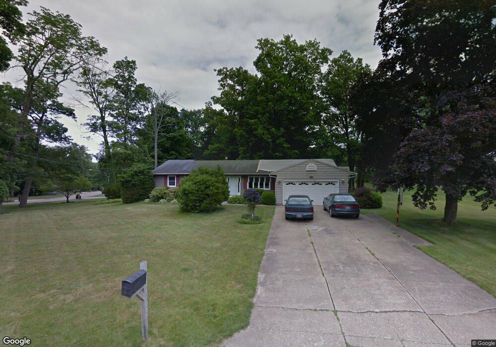
1965 Farmbrook Dr Mansfield, OH 44904
Estimated Value: $241,000 - $270,000
3
Beds
2
Baths
1,680
Sq Ft
$150/Sq Ft
Est. Value
About This Home
This home is located at 1965 Farmbrook Dr, Mansfield, OH 44904 and is currently estimated at $252,363, approximately $150 per square foot. 1965 Farmbrook Dr is a home located in Richland County with nearby schools including Lexington High School, Mansfield Christian School, and Mansfield Seventh-day Adventist School.
Ownership History
Date
Name
Owned For
Owner Type
Purchase Details
Closed on
Oct 16, 1995
Sold by
Thompson Sally L
Bought by
Levesque Kenneth J and Levesque Laurine K
Current Estimated Value
Home Financials for this Owner
Home Financials are based on the most recent Mortgage that was taken out on this home.
Original Mortgage
$96,200
Outstanding Balance
$688
Interest Rate
7.8%
Mortgage Type
New Conventional
Estimated Equity
$251,675
Purchase Details
Closed on
Apr 13, 1992
Sold by
Freund Scott A
Bought by
Thompson Richard A
Create a Home Valuation Report for This Property
The Home Valuation Report is an in-depth analysis detailing your home's value as well as a comparison with similar homes in the area
Home Values in the Area
Average Home Value in this Area
Purchase History
| Date | Buyer | Sale Price | Title Company |
|---|---|---|---|
| Levesque Kenneth J | $106,900 | -- | |
| Thompson Richard A | $85,500 | -- |
Source: Public Records
Mortgage History
| Date | Status | Borrower | Loan Amount |
|---|---|---|---|
| Open | Levesque Kenneth J | $96,200 |
Source: Public Records
Tax History
| Year | Tax Paid | Tax Assessment Tax Assessment Total Assessment is a certain percentage of the fair market value that is determined by local assessors to be the total taxable value of land and additions on the property. | Land | Improvement |
|---|---|---|---|---|
| 2024 | $3,282 | $64,030 | $11,080 | $52,950 |
| 2023 | $3,355 | $64,030 | $11,080 | $52,950 |
| 2022 | $3,037 | $48,790 | $9,510 | $39,280 |
| 2021 | $3,081 | $48,790 | $9,510 | $39,280 |
| 2020 | $2,922 | $48,790 | $9,510 | $39,280 |
| 2019 | $2,667 | $40,890 | $7,970 | $32,920 |
| 2018 | $2,290 | $40,890 | $7,970 | $32,920 |
| 2017 | $2,131 | $40,890 | $7,970 | $32,920 |
| 2016 | $1,997 | $35,180 | $6,780 | $28,400 |
| 2015 | $1,997 | $35,180 | $6,780 | $28,400 |
| 2014 | $1,925 | $35,180 | $6,780 | $28,400 |
| 2012 | $955 | $36,270 | $6,990 | $29,280 |
Source: Public Records
Map
Nearby Homes
- 450 Marwood Dr
- 540 Sherwood Dr
- 594 Dirlam Ln
- 1949 Richwood Dr
- 1938 Richwood Dr
- 615 Bailey Dr
- 601 Karlson Dr
- 2160 Haywood Dr
- 1521 Cape Cod Dr
- 763 York St W
- 1702 Middle Bellville Rd
- 1689 Middle Bellville Rd
- 0 Rippling Brook Dr
- 680 Weller Ave
- 1490 Hess Cir
- 0 Lot #23132 Hess Cir
- 0 Lot #23127 Hess Cir
- 0 Lot #23139 Hess Cir
- 0 Lot #23121 Hess Cir
- 0 Lot #23133 Hess Cir
- 451 Marwood Dr
- 1995 Farmbrook Dr
- 1972 Farmbrook Dr
- 441 Marwood Dr
- 460 Walfield Dr
- 1982 Farmbrook Dr
- 2003 Farmbrook Dr Unit 2205
- 1990 Farmbrook Dr
- 450 Walfield Dr
- 1964 Farmbrook Dr
- 431 Marwood Dr
- 1996 Farmbrook Dr
- 438 Walfield Dr
- 1950 Farmbrook Dr
- 430 Marwood Dr
- 494 Walfield Dr
- 421 Marwood Dr
- 1945 Farmbrook Dr
- 1957 Bellwood Dr
- 467 Walfield Dr
Your Personal Tour Guide
Ask me questions while you tour the home.