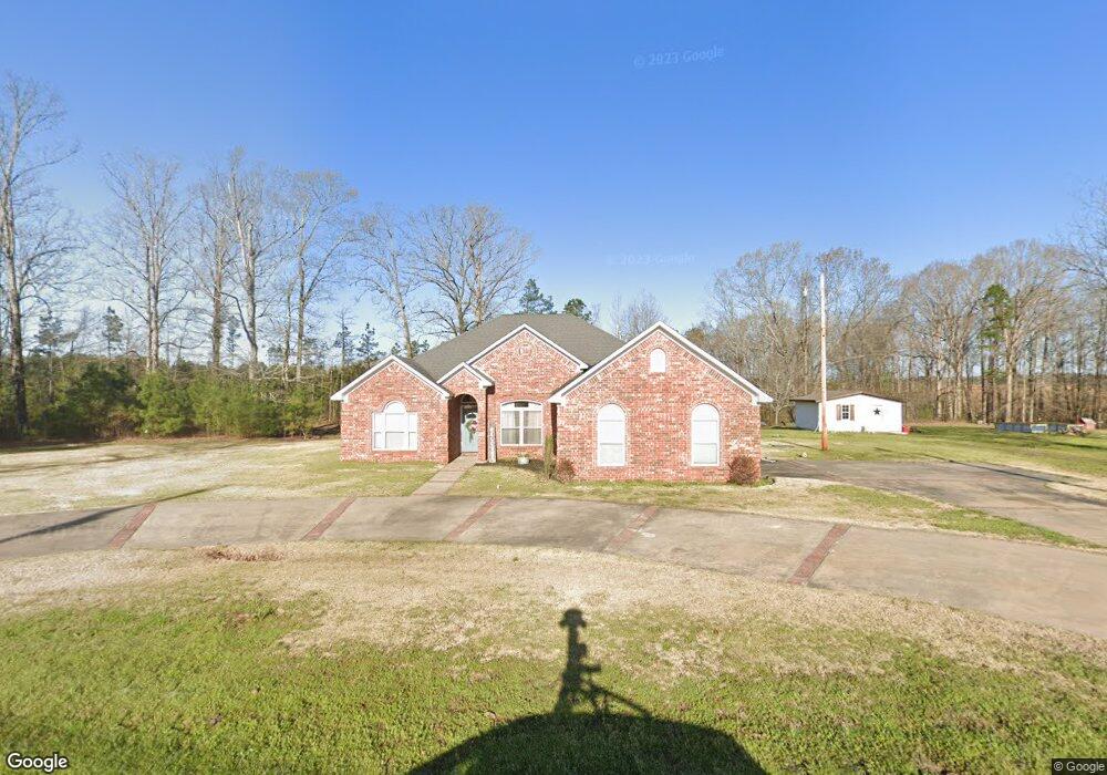
1965 Grant 53 Sheridan, AR 72150
Estimated Value: $245,150 - $308,000
3
Beds
2
Baths
1,699
Sq Ft
$160/Sq Ft
Est. Value
About This Home
This home is located at 1965 Grant 53, Sheridan, AR 72150 and is currently estimated at $272,538, approximately $160 per square foot. 1965 Grant 53 is a home located in Grant County with nearby schools including Sheridan High School.
Ownership History
Date
Name
Owned For
Owner Type
Purchase Details
Closed on
May 1, 2014
Bought by
Avants
Current Estimated Value
Purchase Details
Closed on
Aug 15, 2013
Bought by
Morgan Jp
Purchase Details
Closed on
Sep 27, 2007
Sold by
Sandoval Jose
Bought by
Jpmorgan Chase Bank Na
Home Financials for this Owner
Home Financials are based on the most recent Mortgage that was taken out on this home.
Original Mortgage
$144,000
Interest Rate
6.48%
Mortgage Type
New Conventional
Purchase Details
Closed on
Mar 24, 2003
Bought by
Roy and Roy Evelyene
Create a Home Valuation Report for This Property
The Home Valuation Report is an in-depth analysis detailing your home's value as well as a comparison with similar homes in the area
Home Values in the Area
Average Home Value in this Area
Purchase History
| Date | Buyer | Sale Price | Title Company |
|---|---|---|---|
| Avants | $145,000 | -- | |
| Morgan Jp | -- | -- | |
| Jpmorgan Chase Bank Na | $162,317 | None Available | |
| Roy | -- | -- | |
| Wd- Joint Tenants | -- | -- |
Source: Public Records
Mortgage History
| Date | Status | Borrower | Loan Amount |
|---|---|---|---|
| Previous Owner | Jpmorgan Chase Bank Na | $144,000 |
Source: Public Records
Tax History Compared to Growth
Tax History
| Year | Tax Paid | Tax Assessment Tax Assessment Total Assessment is a certain percentage of the fair market value that is determined by local assessors to be the total taxable value of land and additions on the property. | Land | Improvement |
|---|---|---|---|---|
| 2024 | $1,673 | $37,170 | $1,220 | $35,950 |
| 2023 | $1,323 | $37,170 | $1,220 | $35,950 |
| 2022 | $1,373 | $37,170 | $1,220 | $35,950 |
| 2021 | $1,373 | $37,170 | $1,220 | $35,950 |
| 2020 | $1,329 | $36,200 | $4,040 | $32,160 |
| 2019 | $1,329 | $36,200 | $4,040 | $32,160 |
| 2018 | $1,354 | $36,200 | $4,040 | $32,160 |
| 2017 | $1,354 | $36,200 | $4,040 | $32,160 |
| 2015 | -- | $35,640 | $4,040 | $31,600 |
| 2014 | -- | $35,640 | $4,040 | $31,600 |
| 2012 | -- | $35,640 | $4,040 | $31,600 |
Source: Public Records
Map
Nearby Homes
- 1705 Grant 53
- 234 Mackenzie Dr
- 476 Delta Cir
- LOT #3 Grant 55
- LOT #2 Grant 55
- 1135 Delta Cir
- LOT #5 Grant 55
- LOT #4 Grant 55
- LOT #1 Grant 55
- 252 Spring Rd
- 9029 E Fairview Rd
- 5300 Pleasant Lake Dr
- 8543 E Fairview Rd
- 365 Alex Loop
- 5676 Shore Dr
- 0 Carl Moren Rd Unit 25028739
- 5480 Carl Moren Rd
- 7113 Carl Moren Rd
- 7121 Carl Moren Rd
- 6620 Carl Moren Rd
- 1867 Grant 53
- 1893 Grant 53
- 2031 Grant 53
- 0 Grant 532
- 11825 Highway 167 N
- 126 Grant 532 Unit 154
- 1710 Grant 53
- 616 Grant 580
- 700 Grant 580
- 600 Grant 580
- 000 Grant 53
- 2227 Grant 53
- 11660 Hwy 167 N
- 453 Grant 580
- 11597 Highway 167 N
- 440 Grant 580
- 423 Grant 580
- 431 Grant 532
- 424 Grant 580
- 12237 Highway 167 N