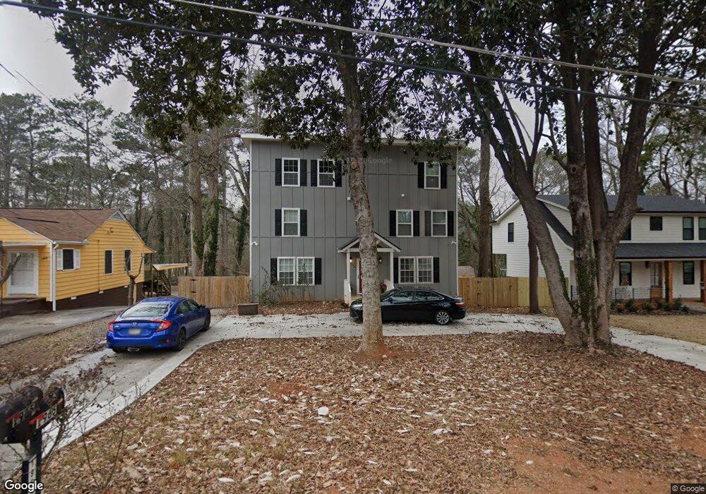
1965 Mcafee Place Decatur, GA 30032
East Lake NeighborhoodEstimated Value: $487,000 - $576,000
4
Beds
4
Baths
2,850
Sq Ft
$183/Sq Ft
Est. Value
About This Home
This home is located at 1965 Mcafee Place, Decatur, GA 30032 and is currently estimated at $520,144, approximately $182 per square foot. 1965 Mcafee Place is a home located in DeKalb County with nearby schools including McNair Middle School, McNair High School, and Charles Drew Charter School.
Ownership History
Date
Name
Owned For
Owner Type
Purchase Details
Closed on
Dec 3, 2021
Sold by
Dk Holdings Llc
Bought by
Green Myron and Green Karina
Current Estimated Value
Home Financials for this Owner
Home Financials are based on the most recent Mortgage that was taken out on this home.
Original Mortgage
$368,000
Outstanding Balance
$337,675
Interest Rate
3.09%
Mortgage Type
New Conventional
Estimated Equity
$182,469
Purchase Details
Closed on
Feb 11, 2020
Sold by
Bmsp Property Ventures Llc
Bought by
Dk Holdings Llc
Purchase Details
Closed on
Feb 7, 2019
Sold by
Tran Properties Llc
Bought by
Curbside Homes Llc
Purchase Details
Closed on
Jan 2, 2018
Sold by
Wright Hattie Mae
Bought by
Secretary Of Housing And Urban
Purchase Details
Closed on
Nov 9, 2004
Sold by
Wright Richard
Bought by
Wright Hattie M
Home Financials for this Owner
Home Financials are based on the most recent Mortgage that was taken out on this home.
Original Mortgage
$180,000
Interest Rate
5.57%
Mortgage Type
New Conventional
Create a Home Valuation Report for This Property
The Home Valuation Report is an in-depth analysis detailing your home's value as well as a comparison with similar homes in the area
Home Values in the Area
Average Home Value in this Area
Purchase History
| Date | Buyer | Sale Price | Title Company |
|---|---|---|---|
| Green Myron | $460,000 | -- | |
| Dk Holdings Llc | $175,000 | -- | |
| Bmsp Property Ventures Llc | $165,000 | -- | |
| Curbside Homes Llc | -- | -- | |
| Tran Properties Llc | $104,115 | -- | |
| Secretary Of Housing And Urban | $147,858 | -- | |
| Wright Hattie M | -- | -- |
Source: Public Records
Mortgage History
| Date | Status | Borrower | Loan Amount |
|---|---|---|---|
| Open | Green Myron | $368,000 | |
| Previous Owner | Wright Hattie M | $180,000 |
Source: Public Records
Tax History Compared to Growth
Tax History
| Year | Tax Paid | Tax Assessment Tax Assessment Total Assessment is a certain percentage of the fair market value that is determined by local assessors to be the total taxable value of land and additions on the property. | Land | Improvement |
|---|---|---|---|---|
| 2025 | $5,936 | $183,040 | $63,600 | $119,440 |
| 2024 | $6,839 | $201,240 | $63,600 | $137,640 |
| 2023 | $6,839 | $193,720 | $63,600 | $130,120 |
| 2022 | $5,834 | $171,160 | $32,000 | $139,160 |
| 2021 | $3,266 | $66,680 | $32,000 | $34,680 |
| 2020 | $2,167 | $41,640 | $26,280 | $15,360 |
| 2019 | $2,358 | $46,000 | $3,080 | $42,920 |
| 2018 | $1,373 | $34,720 | $3,080 | $31,640 |
| 2017 | $1,814 | $29,560 | $3,080 | $26,480 |
| 2016 | $1,352 | $22,920 | $3,080 | $19,840 |
| 2014 | $815 | $10,520 | $1,920 | $8,600 |
Source: Public Records
Map
Nearby Homes
- 1942 E Starmount Way
- 2203 Hillcrest Ave
- 2147 Mcafee Rd
- 2177 Mcafee Rd
- 599 Daniel Ave
- 634 Daniel Ave
- 701 Daniel Ave
- 2164 Rockhaven Cir
- 2009 Delphine Dr
- 1893 Burning Tree Dr
- 673 Quillian Ave
- 2049 Mcafee Rd
- 2093 Garden Cir
- 2076 Garden Cir
- 436 Carter Ave SE
- 678 Quillian Ave
- 2013 Marco Dr
- 1602 Dancing Fox Rd
- 1965 Mcafee Place
- 1971 Mcafee Place
- 1975 Mcafee Place
- 1955 Mcafee Place
- 1979 Mcafee Place
- 1949 Mcafee Place
- 0 Mcafee Place Unit 8637081
- 0 Mcafee Place Unit 8624542
- 0 Mcafee Place Unit 8343470
- 0 Mcafee Place Unit 8014120
- 0 Mcafee Place Unit 8005319
- 0 Mcafee Place Unit 3229610
- 0 Mcafee Place Unit 8668302
- 0 Mcafee Place Unit 8570822
- 0 Mcafee Place Unit 8803307
- 0 Mcafee Place Unit 9007735
- 0 Mcafee Place Unit 8775707
- 0 Mcafee Place Unit 8825565
- 0 Mcafee Place Unit 8877870
- 0 Mcafee Place Unit 7491542