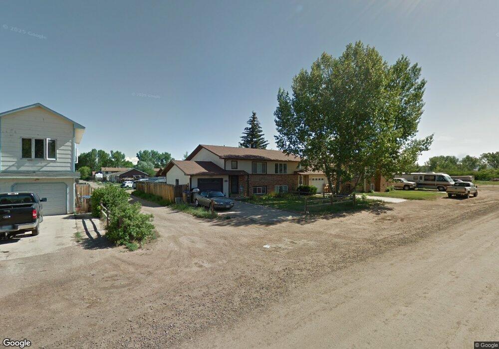
1965 Polk St Laramie, WY 82070
Estimated Value: $241,893 - $245,000
3
Beds
2
Baths
672
Sq Ft
$362/Sq Ft
Est. Value
About This Home
This home is located at 1965 Polk St, Laramie, WY 82070 and is currently estimated at $243,447, approximately $362 per square foot. 1965 Polk St is a home located in Albany County with nearby schools including Velma Linford Elementary School, Laramie Middle School, and Laramie High School.
Ownership History
Date
Name
Owned For
Owner Type
Purchase Details
Closed on
Sep 30, 2021
Sold by
Moore Emmalee and Moore Dalton
Bought by
Moore Levi B
Current Estimated Value
Home Financials for this Owner
Home Financials are based on the most recent Mortgage that was taken out on this home.
Original Mortgage
$180,000
Outstanding Balance
$164,143
Interest Rate
2.8%
Mortgage Type
New Conventional
Estimated Equity
$79,304
Purchase Details
Closed on
Jul 14, 2016
Sold by
Schneider Jessica A
Bought by
Moore Dalton E and Moore Emmalee G
Home Financials for this Owner
Home Financials are based on the most recent Mortgage that was taken out on this home.
Original Mortgage
$145,500
Interest Rate
3.66%
Mortgage Type
Commercial
Purchase Details
Closed on
Aug 27, 2013
Sold by
Mcdonald Charles R
Bought by
Schneider Jessica A
Home Financials for this Owner
Home Financials are based on the most recent Mortgage that was taken out on this home.
Original Mortgage
$134,830
Interest Rate
4.42%
Mortgage Type
Commercial
Purchase Details
Closed on
Jan 5, 2006
Sold by
Barta Scott and Barta Dodie
Bought by
Mcdonald Charles R
Home Financials for this Owner
Home Financials are based on the most recent Mortgage that was taken out on this home.
Original Mortgage
$117,200
Interest Rate
6.23%
Mortgage Type
Commercial
Create a Home Valuation Report for This Property
The Home Valuation Report is an in-depth analysis detailing your home's value as well as a comparison with similar homes in the area
Home Values in the Area
Average Home Value in this Area
Purchase History
| Date | Buyer | Sale Price | Title Company |
|---|---|---|---|
| Moore Levi B | -- | None Available | |
| Moore Dalton E | -- | First American Title | |
| Schneider Jessica A | -- | None Available | |
| Mcdonald Charles R | -- | -- |
Source: Public Records
Mortgage History
| Date | Status | Borrower | Loan Amount |
|---|---|---|---|
| Open | Moore Levi B | $180,000 | |
| Closed | Moore Dalton E | $145,500 | |
| Closed | Moore Dalton E | $7,430 | |
| Previous Owner | Schneider Jessica A | $134,830 | |
| Previous Owner | Mcdonald Charles R | $117,200 |
Source: Public Records
Tax History Compared to Growth
Tax History
| Year | Tax Paid | Tax Assessment Tax Assessment Total Assessment is a certain percentage of the fair market value that is determined by local assessors to be the total taxable value of land and additions on the property. | Land | Improvement |
|---|---|---|---|---|
| 2021 | $1,282 | $17,556 | $4,227 | $13,329 |
| 2020 | $1,171 | $16,038 | $3,791 | $12,247 |
| 2019 | $1,117 | $15,296 | $3,791 | $11,505 |
| 2018 | $1,035 | $14,174 | $3,093 | $11,081 |
| 2017 | $1,036 | $14,191 | $3,093 | $11,098 |
| 2016 | $934 | $12,796 | $2,024 | $10,772 |
| 2015 | $970 | $13,289 | $3,125 | $10,164 |
| 2014 | $951 | $13,034 | $0 | $0 |
Source: Public Records
Map
Nearby Homes
- 174 N Colorado Ave
- 2075 Jefferson St
- 2166 W Wyoming Ave Unit 29
- 2166 W Wyoming Ave Unit 25
- 262 N Taylor St Unit 5
- 370 S Buchanan St
- 153 N Adams St
- 427 S Pierce St
- 1666 Westview Dr
- 1572 Westview Ct
- 529 S Pierce St
- 1560 Westview Ct
- 541 S Johnson St
- 1561 Westview Ct
- 1567 Westview Ct
- 1012 A-B S Colorado Ave
- 627 S Colorado Ave
- 1990 Truman St
- TBD LOT 2 N Mccue St
- TBD N Mccue St
- 1963 Polk St
- 1973 Polk St
- 1975 Polk St
- 260 N Buchanan St
- 1957 Polk St
- 262 N Buchanan St
- 1981 Polk St
- 264 N Buchanan St
- 261 N Lincoln St
- 1966 Polk St
- 1962 Polk St
- 1970 Polk St
- 1982 Polk St
- 1974 Polk St
- 265 N Lincoln St
- 268 N Buchanan St
- 270 N Buchanan St
- 275 N Lincoln St
- 272 N Buchanan St
- 277 N Lincoln St