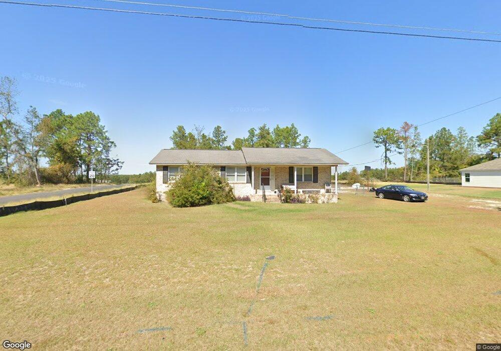
1966 Bunker Hill Rd Lugoff, SC 29078
Estimated Value: $132,687 - $204,000
Studio
--
Bath
1,296
Sq Ft
$140/Sq Ft
Est. Value
About This Home
This home is located at 1966 Bunker Hill Rd, Lugoff, SC 29078 and is currently estimated at $181,922, approximately $140 per square foot. 1966 Bunker Hill Rd is a home located in Kershaw County with nearby schools including Doby's Mill Elementary School, Leslie M. Stover Middle School, and Lugoff-Elgin High School.
Ownership History
Date
Name
Owned For
Owner Type
Purchase Details
Closed on
Dec 12, 2023
Sold by
Miles Mary Rajena and Smith Shannon Miles
Bought by
Miles Family Trust and Miles
Current Estimated Value
Purchase Details
Closed on
Oct 3, 2023
Sold by
Miles Charlie Ray
Bought by
Miles Mary Rajena and Miles R C
Purchase Details
Closed on
Sep 27, 2023
Sold by
Miles Charlie Ray
Bought by
Miles Mary Rajena and Miles R C
Purchase Details
Closed on
Jan 11, 2008
Sold by
Lyles Roosevelt
Bought by
Miles C Ray
Purchase Details
Closed on
Jul 2, 2004
Sold by
Miles C Ray
Bought by
Lyles Roosevelt
Create a Home Valuation Report for This Property
The Home Valuation Report is an in-depth analysis detailing your home's value as well as a comparison with similar homes in the area
Purchase History
| Date | Buyer | Sale Price | Title Company |
|---|---|---|---|
| Miles Family Trust | -- | None Listed On Document | |
| Miles Mary Rajena | -- | None Listed On Document | |
| Miles Mary Rajena | -- | None Listed On Document | |
| Miles C Ray | -- | -- | |
| Lyles Roosevelt | $99,500 | -- |
Source: Public Records
Tax History
| Year | Tax Paid | Tax Assessment Tax Assessment Total Assessment is a certain percentage of the fair market value that is determined by local assessors to be the total taxable value of land and additions on the property. | Land | Improvement |
|---|---|---|---|---|
| 2025 | $308 | $94,300 | $15,000 | $79,300 |
| 2024 | $308 | $94,300 | $15,000 | $79,300 |
| 2023 | $1,030 | $94,300 | $15,000 | $79,300 |
| 2022 | $560 | $94,300 | $15,000 | $79,300 |
| 2021 | $506 | $94,300 | $15,000 | $79,300 |
| 2020 | $433 | $60,700 | $6,000 | $54,700 |
| 2019 | $446 | $60,700 | $6,000 | $54,700 |
| 2018 | $403 | $60,700 | $6,000 | $54,700 |
| 2017 | $390 | $60,700 | $6,000 | $54,700 |
| 2016 | $391 | $62,100 | $5,000 | $57,100 |
| 2015 | $998 | $62,100 | $5,000 | $57,100 |
| 2014 | $998 | $0 | $0 | $0 |
Source: Public Records
Map
Nearby Homes
- 1015 B Elgin Estates Dr
- 2140 Highway 1 S
- 2206 Route 1
- 2011 Highway 1 S
- 48 Smokewood Dr
- 2206 Highway 1 S
- 12 Harvest Ct
- 8 Harvest Ct
- 55 Harvest Wheat Ct
- 64 Harvest Glen Dr
- 9 Harvest Ridge Dr
- 24 Harvest Moon Dr
- 48 Harvest Wheat Ct
- 62 Choctaw Cir
- 44 Harvest Wheat Ct
- 2349 Green Hill Rd
- 517 Watts Hill Rd
- 611 Finch Ct
- 605 Finch Ct
- 1114 West St
- 1952 Bunker Hill Rd
- 1960 Bunker Hill Rd
- 1972 Bunker Hill Rd
- 1965 Bunker Hill Rd
- 1961 Bunker Hill Rd
- 1956 Bunker Hill Rd
- 1978 Bunker Hill Rd
- 1955 Bunker Hill Rd
- 1973 Bunker Hill Rd
- 1951 Bunker Hill Rd
- 532 Railgate Loop
- 1948 Bunker Hill Rd
- 1986 Bunker Hill Rd
- 1985 Bunker Hill Rd
- 1947 Bunker Hill Rd
- 1969 Bunker Hill Rd
- 528 Railgate Loop
- 538 Railgate Loop
- 536 Railgate Loop
- 542 Railgate Loop
Your Personal Tour Guide
Ask me questions while you tour the home.