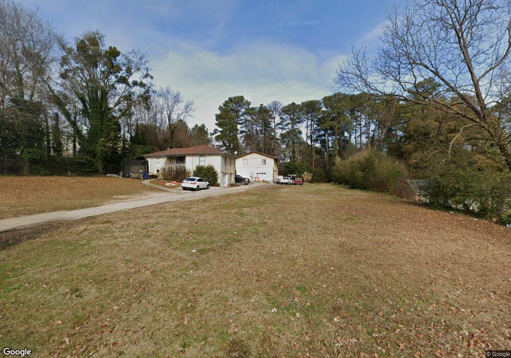
1966 Dering Cir NE Atlanta, GA 30345
Estimated Value: $330,000 - $618,000
3
Beds
1
Bath
845
Sq Ft
$508/Sq Ft
Est. Value
About This Home
This home is located at 1966 Dering Cir NE, Atlanta, GA 30345 and is currently estimated at $428,987, approximately $507 per square foot. 1966 Dering Cir NE is a home located in DeKalb County with nearby schools including John Robert Lewis Elementary School, Sequoyah Middle School, and Cross Keys High School.
Ownership History
Date
Name
Owned For
Owner Type
Purchase Details
Closed on
Apr 4, 2019
Sold by
Gregory C R
Bought by
Garcia Zacuhua Jorge Ramirez and Garcia Rosas Sergio
Current Estimated Value
Home Financials for this Owner
Home Financials are based on the most recent Mortgage that was taken out on this home.
Original Mortgage
$380,000
Outstanding Balance
$315,765
Interest Rate
4.4%
Mortgage Type
New Conventional
Estimated Equity
$113,222
Purchase Details
Closed on
Aug 3, 2010
Sold by
Davila Sandra P
Bought by
Gregory C R
Purchase Details
Closed on
Mar 15, 2005
Sold by
Gregory Cr
Bought by
Davila Sandra P
Home Financials for this Owner
Home Financials are based on the most recent Mortgage that was taken out on this home.
Original Mortgage
$260,000
Interest Rate
5.6%
Create a Home Valuation Report for This Property
The Home Valuation Report is an in-depth analysis detailing your home's value as well as a comparison with similar homes in the area
Home Values in the Area
Average Home Value in this Area
Purchase History
| Date | Buyer | Sale Price | Title Company |
|---|---|---|---|
| Garcia Zacuhua Jorge Ramirez | $400,000 | -- | |
| Gregory C R | $300,000 | -- | |
| Davila Sandra P | $290,000 | -- |
Source: Public Records
Mortgage History
| Date | Status | Borrower | Loan Amount |
|---|---|---|---|
| Open | Garcia Zacuhua Jorge Ramirez | $380,000 | |
| Previous Owner | Davila Sandra P | $260,000 |
Source: Public Records
Tax History Compared to Growth
Tax History
| Year | Tax Paid | Tax Assessment Tax Assessment Total Assessment is a certain percentage of the fair market value that is determined by local assessors to be the total taxable value of land and additions on the property. | Land | Improvement |
|---|---|---|---|---|
| 2025 | $6,499 | $137,840 | $32,320 | $105,520 |
| 2024 | $6,189 | $136,120 | $32,320 | $103,800 |
| 2023 | $6,189 | $127,520 | $32,320 | $95,200 |
| 2022 | $4,712 | $101,400 | $32,320 | $69,080 |
| 2021 | $4,021 | $87,600 | $32,320 | $55,280 |
| 2020 | $4,020 | $86,080 | $32,320 | $53,760 |
| 2019 | $3,915 | $83,840 | $32,320 | $51,520 |
| 2018 | $3,049 | $72,320 | $19,600 | $52,720 |
| 2017 | $3,265 | $66,640 | $19,600 | $47,040 |
| 2016 | $2,892 | $60,760 | $19,600 | $41,160 |
| 2014 | $1,958 | $36,960 | $19,600 | $17,360 |
Source: Public Records
Map
Nearby Homes
- 2002 Variations Dr NE
- 2007 Variations Dr NE
- 1932 Variations Dr NE
- 1924 Variations Dr NE
- 1929 Variations Dr NE
- 1899 Raven Hill Dr NE
- 1956 Skyfall Cir NE
- 1906 Variations Dr NE
- 1892 Skyfall Cir NE
- 1799 Falling Sky Ct NE
- 2601 Stoland Dr NE
- 2431 Skyland Way NE
- 1807 Falling Sky Ct
- 2440 Skyland Way NE
- 2531 Skyland Dr NE
- 2539 Skyland Dr NE
- 1912 Canmont Dr NE
- 1951 Dresden Dr NE
- 1972 Dering Cir NE
- 1976 Dering Cir NE
- 1982 Dering Cir NE
- 1952 Bainbridge Ln
- 1956 Bainbridge Ln Unit 31
- 1956 Bainbridge Ln
- 1952 Bainbridge Ln
- 1950 Bainbridge Ln Unit 29
- 1950 Bainbridge Ln
- 1962 Bainbridge Ln
- 1958 Bainbridge Ln Unit 32
- 1958 Bainbridge Ln Unit 32
- 1958 Bainbridge Ln
- 1958 Bainbridge Ln Unit 1958
- 1958 Bainbridge Ln
- 1950 Bainbridge Ln
- 1950 Bainbridge Ln Unit 29
- 1960 Bainbridge Ln Unit 33
- 1960 Bainbridge Ln
- 2214 Dering Cir NE