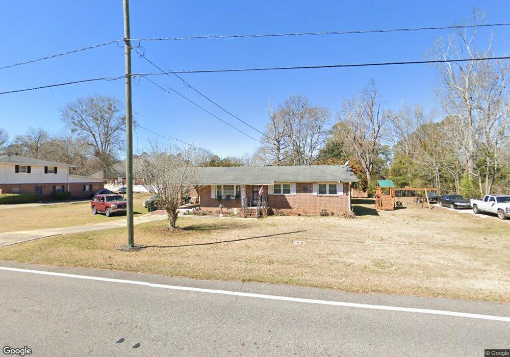
1966 State University Dr Fort Valley, GA 31030
Estimated Value: $86,000 - $135,000
3
Beds
2
Baths
1,150
Sq Ft
$89/Sq Ft
Est. Value
About This Home
This home is located at 1966 State University Dr, Fort Valley, GA 31030 and is currently estimated at $102,702, approximately $89 per square foot. 1966 State University Dr is a home located in Peach County with nearby schools including Hunt Elementary School, Fort Valley Middle School, and Peach County High School.
Ownership History
Date
Name
Owned For
Owner Type
Purchase Details
Closed on
Jun 11, 2025
Sold by
Hammock Willie J
Bought by
Cox Kysha Redding
Current Estimated Value
Home Financials for this Owner
Home Financials are based on the most recent Mortgage that was taken out on this home.
Original Mortgage
$83,000
Outstanding Balance
$82,787
Interest Rate
6.81%
Mortgage Type
VA
Estimated Equity
$19,915
Purchase Details
Closed on
Apr 16, 2007
Sold by
Ellis Alfred H
Bought by
Hammock Willie
Home Financials for this Owner
Home Financials are based on the most recent Mortgage that was taken out on this home.
Original Mortgage
$72,526
Interest Rate
6.1%
Mortgage Type
VA
Purchase Details
Closed on
Apr 13, 2001
Sold by
Ellis Martha J
Bought by
Ellis Alfred H
Purchase Details
Closed on
Jun 13, 1973
Bought by
Ellis Alfred H and Ellis Martha J
Create a Home Valuation Report for This Property
The Home Valuation Report is an in-depth analysis detailing your home's value as well as a comparison with similar homes in the area
Home Values in the Area
Average Home Value in this Area
Purchase History
| Date | Buyer | Sale Price | Title Company |
|---|---|---|---|
| Cox Kysha Redding | $83,000 | -- | |
| Hammock Willie | $71,000 | -- | |
| Ellis Alfred H | -- | -- | |
| Ellis Alfred H | -- | -- |
Source: Public Records
Mortgage History
| Date | Status | Borrower | Loan Amount |
|---|---|---|---|
| Open | Cox Kysha Redding | $83,000 | |
| Closed | Hammock Willie | $72,526 |
Source: Public Records
Tax History Compared to Growth
Tax History
| Year | Tax Paid | Tax Assessment Tax Assessment Total Assessment is a certain percentage of the fair market value that is determined by local assessors to be the total taxable value of land and additions on the property. | Land | Improvement |
|---|---|---|---|---|
| 2024 | $974 | $28,840 | $3,240 | $25,600 |
| 2023 | $899 | $25,800 | $3,160 | $22,640 |
| 2022 | $853 | $24,120 | $3,160 | $20,960 |
| 2021 | $761 | $19,840 | $3,120 | $16,720 |
| 2020 | $925 | $25,080 | $4,800 | $20,280 |
| 2019 | $928 | $25,080 | $4,800 | $20,280 |
| 2018 | $932 | $25,080 | $4,800 | $20,280 |
| 2017 | $935 | $25,080 | $4,800 | $20,280 |
| 2016 | $1,017 | $27,760 | $4,800 | $22,960 |
| 2015 | $1,017 | $27,760 | $4,800 | $22,960 |
| 2014 | $1,065 | $27,200 | $4,800 | $22,400 |
| 2013 | -- | $27,200 | $4,800 | $22,400 |
Source: Public Records
Map
Nearby Homes
- 177 S Jones St
- 47 King St
- 57 Kemp St
- 404 Benjamin St
- 108 Benjamin St
- 202 Charlevoix St
- 191 Daniel Dr
- 302 Fagan Cir
- 207 Carver Dr
- 735 River Rd
- 1011 Pine St
- 1105 River Rd
- 712 Courtland Ave
- 705 Princess Ave
- 710 Pine St
- 708 Princess Ave
- 210 Perry Railroad St
- 34 Rosewood Dr
- 303 State University Dr
- 0 Spillers St Unit 254475
- 1980 State University Dr
- 383 S Jones St
- 1949 State University Dr
- 2006 State University Dr
- 1975 State University Dr
- 1920 State University Dr
- 1939 State University Dr
- 409 S Jones St
- 355 S Jones St
- 1904 State University Dr
- 110 Duncan St
- 147 Wood St
- 392 S Jones St
- 79 Duncan St
- 110 Wood St
- 356 S Jones St
- 2030 State University Dr
- 406 S Jones St
- 113 Wood St
- S S Jones St Unit 4