Estimated Value: $654,000 - $697,568
6
Beds
3
Baths
2,929
Sq Ft
$231/Sq Ft
Est. Value
About This Home
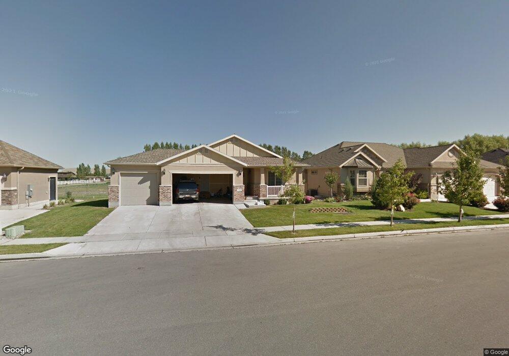
This home is located at 1966 W 1260 N, Lehi, UT 84043 and is currently estimated at $677,642, approximately $231 per square foot. 1966 W 1260 N is a home located in Utah County with nearby schools including North Point Elementary School, Willowcreek Middle School, and Lehi High School.
Ownership History
Date
Name
Owned For
Owner Type
Purchase Details
Closed on
May 18, 2023
Sold by
B & S Holbrook Irrevocable Trust
Bought by
Tenney Michael and Tenney Diane
Current Estimated Value
Home Financials for this Owner
Home Financials are based on the most recent Mortgage that was taken out on this home.
Original Mortgage
$360,000
Outstanding Balance
$349,103
Interest Rate
6.13%
Mortgage Type
New Conventional
Estimated Equity
$328,539
Purchase Details
Closed on
Oct 17, 2016
Sold by
Jensen Ben B
Bought by
Holbrook Bryce E and Holbrook Sherrie A
Purchase Details
Closed on
Sep 3, 2008
Sold by
Ivory Homes Ltd
Bought by
Jensen Ben B
Home Financials for this Owner
Home Financials are based on the most recent Mortgage that was taken out on this home.
Original Mortgage
$298,819
Interest Rate
6.59%
Mortgage Type
FHA
Create a Home Valuation Report for This Property
The Home Valuation Report is an in-depth analysis detailing your home's value as well as a comparison with similar homes in the area
Home Values in the Area
Average Home Value in this Area
Purchase History
| Date | Buyer | Sale Price | Title Company |
|---|---|---|---|
| Tenney Michael | -- | Real Advantage Title | |
| Holbrook Bryce E | -- | Cottonwood Title | |
| Jensen Ben B | -- | Cottonwood Title Insurance | |
| Ivory Homes Ltd | -- | Cottonwood Title Insurance |
Source: Public Records
Mortgage History
| Date | Status | Borrower | Loan Amount |
|---|---|---|---|
| Open | Tenney Michael | $360,000 | |
| Previous Owner | Jensen Ben B | $298,819 |
Source: Public Records
Tax History Compared to Growth
Tax History
| Year | Tax Paid | Tax Assessment Tax Assessment Total Assessment is a certain percentage of the fair market value that is determined by local assessors to be the total taxable value of land and additions on the property. | Land | Improvement |
|---|---|---|---|---|
| 2025 | $2,823 | $373,340 | $254,600 | $424,200 |
| 2024 | $2,823 | $330,330 | $0 | $0 |
| 2023 | $2,443 | $310,420 | $0 | $0 |
| 2022 | $2,636 | $324,665 | $0 | $0 |
| 2021 | $2,343 | $436,300 | $147,300 | $289,000 |
| 2020 | $2,208 | $406,500 | $136,400 | $270,100 |
| 2019 | $1,940 | $371,300 | $136,400 | $234,900 |
| 2018 | $1,852 | $335,100 | $116,900 | $218,200 |
| 2017 | $1,879 | $180,730 | $0 | $0 |
| 2016 | $1,850 | $165,055 | $0 | $0 |
| 2015 | $1,703 | $144,265 | $0 | $0 |
| 2014 | $1,615 | $135,960 | $0 | $0 |
Source: Public Records
Map
Nearby Homes
- 1659 W Boxwood Dr Unit 109
- 1627 W Boxwood Dr Unit 110
- 1542 N 1900 W
- 1127 N 1500 W
- 1648 N 1900 W
- 1302 N 2450 W
- 1132 Titan Dr
- 1032 Titan Dr
- 1908 N 2230 W
- 1896 N 2230 W
- 1332 W 1500 N
- 1870 N 2230 W
- Accord Plan at Riverwalk
- Interlude Plan at Riverwalk
- Trio Plan at Riverwalk
- Fortissimo Plan at Riverwalk
- Ballad Plan at Riverwalk
- Tenor Plan at Riverwalk
- Madrigal Plan at Riverwalk
- Timpani Plan at Riverwalk
- 1946 W 1260 N
- 1988 W 1260 N
- 1924 W 1260 N
- 1998 W 1260 N
- 1995 W 1340 N Unit 17
- 1955 W 1260 N
- 1251 N 1980 W
- 1935 W 1260 N
- 1904 W 1260 N
- 2006 W 1260 N
- 1915 W 1260 N
- 1231 N 1980 W
- 1252 N 2020 W
- 1322 N 2020 W Unit 1
- 1218 N 1980 W
- 1884 W 1260 N
- 1884 W 1260 N
- 1896 W 1340 N
- 1896 W 1340 N Unit 12
- 1862 W 1340 N Unit 13