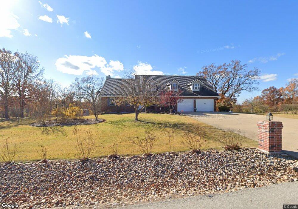
19661 Longview Rd Waynesville, MO 65583
Estimated Value: $341,000 - $363,000
Studio
1
Bath
3,721
Sq Ft
$96/Sq Ft
Est. Value
About This Home
This home is located at 19661 Longview Rd, Waynesville, MO 65583 and is currently estimated at $356,338, approximately $95 per square foot. 19661 Longview Rd is a home located in Pulaski County with nearby schools including Waynesville East Elementary School, Freedom Elementary School, and Waynesville Sixth Grade Center.
Ownership History
Date
Name
Owned For
Owner Type
Purchase Details
Closed on
Mar 30, 2021
Bought by
Avants James N
Current Estimated Value
Purchase Details
Closed on
Jul 15, 2011
Sold by
Caron Toney Stuart and Caron Toney
Bought by
Emperato Carl R and Emperato Shelley
Home Financials for this Owner
Home Financials are based on the most recent Mortgage that was taken out on this home.
Original Mortgage
$191,105
Interest Rate
4.53%
Purchase Details
Closed on
Apr 21, 2006
Sold by
Four J Land And Cattle Company Inc
Bought by
Avants James N and Avants Myong S
Create a Home Valuation Report for This Property
The Home Valuation Report is an in-depth analysis detailing your home's value as well as a comparison with similar homes in the area
Home Values in the Area
Average Home Value in this Area
Purchase History
| Date | Buyer | Sale Price | Title Company |
|---|---|---|---|
| Avants James N | -- | -- | |
| Emperato Carl R | -- | None Available | |
| Avants James N | -- | -- |
Source: Public Records
Mortgage History
| Date | Status | Borrower | Loan Amount |
|---|---|---|---|
| Previous Owner | Emperato Carl R | $191,105 |
Source: Public Records
Tax History
| Year | Tax Paid | Tax Assessment Tax Assessment Total Assessment is a certain percentage of the fair market value that is determined by local assessors to be the total taxable value of land and additions on the property. | Land | Improvement |
|---|---|---|---|---|
| 2025 | $2,196 | $55,998 | $5,700 | $50,298 |
| 2024 | $22 | $50,475 | $4,750 | $45,725 |
| 2023 | $2,144 | $50,475 | $4,750 | $45,725 |
| 2022 | $1,979 | $50,475 | $4,750 | $45,725 |
| 2021 | $1,956 | $50,475 | $4,750 | $45,725 |
| 2020 | $1,915 | $42,357 | $0 | $0 |
| 2019 | $1,914 | $48,298 | $0 | $0 |
| 2018 | $1,913 | $48,298 | $0 | $0 |
| 2017 | $1,912 | $42,357 | $0 | $0 |
| 2016 | $1,815 | $48,300 | $0 | $0 |
| 2015 | $1,813 | $48,300 | $0 | $0 |
| 2014 | $1,813 | $48,300 | $0 | $0 |
Source: Public Records
Map
Nearby Homes
- 0 Laduff Rd
- 20607 London Ln
- 20611 London Ln
- 21046 Larson Rd
- 20565 London Ln
- 20517 Luna Rd
- 21062 Larson Rd
- 19545 Lenox Ln
- 19958 Ladera Rd
- 21056 Lacombe Rd
- 18989 Ladera Rd
- 19580 Lyle Ln
- 21104 Larson Rd
- 19257 Lambert Ln
- 19252 Lambert Ln
- 21805 Revere Ln
- 20172 London Ln
- 0 Tbd Address Unit 23071485
- 19436 Laney Rd
- 19420 Laney Rd
- 19665 Longview Rd
- 19657 Longview Rd
- 19658 Longview Rd
- 19658 Longview Rd
- 19654 Longview Rd
- 19596 Lilly Ln
- 19671 Longview Rd
- 19648 Longview Rd
- 19594 Lilly Ln
- 19592 Lilly Ln
- 19642 Longview Rd
- 21322 Laduff Rd
- 19677 Longview Rd
- 21321 Laduff Rd
- 19590 Lilly Ln
- 19575 Lilly Ln
- 19645 Lilly Ln
- 19643 Longview Rd
- 19570 Lilly Ln
- 19668 Longview Rd
Your Personal Tour Guide
Ask me questions while you tour the home.