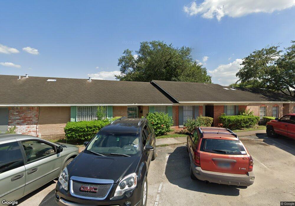
1967 Campbell Rd Unit 1967 Houston, TX 77080
Spring Shadows NeighborhoodEstimated Value: $111,434 - $139,000
2
Beds
1
Bath
918
Sq Ft
$133/Sq Ft
Est. Value
About This Home
This home is located at 1967 Campbell Rd Unit 1967, Houston, TX 77080 and is currently estimated at $122,359, approximately $133 per square foot. 1967 Campbell Rd Unit 1967 is a home located in Harris County with nearby schools including Pine Shadows Elementary School, Spring Woods Middle School, and Spring Woods High School.
Ownership History
Date
Name
Owned For
Owner Type
Purchase Details
Closed on
May 24, 2019
Sold by
Piedra Maria M
Bought by
Duong Thanh
Current Estimated Value
Home Financials for this Owner
Home Financials are based on the most recent Mortgage that was taken out on this home.
Original Mortgage
$59,250
Outstanding Balance
$51,987
Interest Rate
4.1%
Mortgage Type
New Conventional
Estimated Equity
$70,372
Create a Home Valuation Report for This Property
The Home Valuation Report is an in-depth analysis detailing your home's value as well as a comparison with similar homes in the area
Home Values in the Area
Average Home Value in this Area
Purchase History
We collect this data history from publicly available records. To have your information removed, we recommend requesting removal directly through your county’s website.
| Date | Buyer | Sale Price | Title Company |
|---|---|---|---|
| Duong Thanh | -- | American Title Company |
Source: Public Records
Mortgage History
We collect this data history from publicly available records. To have your information removed, we recommend requesting removal directly through your county’s website.
| Date | Status | Borrower | Loan Amount |
|---|---|---|---|
| Open | Duong Thanh | $59,250 |
Source: Public Records
Tax History
| Year | Tax Paid | Tax Assessment Tax Assessment Total Assessment is a certain percentage of the fair market value that is determined by local assessors to be the total taxable value of land and additions on the property. | Land | Improvement |
|---|---|---|---|---|
| 2025 | $2,546 | $115,505 | $21,946 | $93,559 |
| 2024 | $2,546 | $115,505 | $21,946 | $93,559 |
| 2023 | $2,546 | $100,779 | $19,148 | $81,631 |
| 2022 | $2,457 | $100,779 | $19,148 | $81,631 |
| 2021 | $1,876 | $76,835 | $14,599 | $62,236 |
| 2020 | $1,836 | $70,455 | $13,386 | $57,069 |
| 2019 | $1,915 | $70,455 | $13,386 | $57,069 |
| 2018 | $1,750 | $64,500 | $12,255 | $52,245 |
| 2017 | $1,687 | $65,914 | $12,524 | $53,390 |
| 2016 | $1,345 | $51,412 | $9,768 | $41,644 |
| 2015 | $878 | $33,000 | $8,114 | $24,886 |
| 2014 | $878 | $33,000 | $8,114 | $24,886 |
Source: Public Records
Map
Nearby Homes
- 9458 Neuens Rd Unit 9458
- 9442 Neuens Rd Unit 9442
- 1912 Sedgie Dr
- 9522 Hammerly Blvd
- 1917 Elmview Dr
- 9517 Truscon Dr
- 1913 Hoskins Dr Unit E
- 1913 Hoskins Dr Unit D
- 1932 Hoskins Dr
- 2131 Campbell Rd
- 9537 Kerrwood Ln
- 9541 Kerrwood Ln
- 9426 Campbell Rd Unit A
- 9426 Montridge Dr
- 9386 Livernois Rd
- 1926 Hoskins Dr
- 2122 Blalock Rd Unit B
- 2122 Blalock Rd Unit A
- 2131 Blalock Rd Unit D
- 2131 Blalock Rd Unit G
- 1973 Campbell Rd Unit 1973
- 1963 Campbell Rd Unit 1963
- 1959 Campbell Rd Unit 1959
- 1975 Campbell Rd Unit 1975
- 1971 Campbell Rd Unit 1971
- 1951 Campbell Rd Unit 1951
- 1969 Campbell Rd Unit 1969
- 1977 Campbell Rd Unit 1977
- 1965 Campbell Rd Unit 1965
- 1955 Campbell Rd Unit 1955
- 1941 Campbell Rd Unit 1941
- 1961 Campbell Rd Unit 1961
- 1953 Campbell Rd Unit 1953
- 1935 Campbell Rd Unit 1935
- 1981 Campbell Rd Unit 1981
- 1937 Campbell Rd Unit 1937
- 1939 Campbell Rd Unit 1939
- 1979 Campbell Rd Unit 1979
- 1957 Campbell Rd Unit 1957
- 1947 Campbell Rd Unit 1947
Your Personal Tour Guide
Ask me questions while you tour the home.