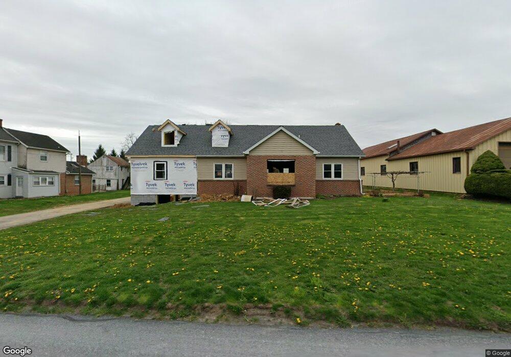
1967 Division Hwy Ephrata, PA 17522
Estimated Value: $363,671 - $473,000
3
Beds
1
Bath
1,540
Sq Ft
$267/Sq Ft
Est. Value
About This Home
This home is located at 1967 Division Hwy, Ephrata, PA 17522 and is currently estimated at $411,918, approximately $267 per square foot. 1967 Division Hwy is a home located in Lancaster County with nearby schools including Garden Spot Middle School, Garden Spot Senior High School, and Hinkletown Mennonite School.
Ownership History
Date
Name
Owned For
Owner Type
Purchase Details
Closed on
Oct 28, 2011
Sold by
Watson Thomas N and Watson Mary E
Bought by
Ebersol John K and Ebersol Rebecca F
Current Estimated Value
Home Financials for this Owner
Home Financials are based on the most recent Mortgage that was taken out on this home.
Original Mortgage
$165,000
Outstanding Balance
$112,460
Interest Rate
4.01%
Mortgage Type
Credit Line Revolving
Estimated Equity
$299,458
Purchase Details
Closed on
May 8, 2009
Sold by
Watson Thomas N and Watson Mary E
Bought by
Watson Thomas N and Watson Mary E
Home Financials for this Owner
Home Financials are based on the most recent Mortgage that was taken out on this home.
Original Mortgage
$164,800
Interest Rate
4.85%
Mortgage Type
New Conventional
Create a Home Valuation Report for This Property
The Home Valuation Report is an in-depth analysis detailing your home's value as well as a comparison with similar homes in the area
Home Values in the Area
Average Home Value in this Area
Purchase History
| Date | Buyer | Sale Price | Title Company |
|---|---|---|---|
| Ebersol John K | $210,000 | None Available | |
| Watson Thomas N | -- | None Available |
Source: Public Records
Mortgage History
| Date | Status | Borrower | Loan Amount |
|---|---|---|---|
| Open | Ebersol John K | $165,000 | |
| Previous Owner | Watson Thomas N | $164,800 |
Source: Public Records
Tax History Compared to Growth
Tax History
| Year | Tax Paid | Tax Assessment Tax Assessment Total Assessment is a certain percentage of the fair market value that is determined by local assessors to be the total taxable value of land and additions on the property. | Land | Improvement |
|---|---|---|---|---|
| 2025 | $3,836 | $223,200 | $85,900 | $137,300 |
| 2024 | $3,836 | $223,200 | $85,900 | $137,300 |
| 2023 | $3,779 | $223,200 | $85,900 | $137,300 |
| 2022 | $3,736 | $223,200 | $85,900 | $137,300 |
| 2021 | $3,674 | $223,200 | $85,900 | $137,300 |
| 2020 | $3,674 | $223,200 | $85,900 | $137,300 |
| 2019 | $3,632 | $223,200 | $85,900 | $137,300 |
| 2018 | $5,401 | $223,200 | $85,900 | $137,300 |
| 2017 | $2,902 | $144,900 | $34,600 | $110,300 |
| 2016 | $2,902 | $144,900 | $34,600 | $110,300 |
| 2015 | $722 | $144,900 | $34,600 | $110,300 |
| 2014 | $2,024 | $144,900 | $34,600 | $110,300 |
Source: Public Records
Map
Nearby Homes
- 306 Spring Glen Dr
- 883 E Main St
- 883 E Main St Unit 23
- 200 Pleasant Valley Rd
- 111 Ridge Ave
- 394 N Railroad Ave
- 151 Valley View Dr
- 220 Sycamore Ln
- 14 Hazelwood Cir
- 28 Hearth Dr
- 474 N Maple St
- 538 E Main St
- 67 E Mohler Church Rd
- 18 Akron Rd
- 221 Marion Terrace
- 214 Linda Terrace
- 210 Marion Terrace
- 335 Lincoln Ave
- 323 Lincoln Ave
- 144 W Conestoga St
- 1977 Division Hwy
- 1991 Division Hwy
- 1983 Division Hwy
- 1972 Division Hwy
- 1964 Division Hwy
- 1931 Division Hwy
- 2011 Division Hwy
- 639 Farmersville Rd
- 639 E Farmersville Rd
- 1901 Division Hwy
- 635 Farmersville Rd
- 1912 Division Hwy
- 631 Farmersville Rd
- 1900 Division Hwy
- 636 E Farmersville Rd
- 636 Farmersville Rd
- 634 Farmersville Rd
- 632 Farmersville Rd
- 1884 Division Hwy
- 145 Wanner Rd