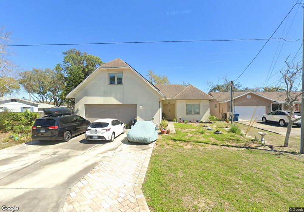
1967 Forest Ave Daytona Beach, FL 32119
Estimated Value: $299,000 - $406,000
4
Beds
3
Baths
2,340
Sq Ft
$148/Sq Ft
Est. Value
About This Home
This home is located at 1967 Forest Ave, Daytona Beach, FL 32119 and is currently estimated at $345,599, approximately $147 per square foot. 1967 Forest Ave is a home located in Volusia County with nearby schools including South Daytona Elementary School, Atlantic High School, and Campbell Middle School.
Ownership History
Date
Name
Owned For
Owner Type
Purchase Details
Closed on
Mar 12, 2018
Sold by
Luncsford Martin E and Luncsford Martin Elijah
Bought by
Lunsford Ii Martin Elijah
Current Estimated Value
Home Financials for this Owner
Home Financials are based on the most recent Mortgage that was taken out on this home.
Original Mortgage
$200,000
Outstanding Balance
$170,730
Interest Rate
4.22%
Mortgage Type
VA
Estimated Equity
$174,869
Purchase Details
Closed on
Aug 22, 2006
Sold by
Hanna Jason and Hanna Darcy
Bought by
Lunsford Martin E
Home Financials for this Owner
Home Financials are based on the most recent Mortgage that was taken out on this home.
Original Mortgage
$54,000
Interest Rate
6.67%
Mortgage Type
Purchase Money Mortgage
Purchase Details
Closed on
Nov 15, 1984
Bought by
Lunsford Martin E
Purchase Details
Closed on
Feb 15, 1974
Bought by
Lunsford Martin E
Create a Home Valuation Report for This Property
The Home Valuation Report is an in-depth analysis detailing your home's value as well as a comparison with similar homes in the area
Home Values in the Area
Average Home Value in this Area
Purchase History
| Date | Buyer | Sale Price | Title Company |
|---|---|---|---|
| Lunsford Ii Martin Elijah | -- | None Available | |
| Lunsford Martin E | $60,000 | Adams Cameron Title Svcs Inc | |
| Lunsford Martin E | $13,500 | -- | |
| Lunsford Martin E | $1,000 | -- |
Source: Public Records
Mortgage History
| Date | Status | Borrower | Loan Amount |
|---|---|---|---|
| Open | Lunsford Ii Martin Elijah | $200,000 | |
| Previous Owner | Lunsford Martin E | $54,000 |
Source: Public Records
Tax History Compared to Growth
Tax History
| Year | Tax Paid | Tax Assessment Tax Assessment Total Assessment is a certain percentage of the fair market value that is determined by local assessors to be the total taxable value of land and additions on the property. | Land | Improvement |
|---|---|---|---|---|
| 2025 | $3,257 | $217,036 | -- | -- |
| 2024 | $3,257 | $210,920 | -- | -- |
| 2023 | $3,257 | $204,777 | $0 | $0 |
| 2022 | $3,188 | $198,813 | $0 | $0 |
| 2021 | $3,270 | $193,022 | $0 | $0 |
| 2020 | $3,215 | $190,357 | $0 | $0 |
| 2019 | $3,181 | $186,077 | $0 | $0 |
| 2018 | $3,142 | $182,607 | $0 | $0 |
| 2017 | $3,132 | $178,851 | $0 | $0 |
| 2016 | $3,134 | $175,172 | $0 | $0 |
| 2015 | $3,213 | $173,954 | $0 | $0 |
| 2014 | $3,156 | $172,573 | $0 | $0 |
Source: Public Records
Map
Nearby Homes
- 1959 Forest Ave
- 1291 Mayflower Dr
- 1957 Deloy Dr
- 1293 Williamsburg Place
- 1301 Bunker Hill Dr
- 1279 Mayflower Dr
- 1178 Lavonne Dr
- 1283 Jamestown Dr
- 1282 Bunker Hill Dr
- 1275 Jamestown Dr
- 1283 Monticello Dr
- 1255 Williamsburg Place
- 1275 Monticello Dr
- 2142 La Costa Village Blvd Unit 445B
- 1283 Constitution Dr
- 1268 Plantation Place
- 1667 E Shangri la Dr
- 1290 Constitution Dr
- 1260 Valley Forge Dr
- 1278 Constitution Dr
- 1969 Forest Ave
- 1971 Forest Ave
- 1299 Mayflower Dr
- 1961 Forest Ave
- 1301 Pilgrim Place
- 1964 Forest Ave
- 1300 Pilgrim Place
- 1975 Forest Ave
- 1169 Houdyshell Rd
- 1962 Forest Ave
- 1965 Deloy Dr
- 1974 Forest Ave
- 1172 Houdyshell Rd
- 1960 Forest Ave
- 1957 Forest Ave
- 1979 Forest Ave
- 1174 Spruce St
- 1961 Deloy Dr
- 1293 Valley Forge Dr
- 1173 Houdyshell Rd