Estimated Value: $186,000 - $230,000
3
Beds
2
Baths
1,188
Sq Ft
$178/Sq Ft
Est. Value
About This Home
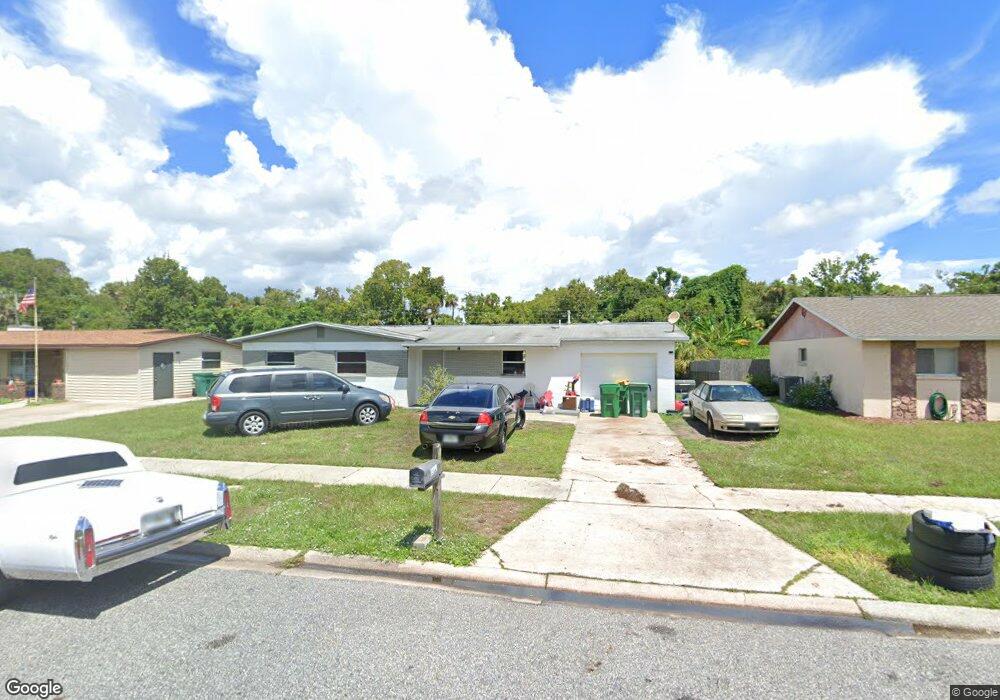
This home is located at 1967 Furman Ct, Cocoa, FL 32922 and is currently estimated at $211,909, approximately $178 per square foot. 1967 Furman Ct is a home located in Brevard County with nearby schools including Cambridge Elementary Magnet School, Cocoa High School, and Emma Jewel Charter Academy.
Ownership History
Date
Name
Owned For
Owner Type
Purchase Details
Closed on
Mar 26, 2014
Sold by
Brown Christine Gordon
Bought by
Brown Christine Gordon and Christine Gordon Brown Declaration Of Tr
Current Estimated Value
Purchase Details
Closed on
Nov 30, 2001
Sold by
Mosley Gloria H
Bought by
Brown Warren T and Brown Christine Gordon
Home Financials for this Owner
Home Financials are based on the most recent Mortgage that was taken out on this home.
Original Mortgage
$38,726
Outstanding Balance
$14,964
Interest Rate
6.42%
Estimated Equity
$196,945
Create a Home Valuation Report for This Property
The Home Valuation Report is an in-depth analysis detailing your home's value as well as a comparison with similar homes in the area
Home Values in the Area
Average Home Value in this Area
Purchase History
| Date | Buyer | Sale Price | Title Company |
|---|---|---|---|
| Brown Christine Gordon | -- | Attorney | |
| Brown Warren T | $47,000 | -- |
Source: Public Records
Mortgage History
| Date | Status | Borrower | Loan Amount |
|---|---|---|---|
| Open | Brown Warren T | $38,726 |
Source: Public Records
Tax History Compared to Growth
Tax History
| Year | Tax Paid | Tax Assessment Tax Assessment Total Assessment is a certain percentage of the fair market value that is determined by local assessors to be the total taxable value of land and additions on the property. | Land | Improvement |
|---|---|---|---|---|
| 2025 | $2,672 | $186,510 | -- | -- |
| 2024 | $2,482 | $182,110 | -- | -- |
| 2023 | $2,482 | $164,940 | $0 | $0 |
| 2022 | $2,120 | $147,160 | $0 | $0 |
| 2021 | $1,789 | $93,110 | $36,000 | $57,110 |
| 2020 | $1,626 | $82,240 | $36,000 | $46,240 |
| 2019 | $1,572 | $82,960 | $36,000 | $46,960 |
| 2018 | $1,354 | $72,240 | $25,000 | $47,240 |
| 2017 | $1,216 | $55,740 | $17,000 | $38,740 |
| 2016 | $1,119 | $46,400 | $9,000 | $37,400 |
| 2015 | $1,045 | $40,620 | $9,000 | $31,620 |
| 2014 | $968 | $38,880 | $10,000 | $28,880 |
Source: Public Records
Map
Nearby Homes
- 1810 Dixon Blvd
- 1326 Stetson Ct
- 1740 Rosa St
- 1735 Minnie St
- 1417 Walter St
- 2029 Ivy Dr Unit 2
- 1723 Dixon Blvd Unit 4
- 1422 E Stetson Cir
- 1424 E Stetson Cir
- 1353 S Stetson Dr
- 1711 Dixon Blvd Unit 179
- 1711 Dixon Blvd Unit 244
- 1711 Dixon Blvd Unit 244, 63, 4
- 1711 Dixon Blvd Unit 240
- 1711 Dixon Blvd Unit 210
- 1713 Dixon Blvd Unit 163
- 1686 Ackley Rd
- 1684 Ackley Rd
- 0 University Ln
- 1523 Clearlake Ct
- 1963 Furman Ct
- 1971 Furman Ct
- 1959 Furman Ct
- 1975 Furman Ct
- 1966 Furman Ct
- 1962 Furman Ct
- 1970 Furman Ct
- 1958 Furman Ct
- 1955 Furman Ct
- 1423 College Ave
- 1910 Furman Ct
- 1954 Furman Ct
- 1914 Furman Ct
- 1906 Furman Ct
- 1424 College Ave
- 1951 Furman Ct
- 1918 Furman Ct
- 1409 College Ave
- 1420 College Ave
- 1922 Furman Ct