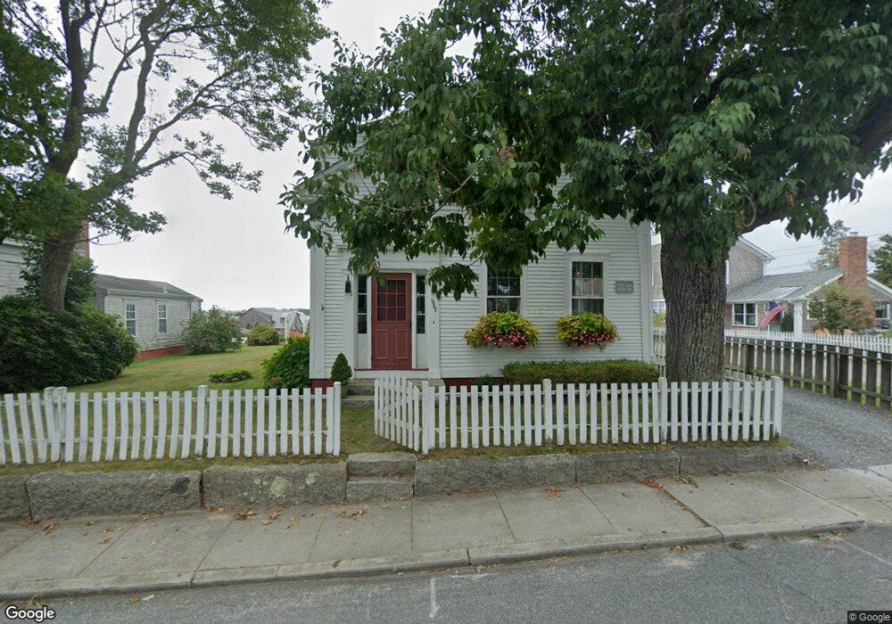
1967 Main Rd Westport Point, MA 02791
Westport Point NeighborhoodEstimated Value: $1,245,000 - $1,659,860
--
Bed
--
Bath
2,842
Sq Ft
$533/Sq Ft
Est. Value
About This Home
This home is located at 1967 Main Rd, Westport Point, MA 02791 and is currently estimated at $1,515,465, approximately $533 per square foot. 1967 Main Rd is a home with nearby schools including Alice A. Macomber Primary School, Westport Elementary School, and Westport Middle-High School.
Ownership History
Date
Name
Owned For
Owner Type
Purchase Details
Closed on
Nov 30, 2009
Sold by
Rog Ft
Bought by
Rog Dennis J and Rog Ruth S
Current Estimated Value
Home Financials for this Owner
Home Financials are based on the most recent Mortgage that was taken out on this home.
Original Mortgage
$270,000
Outstanding Balance
$177,001
Interest Rate
4.92%
Estimated Equity
$1,338,464
Purchase Details
Closed on
Jun 30, 1995
Sold by
Richards David Alan and Richards Marianne D
Bought by
Rog Dennis J and Rog Ruth S
Purchase Details
Closed on
Dec 19, 1988
Sold by
Sharp Rt
Bought by
Richards David A
Create a Home Valuation Report for This Property
The Home Valuation Report is an in-depth analysis detailing your home's value as well as a comparison with similar homes in the area
Home Values in the Area
Average Home Value in this Area
Purchase History
| Date | Buyer | Sale Price | Title Company |
|---|---|---|---|
| Rog Dennis J | -- | -- | |
| Rog Dennis J | -- | -- | |
| Rog Dennis J | $385,000 | -- | |
| Rog Dennis J | $385,000 | -- | |
| Richards David A | $380,000 | -- |
Source: Public Records
Mortgage History
| Date | Status | Borrower | Loan Amount |
|---|---|---|---|
| Open | Richards David A | $270,000 | |
| Previous Owner | Richards David A | $42,206 |
Source: Public Records
Tax History Compared to Growth
Tax History
| Year | Tax Paid | Tax Assessment Tax Assessment Total Assessment is a certain percentage of the fair market value that is determined by local assessors to be the total taxable value of land and additions on the property. | Land | Improvement |
|---|---|---|---|---|
| 2025 | $9,145 | $1,227,500 | $900,400 | $327,100 |
| 2024 | $8,954 | $1,158,400 | $834,200 | $324,200 |
| 2023 | $8,651 | $1,060,200 | $770,000 | $290,200 |
| 2022 | $7,164 | $964,400 | $733,300 | $231,100 |
| 2021 | $0 | $831,100 | $600,000 | $231,100 |
| 2020 | $6,804 | $807,100 | $576,000 | $231,100 |
| 2019 | $6,583 | $796,000 | $576,000 | $220,000 |
| 2018 | $0 | $647,200 | $424,300 | $222,900 |
| 2017 | $5,057 | $634,500 | $424,300 | $210,200 |
| 2016 | $4,956 | $626,500 | $424,300 | $202,200 |
| 2015 | $4,798 | $605,100 | $435,800 | $169,300 |
Source: Public Records
Map
Nearby Homes
- 1881 Main Rd
- 1749 Main Rd
- 1702J Drift Rd
- 1702 Drift Rd
- 1580 Main Rd
- 19 Seabury Ln
- 1346 Main Rd Unit B
- 99 Sylvia Ln
- 238-242 E Beach Rd
- 189 Brayton Point Rd
- 304 Brayton Point Rd
- 255 John Dyer Rd
- Lot 2 Horseneck Rd
- 245 John Dyer Rd
- 225 Hixbridge Rd
- 920 Drift Rd
- 17 Quail Trail
- 101 Adamsville Rd
- Lot 2E Horseneck Rd
- 837 Main Rd