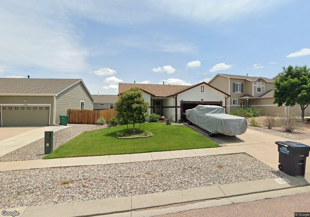
1967 Sage Grouse Ln Colorado Springs, CO 80951
Estimated Value: $378,000 - $417,000
2
Beds
2
Baths
1,160
Sq Ft
$337/Sq Ft
Est. Value
About This Home
This home is located at 1967 Sage Grouse Ln, Colorado Springs, CO 80951 and is currently estimated at $391,247, approximately $337 per square foot. 1967 Sage Grouse Ln is a home located in El Paso County with nearby schools including Evans International Elementary School, Horizon Middle School, and Sand Creek High School.
Ownership History
Date
Name
Owned For
Owner Type
Purchase Details
Closed on
Oct 5, 2005
Sold by
Baker Lura J
Bought by
Mason Quentin R and Mason Lura J
Current Estimated Value
Home Financials for this Owner
Home Financials are based on the most recent Mortgage that was taken out on this home.
Original Mortgage
$161,500
Outstanding Balance
$85,842
Interest Rate
5.65%
Mortgage Type
Fannie Mae Freddie Mac
Estimated Equity
$305,405
Purchase Details
Closed on
Sep 26, 2003
Sold by
Richmond American Homes Of Colorado Inc
Bought by
Baker Lura J
Home Financials for this Owner
Home Financials are based on the most recent Mortgage that was taken out on this home.
Original Mortgage
$143,240
Interest Rate
7.87%
Mortgage Type
Unknown
Create a Home Valuation Report for This Property
The Home Valuation Report is an in-depth analysis detailing your home's value as well as a comparison with similar homes in the area
Home Values in the Area
Average Home Value in this Area
Purchase History
| Date | Buyer | Sale Price | Title Company |
|---|---|---|---|
| Mason Quentin R | -- | Security Title | |
| Baker Lura J | $143,240 | Stewart Title |
Source: Public Records
Mortgage History
| Date | Status | Borrower | Loan Amount |
|---|---|---|---|
| Open | Mason Quentin R | $161,500 | |
| Previous Owner | Baker Lura J | $143,240 |
Source: Public Records
Tax History Compared to Growth
Tax History
| Year | Tax Paid | Tax Assessment Tax Assessment Total Assessment is a certain percentage of the fair market value that is determined by local assessors to be the total taxable value of land and additions on the property. | Land | Improvement |
|---|---|---|---|---|
| 2025 | $1,692 | $26,110 | -- | -- |
| 2024 | $1,082 | $26,440 | $5,290 | $21,150 |
| 2023 | $1,082 | $26,440 | $5,290 | $21,150 |
| 2022 | $1,113 | $18,540 | $4,170 | $14,370 |
| 2021 | $1,155 | $19,080 | $4,290 | $14,790 |
| 2020 | $775 | $15,130 | $3,580 | $11,550 |
| 2019 | $814 | $15,130 | $3,580 | $11,550 |
| 2018 | $604 | $11,710 | $3,560 | $8,150 |
| 2017 | $569 | $11,710 | $3,560 | $8,150 |
| 2016 | $1,131 | $11,920 | $3,580 | $8,340 |
| 2015 | $1,132 | $11,920 | $3,580 | $8,340 |
| 2014 | $1,048 | $10,890 | $3,580 | $7,310 |
Source: Public Records
Map
Nearby Homes
- 2060 Pinyon Jay Dr
- 2068 Killdeer Ct
- 2265 Sage Grouse Ln
- 8809 Christy Ct
- 2338 Jeanette Way
- 2210 Whale Point
- 2404 Obsidian Forest View
- 2322 Zebra Point
- 1649 Reilly Grove
- 2575 Shannara Grove
- 1974 Capital Dr
- 1768 Reilly Grove
- 8163 Postrock Dr
- 7820 Parsonage Ln
- 2034 Lillian Way
- 1925 Dewhirst Dr
- 1725 Bucolo Ave
- 8042 Parsonage Ln
- 2021 Dewhirst Dr
- 2631 Gobi Dr
- 1955 Sage Grouse Ln
- 1991 Sage Grouse Ln
- 1982 Woodpark Dr
- 1931 Sage Grouse Ln
- 1994 Woodpark Dr
- 1966 Sage Grouse Ln
- 1919 Sage Grouse Ln
- 1958 Woodpark Dr
- 1954 Sage Grouse Ln
- 1978 Sage Grouse Ln
- 1942 Sage Grouse Ln
- 1990 Sage Grouse Ln
- 2015 Sage Grouse Ln
- 1930 Sage Grouse Ln
- 1946 Woodpark Dr
- 1907 Sage Grouse Ln
- 2006 Woodpark Dr
- 1918 Sage Grouse Ln
- 1995 Woodpark Dr
- 2027 Sage Grouse Ln