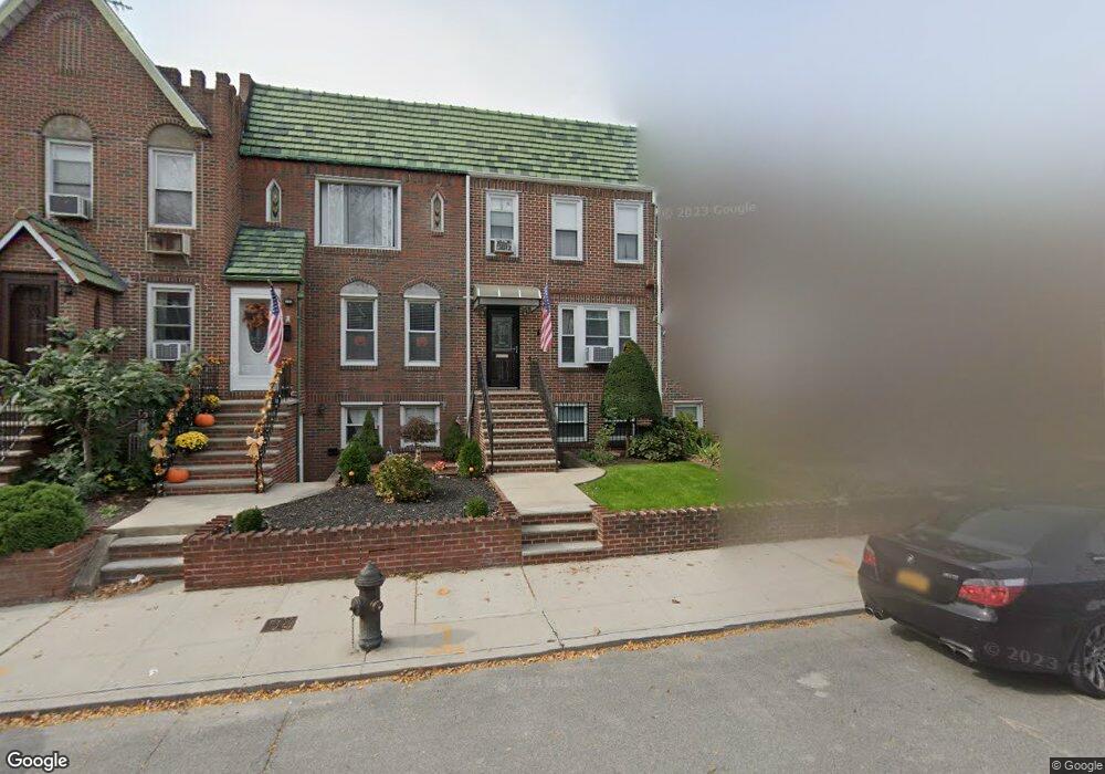
1968 E 29th St Brooklyn, NY 11229
Madison NeighborhoodEstimated Value: $875,964 - $930,000
Studio
--
Bath
1,785
Sq Ft
$503/Sq Ft
Est. Value
About This Home
This home is located at 1968 E 29th St, Brooklyn, NY 11229 and is currently estimated at $898,741, approximately $503 per square foot. 1968 E 29th St is a home located in Kings County with nearby schools including PS 222 Katherine R Snyder, Jhs 234 Arthur W Cunningham, and James Madison High School.
Ownership History
Date
Name
Owned For
Owner Type
Purchase Details
Closed on
Aug 4, 2023
Sold by
Acampora Julia A
Bought by
Julia Acampora Trust and Victoria Rose Acampora As Trustee
Current Estimated Value
Purchase Details
Closed on
Jun 14, 1995
Sold by
Acampora Julia A and Acampora Pasquale
Bought by
Acampora Julia A
Create a Home Valuation Report for This Property
The Home Valuation Report is an in-depth analysis detailing your home's value as well as a comparison with similar homes in the area
Home Values in the Area
Average Home Value in this Area
Purchase History
| Date | Buyer | Sale Price | Title Company |
|---|---|---|---|
| Julia Acampora Trust | -- | -- | |
| Julia Acampora Trust | -- | -- | |
| Julia Acampora Trust | -- | -- | |
| Acampora Julia A | $85,000 | First American Title Ins Co | |
| Acampora Julia A | -- | First American Title Ins Co |
Source: Public Records
Tax History
| Year | Tax Paid | Tax Assessment Tax Assessment Total Assessment is a certain percentage of the fair market value that is determined by local assessors to be the total taxable value of land and additions on the property. | Land | Improvement |
|---|---|---|---|---|
| 2025 | $6,955 | $59,580 | $9,660 | $49,920 |
| 2024 | $6,955 | $53,400 | $9,660 | $43,740 |
| 2023 | $3,710 | $55,860 | $9,660 | $46,200 |
| 2022 | $6,555 | $49,380 | $9,660 | $39,720 |
| 2021 | $6,402 | $47,460 | $9,660 | $37,800 |
| 2019 | $5,988 | $45,720 | $9,660 | $36,060 |
| 2018 | $5,777 | $29,798 | $6,279 | $23,519 |
| 2017 | $5,431 | $28,112 | $6,715 | $21,397 |
| 2016 | $4,992 | $26,521 | $7,584 | $18,937 |
| 2015 | $3,083 | $25,020 | $10,740 | $14,280 |
| 2014 | $3,083 | $25,020 | $10,740 | $14,280 |
Source: Public Records
Map
Nearby Homes
- 1953 E 28th St
- 1963 E 27th St
- 3334 Nostrand Ave
- 3338 Nostrand Ave
- 2011 E 27th St
- 1941 E 29th St
- 2063 E 28th St
- 2024 Haring St
- 1934 Haring St
- 2711 Avenue S Unit 5C
- 2611 Avenue S
- 1921 Haring St
- 1874 E 27th St
- 3202 Nostrand Ave Unit 1G
- 3203 Nostrand Ave Unit 5T
- 3203 Nostrand Ave Unit 5E
- 3203 Nostrand Ave Unit LB
- 1848 Haring St
- 3178 Nostrand Ave Unit 1C
- 3178 Nostrand Ave Unit 1M
- 1966 E 29th St
- 1970 E 29th St
- 1964 E 29th St
- 1972 E 29th St
- 1964 E 29 St
- 1960 E 29th St
- 1960 E 29 St
- 1974 E 29th St
- 1976 E 29 St
- 1958 E 29th St
- 1976 E 29th St
- 1956 E 29th St
- 1978 E 29th St
- 1965 E 28th St
- 1967 E 28th St
- 1963 E 28th St
- 1954 E 29th St
- 1980 E 29th St
- 1980 E 29th St Unit 1
- 1969 E 28th St
Your Personal Tour Guide
Ask me questions while you tour the home.