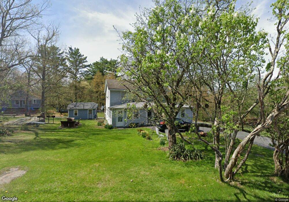
1968 Route 590 Hawley, PA 18428
Estimated Value: $260,351 - $320,000
4
Beds
2
Baths
1,974
Sq Ft
$147/Sq Ft
Est. Value
About This Home
This home is located at 1968 Route 590, Hawley, PA 18428 and is currently estimated at $290,176, approximately $146 per square foot. 1968 Route 590 is a home with nearby schools including Wallenpaupack Area High School and Son-Shine Christian School.
Ownership History
Date
Name
Owned For
Owner Type
Purchase Details
Closed on
Sep 26, 2006
Sold by
Kropf Diana T
Bought by
Bright Leroy D
Current Estimated Value
Home Financials for this Owner
Home Financials are based on the most recent Mortgage that was taken out on this home.
Original Mortgage
$185,000
Outstanding Balance
$110,759
Interest Rate
6.52%
Mortgage Type
New Conventional
Estimated Equity
$179,417
Create a Home Valuation Report for This Property
The Home Valuation Report is an in-depth analysis detailing your home's value as well as a comparison with similar homes in the area
Home Values in the Area
Average Home Value in this Area
Purchase History
| Date | Buyer | Sale Price | Title Company |
|---|---|---|---|
| Bright Leroy D | $185,000 | None Available |
Source: Public Records
Mortgage History
| Date | Status | Borrower | Loan Amount |
|---|---|---|---|
| Open | Bright Leroy D | $185,000 |
Source: Public Records
Tax History Compared to Growth
Tax History
| Year | Tax Paid | Tax Assessment Tax Assessment Total Assessment is a certain percentage of the fair market value that is determined by local assessors to be the total taxable value of land and additions on the property. | Land | Improvement |
|---|---|---|---|---|
| 2025 | $2,178 | $18,300 | $3,400 | $14,900 |
| 2024 | $2,178 | $18,300 | $3,400 | $14,900 |
| 2023 | $2,101 | $18,300 | $3,400 | $14,900 |
| 2022 | $2,055 | $18,300 | $3,400 | $14,900 |
| 2021 | $2,018 | $18,300 | $3,400 | $14,900 |
| 2020 | $2,018 | $18,300 | $3,400 | $14,900 |
| 2019 | $1,958 | $18,300 | $3,400 | $14,900 |
| 2018 | $1,928 | $18,300 | $3,400 | $14,900 |
| 2017 | $1,872 | $18,300 | $3,400 | $14,900 |
| 2016 | $0 | $18,300 | $3,400 | $14,900 |
| 2014 | -- | $18,300 | $3,400 | $14,900 |
Source: Public Records
Map
Nearby Homes
- 1936 Route 590
- Lot 21 Woodledge Hills Dr
- Lot 9 Tamarack Dr
- 20 Chuck Foster Dr
- 155 Tink Wig Dr
- 155 Tink Wig Dr
- 43 Woodledge East Lake Dr
- Lot 116 Beech Tree Ct
- 56 Cedar Ridge
- 0 Creek Rd
- 390 Creek Ct
- Lot 109 Oriole Ct
- Woodledge Village Meadows Ct
- Lot 3 Cedar Ridge Rd
- 0 Cedar Ridge Rd
- 22 Meadows Dr
- Lot 358 Westwood Ln
- 353 Westwood Ln
- 335 Westwood Ln
- Lot 21 Ridge View Rd