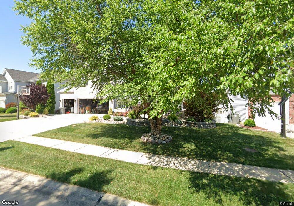
1968 Williamstown Dr Saint Peters, MO 63376
Estimated Value: $458,000 - $508,363
4
Beds
4
Baths
3,220
Sq Ft
$148/Sq Ft
Est. Value
About This Home
This home is located at 1968 Williamstown Dr, Saint Peters, MO 63376 and is currently estimated at $476,341, approximately $147 per square foot. 1968 Williamstown Dr is a home located in St. Charles County with nearby schools including Progress South Elementary School, Fort Zumwalt South Middle School, and Fort Zumwalt South High School.
Ownership History
Date
Name
Owned For
Owner Type
Purchase Details
Closed on
Aug 9, 2001
Sold by
The Jones Company Custom Homes Inc
Bought by
Epperson Jason
Current Estimated Value
Create a Home Valuation Report for This Property
The Home Valuation Report is an in-depth analysis detailing your home's value as well as a comparison with similar homes in the area
Home Values in the Area
Average Home Value in this Area
Purchase History
| Date | Buyer | Sale Price | Title Company |
|---|---|---|---|
| Epperson Jason | $292,126 | -- |
Source: Public Records
Tax History Compared to Growth
Tax History
| Year | Tax Paid | Tax Assessment Tax Assessment Total Assessment is a certain percentage of the fair market value that is determined by local assessors to be the total taxable value of land and additions on the property. | Land | Improvement |
|---|---|---|---|---|
| 2025 | $5,340 | $83,502 | -- | -- |
| 2023 | $5,342 | $80,957 | $0 | $0 |
| 2022 | $4,466 | $62,912 | $0 | $0 |
| 2021 | $4,469 | $62,912 | $0 | $0 |
| 2020 | $4,445 | $60,589 | $0 | $0 |
| 2019 | $4,456 | $60,589 | $0 | $0 |
| 2018 | $4,342 | $56,377 | $0 | $0 |
| 2017 | $4,295 | $56,377 | $0 | $0 |
| 2016 | $3,970 | $51,898 | $0 | $0 |
| 2015 | $3,691 | $51,898 | $0 | $0 |
| 2014 | $3,357 | $46,407 | $0 | $0 |
Source: Public Records
Map
Nearby Homes
- 2068 Williamstown Dr
- 114 Knaust Rd
- 67 Oakridge West Dr
- 28 Steiert Dr
- 2 Oak Point Ct
- 42 Kingspointe Dr
- 146 Huntington Crossing Dr
- 619 Turtle Creek Ct
- 8201 Bristol Valley Dr
- 307 Santa Fe Trail Dr
- 523 Coldstream Ct
- 113 Stage Coach Landing Dr
- Dover Plan at Birdie Hill Crossing - Cottage Collection
- Devonshire Plan at Birdie Hill Crossing - Cottage Collection
- Windsor Plan at Birdie Hill Crossing - Cottage Collection
- Fairground - Exterior Townhome Plan at Birdie Hill Crossing - Townhome Collection
- Fairground Plan at Birdie Hill Crossing - Townhome Collection
- Fairground - Interior Townhome Plan at Birdie Hill Crossing - Townhome Collection
- 34 Aspen Pointe Dr
- Franklin Plan at Strawberry Farms - Liberty Series
- 1974 Williamstown Dr
- 1962 Williamstown Dr
- 1959 Lunenburg Dr
- 1963 Lunenburg Dr
- 2002 Williamstown Dr
- 1956 Williamstown Dr
- 1969 Williamstown Dr
- 1967 Lunenburg Dr
- 1955 Lunenburg Dr
- 1 Williamstown Ct
- 1965 Williamstown Dr
- 1961 Williamstown Dr
- 2006 Williamstown Dr
- 1950 Williamstown Dr
- 1971 Lunenburg Dr
- 1951 Lunenburg Dr
- 3 Williamstown Ct
- 1957 Williamstown Dr
- 1958 Lunenburg Dr
- 2 Williamstown Ct