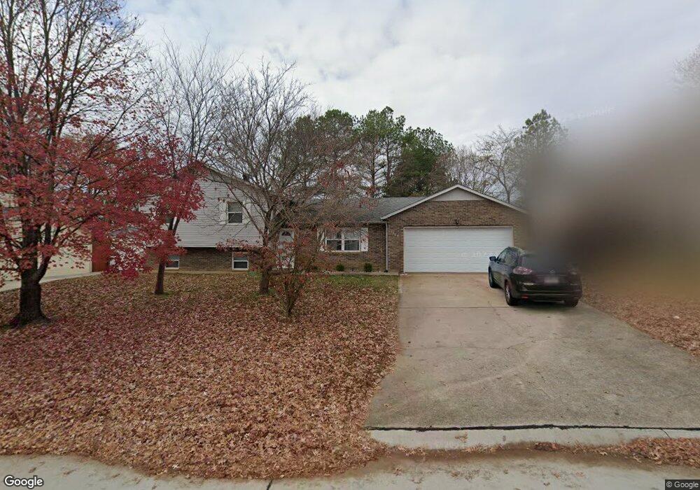
1969 David St Cape Girardeau, MO 63701
Estimated Value: $205,000 - $212,000
3
Beds
2
Baths
2
Sq Ft
$103,646/Sq Ft
Est. Value
About This Home
This home is located at 1969 David St, Cape Girardeau, MO 63701 and is currently estimated at $207,293, approximately $103,646 per square foot. 1969 David St is a home located in Cape Girardeau County with nearby schools including Alma Schrader Elementary School, Central Middle School, and Central Junior High School.
Ownership History
Date
Name
Owned For
Owner Type
Purchase Details
Closed on
Jul 17, 2020
Sold by
Seyer Brent A and Seyer Emily I
Bought by
Wisidagamage Thusita Prasanna and Patabandige Sujani Geewanthi
Current Estimated Value
Home Financials for this Owner
Home Financials are based on the most recent Mortgage that was taken out on this home.
Original Mortgage
$137,133
Outstanding Balance
$121,600
Interest Rate
3.1%
Mortgage Type
New Conventional
Estimated Equity
$85,693
Purchase Details
Closed on
May 24, 2013
Sold by
Yoffie George A and Yoffie Karen D
Bought by
Seyer Brent A and Honey Emily I
Home Financials for this Owner
Home Financials are based on the most recent Mortgage that was taken out on this home.
Original Mortgage
$115,900
Interest Rate
3.41%
Mortgage Type
New Conventional
Purchase Details
Closed on
Jun 23, 2005
Sold by
Yoffie Mary Kathryn
Bought by
Yoffie George Andrew
Purchase Details
Closed on
Jun 16, 2005
Sold by
Yoffie Mary Kathryn
Bought by
Yoffie George Andrew
Create a Home Valuation Report for This Property
The Home Valuation Report is an in-depth analysis detailing your home's value as well as a comparison with similar homes in the area
Purchase History
| Date | Buyer | Sale Price | Title Company |
|---|---|---|---|
| Wisidagamage Thusita Prasanna | -- | None Available | |
| Seyer Brent A | -- | -- | |
| Yoffie George Andrew | -- | None Available | |
| Yoffie George Andrew | -- | None Available |
Source: Public Records
Mortgage History
| Date | Status | Borrower | Loan Amount |
|---|---|---|---|
| Open | Wisidagamage Thusita Prasanna | $137,133 | |
| Previous Owner | Seyer Brent A | $115,900 |
Source: Public Records
Tax History
| Year | Tax Paid | Tax Assessment Tax Assessment Total Assessment is a certain percentage of the fair market value that is determined by local assessors to be the total taxable value of land and additions on the property. | Land | Improvement |
|---|---|---|---|---|
| 2025 | $1,185 | $22,690 | $3,220 | $19,470 |
| 2024 | $11 | $21,620 | $3,070 | $18,550 |
| 2023 | $1,124 | $21,620 | $3,070 | $18,550 |
| 2022 | $1,036 | $19,920 | $2,830 | $17,090 |
| 2021 | $1,036 | $19,920 | $2,830 | $17,090 |
| 2020 | $1,039 | $19,920 | $2,830 | $17,090 |
| 2019 | $1,037 | $19,920 | $0 | $0 |
| 2018 | $1,035 | $19,920 | $0 | $0 |
| 2017 | $1,038 | $19,920 | $0 | $0 |
| 2016 | $1,034 | $19,920 | $0 | $0 |
| 2015 | $1,034 | $19,920 | $0 | $0 |
| 2014 | $1,040 | $19,920 | $0 | $0 |
Source: Public Records
Map
Nearby Homes
- 1813 Belleridge Pike
- 1925 Randol Dr
- 1843 Dixie Blvd
- 1813 Meyer Dr
- 2033 Anthony Dr
- 2214 Kent Dr
- 2009 Steven Dr
- 2019 Kevin Dr
- 1952 Perryville Rd
- 1960 Briarwood Dr
- 3051 N Church St
- 2022 Allen Dr
- 1829 Weissinger Ln W
- 2062 Concord Place
- 2306 Abbey Rd
- 2137 Chesapeake Ave
- 2308 Kenneth Dr
- 1860 Autumn Dr
- 1465 David St
- 1508 Kingsbury Rd
- 1973 David St
- 1965 David St
- 1954 Grandview Dr
- 1970 David Dr
- 1950 Grandview Dr
- 1961 David St
- 1958 Grandview Dr
- 1966 David St
- 1970 David St
- 1974 David St
- 1946 Grandview Dr
- 1962 David St
- 1942 Grandview Dr
- 1957 David St
- 3417 Grandview Dr
- 1947 Grandview Dr
- 1958 David St
- 1951 Grandview Dr
- 1938 Grandview Dr
- 1985 Longview Dr
Your Personal Tour Guide
Ask me questions while you tour the home.