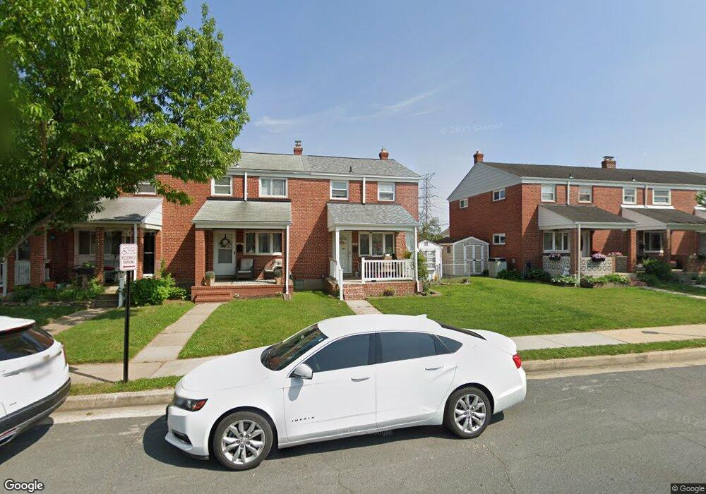
1969 Denbury Dr Dundalk, MD 21222
Estimated Value: $215,921 - $233,000
3
Beds
2
Baths
1,008
Sq Ft
$224/Sq Ft
Est. Value
About This Home
This home is located at 1969 Denbury Dr, Dundalk, MD 21222 and is currently estimated at $225,480, approximately $223 per square foot. 1969 Denbury Dr is a home located in Baltimore County with nearby schools including Grange Elementary School, General John Stricker Middle School, and Patapsco High & Center for Arts.
Ownership History
Date
Name
Owned For
Owner Type
Purchase Details
Closed on
Dec 3, 2010
Sold by
Houser Jacalyn D
Bought by
Martin Kristina L
Current Estimated Value
Home Financials for this Owner
Home Financials are based on the most recent Mortgage that was taken out on this home.
Original Mortgage
$138,400
Outstanding Balance
$91,531
Interest Rate
4.24%
Mortgage Type
FHA
Estimated Equity
$133,949
Purchase Details
Closed on
Aug 8, 1995
Sold by
Brookhart George J
Bought by
Houser Jacalyn D
Home Financials for this Owner
Home Financials are based on the most recent Mortgage that was taken out on this home.
Original Mortgage
$70,000
Interest Rate
7.48%
Create a Home Valuation Report for This Property
The Home Valuation Report is an in-depth analysis detailing your home's value as well as a comparison with similar homes in the area
Home Values in the Area
Average Home Value in this Area
Purchase History
| Date | Buyer | Sale Price | Title Company |
|---|---|---|---|
| Martin Kristina L | $142,000 | -- | |
| Houser Jacalyn D | $85,000 | -- |
Source: Public Records
Mortgage History
| Date | Status | Borrower | Loan Amount |
|---|---|---|---|
| Open | Martin Kristina L | $138,400 | |
| Previous Owner | Houser Jacalyn D | $70,000 | |
| Closed | Houser Jacalyn D | $5,000 |
Source: Public Records
Tax History Compared to Growth
Tax History
| Year | Tax Paid | Tax Assessment Tax Assessment Total Assessment is a certain percentage of the fair market value that is determined by local assessors to be the total taxable value of land and additions on the property. | Land | Improvement |
|---|---|---|---|---|
| 2025 | $2,424 | $156,500 | -- | -- |
| 2024 | $2,424 | $143,900 | $0 | $0 |
| 2023 | $1,178 | $131,300 | $38,000 | $93,300 |
| 2022 | $2,303 | $129,033 | $0 | $0 |
| 2021 | $2,217 | $126,767 | $0 | $0 |
| 2020 | $2,217 | $124,500 | $38,000 | $86,500 |
| 2019 | $2,101 | $121,233 | $0 | $0 |
| 2018 | $1,995 | $117,967 | $0 | $0 |
| 2017 | $2,021 | $114,700 | $0 | $0 |
| 2016 | $2,256 | $114,700 | $0 | $0 |
| 2015 | $2,256 | $114,700 | $0 | $0 |
| 2014 | $2,256 | $126,200 | $0 | $0 |
Source: Public Records
Map
Nearby Homes
- 2743 Kirkleigh Rd
- 1940 Wareham Rd
- 1935 Stanhope Rd
- 2746 Moorgate Rd
- 2738 Moorgate Rd
- 7807 Rockbourne Rd
- 9 Vista Mobile Dr
- 7252 Meadow Ln
- 1894 Church Rd
- 1907 Wills Rd
- 7839 Harold Rd
- 1940H Robinwood Rd
- 1914 Armco Way
- 2007 Dineen Dr
- 2953 Yorkway
- 1943 Dineen Dr
- 3135 Sollers Point Rd
- 2970 Yorkway
- 1614 Lynch Rd
- 8427 Stansbury Lake Dr
- 1967 Denbury Dr
- 1971 Denbury Dr
- 1965 Denbury Dr
- 1973 Denbury Dr
- 1963 Denbury Dr
- 1975 Denbury Dr
- 1961 Denbury Dr
- 1977 Denbury Dr
- 1959 Denbury Dr
- 1957 Denbury Dr
- 2814 Kirkleigh Rd
- 1955 Denbury Dr
- 1962 Denbury Dr
- 1960 Denbury Dr
- 1958 Denbury Dr
- 1956 Denbury Dr
- 2812 Kirkleigh Rd
- 1954 Denbury Dr
- 1953 Denbury Dr
- 1952 Denbury Dr