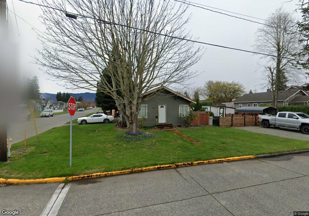
1969 Division St Enumclaw, WA 98022
Estimated Value: $400,000 - $460,000
2
Beds
1
Bath
910
Sq Ft
$470/Sq Ft
Est. Value
About This Home
This home is located at 1969 Division St, Enumclaw, WA 98022 and is currently estimated at $427,993, approximately $470 per square foot. 1969 Division St is a home located in King County with nearby schools including Byron Kibler Elementary School, Enumclaw Middle School, and Enumclaw Senior High School.
Ownership History
Date
Name
Owned For
Owner Type
Purchase Details
Closed on
Sep 23, 2002
Sold by
Sylvain Chris
Bought by
Sylvain Chris and Sylvain Kimberly K
Current Estimated Value
Home Financials for this Owner
Home Financials are based on the most recent Mortgage that was taken out on this home.
Original Mortgage
$112,000
Interest Rate
6.16%
Mortgage Type
Credit Line Revolving
Purchase Details
Closed on
Apr 25, 1990
Sold by
Erickson Paul W
Bought by
Sylvain Chris
Create a Home Valuation Report for This Property
The Home Valuation Report is an in-depth analysis detailing your home's value as well as a comparison with similar homes in the area
Home Values in the Area
Average Home Value in this Area
Purchase History
| Date | Buyer | Sale Price | Title Company |
|---|---|---|---|
| Sylvain Chris | -- | First American Title Ins Co | |
| Sylvain Chris | $59,900 | -- |
Source: Public Records
Mortgage History
| Date | Status | Borrower | Loan Amount |
|---|---|---|---|
| Closed | Sylvain Chris | $112,000 |
Source: Public Records
Tax History
| Year | Tax Paid | Tax Assessment Tax Assessment Total Assessment is a certain percentage of the fair market value that is determined by local assessors to be the total taxable value of land and additions on the property. | Land | Improvement |
|---|---|---|---|---|
| 2024 | $3,391 | $353,000 | $178,000 | $175,000 |
| 2023 | $3,149 | $303,000 | $153,000 | $150,000 |
| 2022 | $2,822 | $346,000 | $175,000 | $171,000 |
| 2021 | $2,602 | $281,000 | $151,000 | $130,000 |
| 2020 | $2,377 | $236,000 | $99,000 | $137,000 |
| 2018 | $2,036 | $214,000 | $92,000 | $122,000 |
| 2017 | $1,807 | $166,000 | $84,000 | $82,000 |
| 2016 | $1,727 | $152,000 | $78,000 | $74,000 |
| 2015 | $1,602 | $143,000 | $74,000 | $69,000 |
| 2014 | -- | $127,000 | $81,000 | $46,000 |
| 2013 | -- | $111,000 | $65,000 | $46,000 |
Source: Public Records
Map
Nearby Homes
- 1966 Wilson Ave
- 1975 Wilson Ave
- 1730 Hillcrest Ave
- 1705 Marshall Ave
- 2921 Frederickson St
- 1722 Harding St
- 1720 Garfield St Unit 4
- 1318 Lafromboise St
- 1355 Mchugh Ave
- 1107 Griffin Ave
- 0 xx 266th Ave SE
- 42801 264th Ave SE
- 2881 Initial Ave
- 1234 Lincoln Ave Unit A
- 1234 Lincoln Ave Unit B
- 27008 SE & 27012 432nd St
- 111 Chinook Ave
- 1909 Highpoint St
- 2054 Roosevelt Ave
- 431 Rainier Ave
- 1959 Division St
- 1949 Division St
- 1995 Kibler Ave
- 1970 Kibler Ave
- 1985 Kibler Ave
- 1941 Division St
- 1966 Kibler Ave
- 2919 Division St
- 1975 Kibler Ave
- 1965 Kibler Ave
- 1926 Hillcrest Ave
- 1955 Kibler Ave
- 2935 Division St
- 1945 Kibler Ave
- 1982 Wilson Ave
- 2024 James St
- 2038 James St
- 2949 Division St
- 2014 James St
- 1929 Washington Ave
Your Personal Tour Guide
Ask me questions while you tour the home.