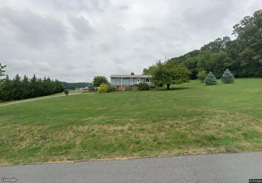
1969 Rockville Rd Spring Grove, PA 17362
Estimated Value: $247,000 - $365,145
3
Beds
1
Bath
1,152
Sq Ft
$261/Sq Ft
Est. Value
About This Home
This home is located at 1969 Rockville Rd, Spring Grove, PA 17362 and is currently estimated at $300,786, approximately $261 per square foot. 1969 Rockville Rd is a home located in York County with nearby schools including Spring Grove Area Middle School and Spring Grove Area High School.
Ownership History
Date
Name
Owned For
Owner Type
Purchase Details
Closed on
Mar 27, 2009
Sold by
Deutsche Bank National Trust Company
Bought by
Davis William G and Hofler Janet M
Current Estimated Value
Purchase Details
Closed on
Sep 24, 2008
Sold by
Laughman Leonard T and Laughman Paula
Bought by
Deutsche Bank National Trust Co
Create a Home Valuation Report for This Property
The Home Valuation Report is an in-depth analysis detailing your home's value as well as a comparison with similar homes in the area
Home Values in the Area
Average Home Value in this Area
Purchase History
| Date | Buyer | Sale Price | Title Company |
|---|---|---|---|
| Davis William G | $140,000 | None Available | |
| Deutsche Bank National Trust Co | $2,147 | None Available |
Source: Public Records
Tax History Compared to Growth
Tax History
| Year | Tax Paid | Tax Assessment Tax Assessment Total Assessment is a certain percentage of the fair market value that is determined by local assessors to be the total taxable value of land and additions on the property. | Land | Improvement |
|---|---|---|---|---|
| 2025 | $6,580 | $197,290 | $67,370 | $129,920 |
| 2024 | $6,509 | $197,290 | $67,370 | $129,920 |
| 2023 | $6,509 | $197,290 | $67,370 | $129,920 |
| 2022 | $6,509 | $197,290 | $67,370 | $129,920 |
| 2021 | $6,228 | $197,290 | $67,370 | $129,920 |
| 2020 | $6,228 | $197,290 | $67,370 | $129,920 |
| 2019 | $6,183 | $197,290 | $67,370 | $129,920 |
| 2018 | $6,102 | $197,290 | $67,370 | $129,920 |
| 2017 | $5,963 | $197,290 | $67,370 | $129,920 |
| 2016 | $0 | $197,290 | $67,370 | $129,920 |
| 2015 | -- | $197,290 | $67,370 | $129,920 |
| 2014 | -- | $197,290 | $67,370 | $129,920 |
Source: Public Records
Map
Nearby Homes
- 4815 Zeiglers Church Rd
- 5363 Waltersdorff Rd
- 2116 Jefferson Rd
- 1982 Whyte Ln
- 5497 Stambaugh Rd
- 0 Jefferson Rd Unit PAYK2090674
- 1495 Jefferson Rd
- 6 Lakeview Dr
- 6322 Liam
- 6325 Liam Dr
- 6324 Liam
- 6304 Liam Dr
- 6319 Liam Dr
- 0 Pin Oak 5br Plan at Hills at Valley View Unit PAYK2087614
- 6317 Liam Dr
- 0 Sweet Birch Plan at Hills at Valley View Unit PAYK2082022
- 0 Willow Plan at Hills at Valley View Unit PAYK2082084
- 0 Pin Oak Plan at Hills at Valley View Unit PAYK2082014
- 0 Black Cherry Plan at Hills at Valley View Unit PAYK2082012
- Emily Plan at Hills at Valley View
- 5065 Rislyn Ct
- 5071 Rislyn Ct
- 1960 Rockville Rd
- 1994 Rockville Rd
- 5053 Rislyn Ct
- 5075 Waltersdorff Rd
- 5085 Waltersdorff Rd
- 5065 Waltersdorff Rd
- 1970 Rockville Rd
- 5045 Rislyn Ct
- 5093 Waltersdorff Rd
- 5076 Waltersdorff Rd
- 5082 Waltersdorff Rd
- 5101 Waltersdorff Rd
- 5068 Waltersdorff Rd
- 5041 Rislyn Ct
- 5053 Waltersdorff Rd
- 1943 Rockville Rd
- 5042 Rislyn Ct
- 5062 Waltersdorff Rd