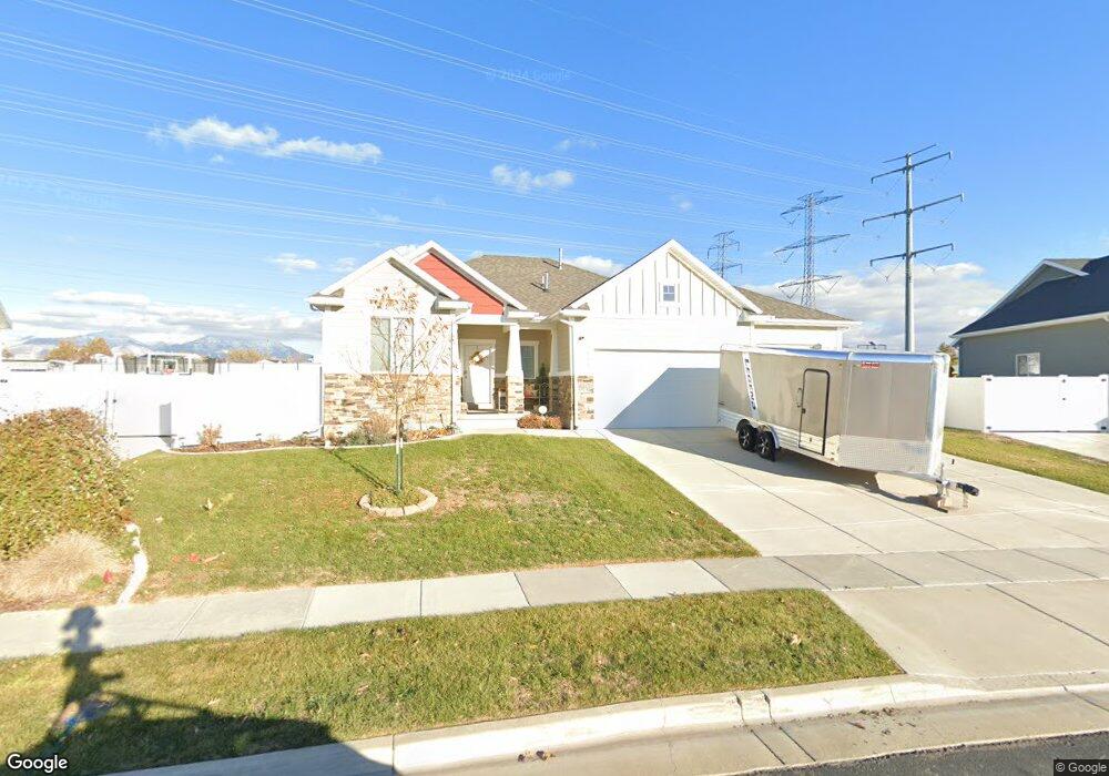
1969 S 525 W Syracuse, UT 84075
Estimated Value: $577,000 - $602,000
2
Beds
2
Baths
3,105
Sq Ft
$191/Sq Ft
Est. Value
About This Home
This home is located at 1969 S 525 W, Syracuse, UT 84075 and is currently estimated at $594,548, approximately $191 per square foot. 1969 S 525 W is a home located in Davis County with nearby schools including Bluff Ridge Elementary, Legacy Junior High School, and Clearfield High School.
Ownership History
Date
Name
Owned For
Owner Type
Purchase Details
Closed on
Sep 25, 2019
Sold by
Solomon Charles E and Solomon Sandra K
Bought by
Solomon Charles E and Solomon Sandra K
Current Estimated Value
Purchase Details
Closed on
Sep 26, 2018
Sold by
Isaacson Nikki M
Bought by
Solomon Charles E and Solomon Sandra K
Home Financials for this Owner
Home Financials are based on the most recent Mortgage that was taken out on this home.
Original Mortgage
$210,000
Outstanding Balance
$182,755
Interest Rate
4.5%
Mortgage Type
New Conventional
Estimated Equity
$411,793
Purchase Details
Closed on
Feb 5, 2016
Sold by
Perry Homes Utah Inc
Bought by
Isaacson Nikkie M
Create a Home Valuation Report for This Property
The Home Valuation Report is an in-depth analysis detailing your home's value as well as a comparison with similar homes in the area
Home Values in the Area
Average Home Value in this Area
Purchase History
| Date | Buyer | Sale Price | Title Company |
|---|---|---|---|
| Solomon Charles E | -- | None Available | |
| Solomon Charles E | -- | Security Title Of Davis | |
| Isaacson Nikkie M | -- | Meridian Title | |
| Perry Homes Utah Inc | -- | Meridian Title |
Source: Public Records
Mortgage History
| Date | Status | Borrower | Loan Amount |
|---|---|---|---|
| Open | Solomon Charles E | $210,000 |
Source: Public Records
Tax History Compared to Growth
Tax History
| Year | Tax Paid | Tax Assessment Tax Assessment Total Assessment is a certain percentage of the fair market value that is determined by local assessors to be the total taxable value of land and additions on the property. | Land | Improvement |
|---|---|---|---|---|
| 2025 | $3,021 | $291,500 | $105,208 | $186,292 |
| 2024 | $2,984 | $289,850 | $86,061 | $203,789 |
| 2023 | $2,882 | $510,000 | $119,970 | $390,030 |
| 2022 | $3,061 | $297,000 | $69,190 | $227,810 |
| 2021 | $2,656 | $399,000 | $102,140 | $296,860 |
| 2020 | $2,400 | $349,000 | $89,453 | $259,547 |
| 2019 | $2,536 | $364,000 | $86,852 | $277,148 |
| 2018 | $2,386 | $340,000 | $84,194 | $255,806 |
| 2016 | $2,131 | $159,280 | $38,043 | $121,237 |
| 2015 | $685 | $48,732 | $38,043 | $10,689 |
| 2014 | $954 | $69,169 | $69,169 | $0 |
Source: Public Records
Map
Nearby Homes
- 1969 S 525 W Unit 506
- 1983 S 525 W
- 1955 S 525 W
- 1997 S 525 W
- 1978 S 525 W
- 1941 S 525 W Unit 508
- 1962 S 525 W
- 548 W 2010 S
- 1946 S 525 W
- 1927 S 525 W
- 1993 S 585 W Unit 333
- 1963 S 585 W
- 519 W 2010 S
- 535 W 2010 S Unit 502
- 1971 S 585 W
- 1930 S 525 W
- 551 W 2010 S
- 1925 Jenny Ln
- 1949 S 585 W Unit 330
- 1949 S 585 W