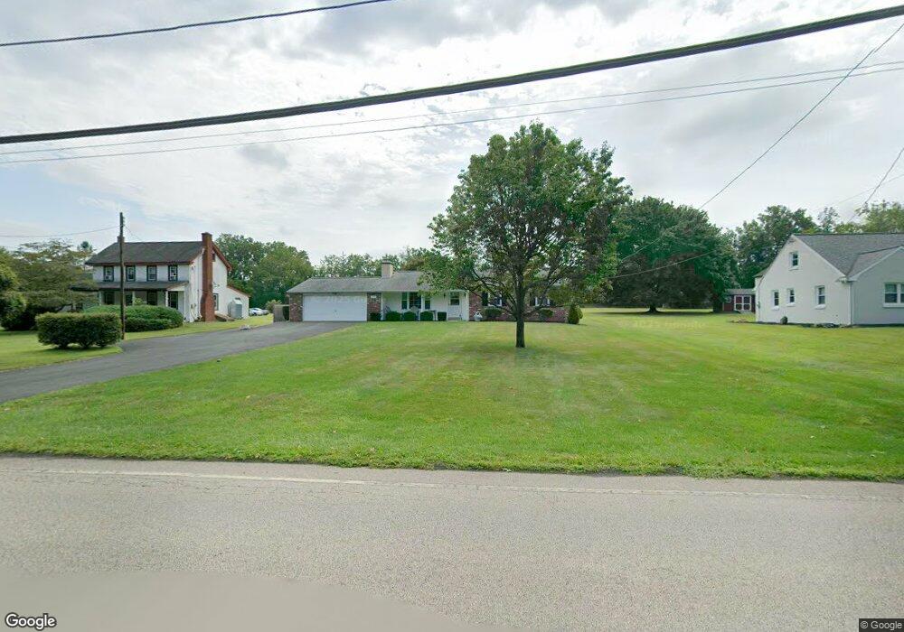
1969 W Point Pike Lansdale, PA 19446
Estimated Value: $437,000 - $524,000
3
Beds
2
Baths
1,647
Sq Ft
$293/Sq Ft
Est. Value
About This Home
This home is located at 1969 W Point Pike, Lansdale, PA 19446 and is currently estimated at $482,967, approximately $293 per square foot. 1969 W Point Pike is a home with nearby schools including North Wales Elementary School, Pennbrook Middle School, and North Penn Senior High School.
Ownership History
Date
Name
Owned For
Owner Type
Purchase Details
Closed on
Jan 22, 2025
Sold by
Patterson Crawford C and Patterson Jeffrey C
Bought by
Patterson Jeffrey C and Patterson Stephanie C
Current Estimated Value
Purchase Details
Closed on
Jan 1, 1970
Bought by
Patterson Crawford C and Patterson Dorothy M
Create a Home Valuation Report for This Property
The Home Valuation Report is an in-depth analysis detailing your home's value as well as a comparison with similar homes in the area
Home Values in the Area
Average Home Value in this Area
Purchase History
| Date | Buyer | Sale Price | Title Company |
|---|---|---|---|
| Patterson Jeffrey C | -- | None Listed On Document | |
| Patterson Jeffrey C | -- | None Listed On Document | |
| Patterson Crawford C | -- | -- |
Source: Public Records
Tax History Compared to Growth
Tax History
| Year | Tax Paid | Tax Assessment Tax Assessment Total Assessment is a certain percentage of the fair market value that is determined by local assessors to be the total taxable value of land and additions on the property. | Land | Improvement |
|---|---|---|---|---|
| 2025 | $6,085 | $165,850 | $60,710 | $105,140 |
| 2024 | $6,085 | $165,850 | $60,710 | $105,140 |
| 2023 | $5,801 | $165,850 | $60,710 | $105,140 |
| 2022 | $5,593 | $165,850 | $60,710 | $105,140 |
| 2021 | $5,446 | $165,850 | $60,710 | $105,140 |
| 2020 | $5,305 | $165,850 | $60,710 | $105,140 |
| 2019 | $5,208 | $165,850 | $60,710 | $105,140 |
| 2018 | $5,208 | $165,850 | $60,710 | $105,140 |
| 2017 | $4,989 | $165,850 | $60,710 | $105,140 |
| 2016 | $4,924 | $165,850 | $60,710 | $105,140 |
| 2015 | $4,702 | $165,850 | $60,710 | $105,140 |
| 2014 | $4,702 | $165,850 | $60,710 | $105,140 |
Source: Public Records
Map
Nearby Homes
- 1961 W Point Pike
- 1973 W Point Pike
- 1977 W Point Pike
- 600 Dehaven Dr
- 1974 W Point Pike
- 601 Dehaven Dr
- 1981 W Point Pike
- 1978 W Point Pike
- 606 Dehaven Dr
- 1982 W Point Pike
- 3201 Lilac Ct
- 1985 W Point Pike
- 607 Dehaven Dr
- 3205 Lilac Ct
- 3101 Lilac Ct
- 3108 Lilac Ct
- 3304 Lilac Ct
- 3105 Lilac Ct
- 3102 Lilac Ct
- 3107 Lilac Ct