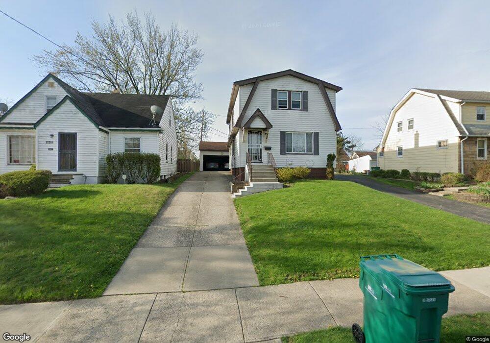
19698 Raymond St Maple Heights, OH 44137
Estimated Value: $123,691 - $150,000
3
Beds
2
Baths
1,360
Sq Ft
$97/Sq Ft
Est. Value
About This Home
This home is located at 19698 Raymond St, Maple Heights, OH 44137 and is currently estimated at $131,423, approximately $96 per square foot. 19698 Raymond St is a home located in Cuyahoga County with nearby schools including Abraham Lincoln Elementary School, Rockside/ J.F. Kennedy School, and Italy High School.
Ownership History
Date
Name
Owned For
Owner Type
Purchase Details
Closed on
Sep 10, 1985
Sold by
Chmura Kathleen A
Bought by
Connor Joseph C and Connor Rina C
Current Estimated Value
Purchase Details
Closed on
Aug 14, 1985
Sold by
Chmura Bernard
Bought by
Chmura Kathleen M
Purchase Details
Closed on
Apr 29, 1982
Sold by
Mauk Thomas Anthony
Bought by
Chmura Bernard
Purchase Details
Closed on
Jun 8, 1979
Sold by
Biros George J and Biros Doreen
Bought by
Mauk Thomas Anthony
Purchase Details
Closed on
Jan 1, 1975
Bought by
Biros George J and Biros Doreen
Create a Home Valuation Report for This Property
The Home Valuation Report is an in-depth analysis detailing your home's value as well as a comparison with similar homes in the area
Home Values in the Area
Average Home Value in this Area
Purchase History
| Date | Buyer | Sale Price | Title Company |
|---|---|---|---|
| Connor Joseph C | $50,000 | -- | |
| Chmura Kathleen M | -- | -- | |
| Chmura Bernard | $49,500 | -- | |
| Mauk Thomas Anthony | $39,900 | -- | |
| Biros George J | -- | -- |
Source: Public Records
Tax History Compared to Growth
Tax History
| Year | Tax Paid | Tax Assessment Tax Assessment Total Assessment is a certain percentage of the fair market value that is determined by local assessors to be the total taxable value of land and additions on the property. | Land | Improvement |
|---|---|---|---|---|
| 2024 | $2,554 | $38,570 | $6,720 | $31,850 |
| 2023 | $1,417 | $22,060 | $3,890 | $18,170 |
| 2022 | $1,450 | $22,050 | $3,890 | $18,170 |
| 2021 | $1,543 | $22,050 | $3,890 | $18,170 |
| 2020 | $1,097 | $16,700 | $2,940 | $13,760 |
| 2019 | $1,086 | $47,700 | $8,400 | $39,300 |
| 2018 | $539 | $16,700 | $2,940 | $13,760 |
| 2017 | $971 | $15,550 | $2,700 | $12,850 |
| 2016 | $936 | $15,550 | $2,700 | $12,850 |
| 2015 | $1,013 | $15,550 | $2,700 | $12,850 |
| 2014 | $1,013 | $17,090 | $2,980 | $14,110 |
Source: Public Records
Map
Nearby Homes
- 19309 Nitra Ave
- 5165 Camden Rd
- 19807 Gardenview Dr
- 19520 Maple Heights Blvd
- 20120 Mccracken Rd
- 19806 Mountville Dr
- 20107 Libby Rd
- 5265 Bellview St
- 19812 Stockton Ave
- 19289 Stafford Ave
- 20715 Watson Rd
- 20510 Mountville Dr
- 19221 Stafford Ave
- 20814 Watson Rd
- 20907 Watson Rd
- 20701 Kenyon Dr
- 18909 Maple Heights Blvd
- 20814 Kenyon Dr
- 21102 Raymond St
- 5234 Erwin St
- 19700 Raymond St
- 19652 Raymond St
- 19610 Raymond St
- 19740 Raymond St
- 19711 Nitra Ave
- 19606 Raymond St
- 19705 Nitra Ave
- 19715 Nitra Ave
- 19701 Nitra Ave
- 19617 Raymond St
- 19600 Raymond St
- 19703 Raymond St
- 19613 Raymond St
- 19707 Raymond St
- 19651 Raymond St
- 19613 Nitra Ave
- 19711 Raymond St
- 19518 Raymond St
- 19605 Raymond St
- 19601 Raymond St