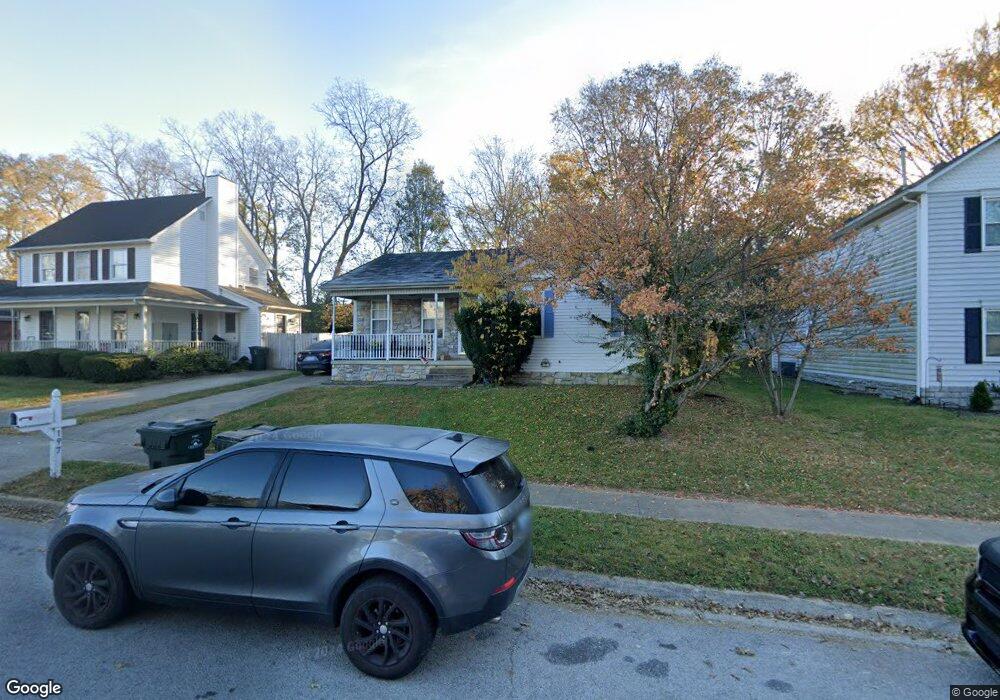
197 Keelridge Dr Georgetown, KY 40324
Estimated Value: $210,398 - $245,000
--
Bed
--
Bath
1,160
Sq Ft
$195/Sq Ft
Est. Value
About This Home
This home is located at 197 Keelridge Dr, Georgetown, KY 40324 and is currently estimated at $226,600, approximately $195 per square foot. 197 Keelridge Dr is a home located in Scott County with nearby schools including Anne Mason Elementary School, Creekside Elementary School, and Scott County Middle School.
Ownership History
Date
Name
Owned For
Owner Type
Purchase Details
Closed on
May 23, 2014
Sold by
Perry Terry L and Perry Mary
Bought by
Lancaster Carolyn and Caywood Taylor
Current Estimated Value
Purchase Details
Closed on
Jan 4, 2013
Sold by
Baldwin Jennifer Marie
Bought by
Perry Terry L and Perry Mary
Home Financials for this Owner
Home Financials are based on the most recent Mortgage that was taken out on this home.
Original Mortgage
$104,900
Interest Rate
3.35%
Mortgage Type
VA
Create a Home Valuation Report for This Property
The Home Valuation Report is an in-depth analysis detailing your home's value as well as a comparison with similar homes in the area
Home Values in the Area
Average Home Value in this Area
Purchase History
| Date | Buyer | Sale Price | Title Company |
|---|---|---|---|
| Lancaster Carolyn | $98,000 | None Available | |
| Perry Terry L | $104,900 | None Available |
Source: Public Records
Mortgage History
| Date | Status | Borrower | Loan Amount |
|---|---|---|---|
| Previous Owner | Perry Terry L | $104,900 |
Source: Public Records
Tax History Compared to Growth
Tax History
| Year | Tax Paid | Tax Assessment Tax Assessment Total Assessment is a certain percentage of the fair market value that is determined by local assessors to be the total taxable value of land and additions on the property. | Land | Improvement |
|---|---|---|---|---|
| 2024 | $1,492 | $165,900 | $0 | $0 |
| 2023 | $1,346 | $148,500 | $32,500 | $116,000 |
| 2022 | $1,233 | $145,000 | $29,000 | $116,000 |
| 2021 | $1,257 | $133,400 | $29,000 | $104,400 |
| 2020 | $1,066 | $124,100 | $29,000 | $95,100 |
| 2019 | $1,012 | $116,000 | $0 | $0 |
| 2018 | $971 | $111,900 | $0 | $0 |
| 2017 | $926 | $106,140 | $0 | $0 |
| 2016 | $841 | $104,400 | $0 | $0 |
| 2015 | $784 | $98,000 | $0 | $0 |
| 2014 | $571 | $68,920 | $0 | $0 |
| 2011 | $63 | $100,920 | $0 | $0 |
Source: Public Records
Map
Nearby Homes
- 106 Plymouth Ct
- 129 Cornwallis Dr
- 245 Sturbridge Dr
- 145 Inverness Dr
- 210 Taylorsville Trail
- 177 Swilcan Bridge Way
- 103 War Admiral Way
- 109 Blackberry Ln
- 110 Blackberry Ln
- 116 Falls Creek Dr
- 113 Blackberry Ln
- 123 Blackberry Ln
- 125 Blackberry Ln
- 118 Falls Creek Dr
- 136 Blackberry Ln
- 139 Blackberry Ln
- 120 Falls Creek Dr
- 141 Blackberry Ln
- 143 Blackberry Ln
- 100 Woods Point Cir
- 201 Keelridge Dr
- 205 Keelridge Dr
- 129 Colony Blvd
- 189 Keelridge Dr
- 189 Keelridge Dr Unit 1
- 209 Keelridge Dr
- 196 Keelridge Dr
- 192 Keelridge Dr
- 213 Keelridge Dr
- 125 Colony Blvd
- 125 Colony Blvd
- 125 Colony Blvd
- 188 Keelridge Dr
- 101 Salem Ct
- 217 Keelridge Dr
- 128 Salem Ct
- 136 Salem Ct
- 124 Salem Ct
- 132 Salem Ct
- 105 Salem Ct