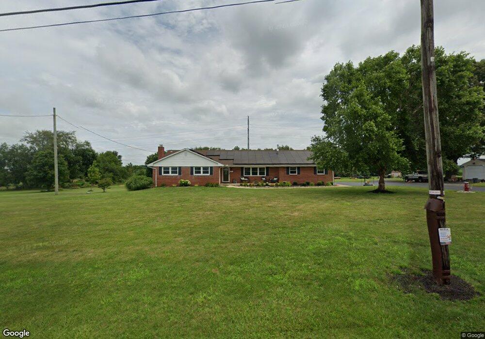
197 Robbins Rd Pilesgrove, NJ 08098
Estimated Value: $440,000 - $630,000
3
Beds
2
Baths
1,700
Sq Ft
$290/Sq Ft
Est. Value
About This Home
This home is located at 197 Robbins Rd, Pilesgrove, NJ 08098 and is currently estimated at $493,573, approximately $290 per square foot. 197 Robbins Rd is a home located in Salem County with nearby schools including Mary S. Shoemaker School, Woodstown Middle School, and Woodstown High School.
Ownership History
Date
Name
Owned For
Owner Type
Purchase Details
Closed on
Jun 25, 2010
Sold by
Simmons Michael L
Bought by
Kirby Scott and Kirby Stephanie
Current Estimated Value
Home Financials for this Owner
Home Financials are based on the most recent Mortgage that was taken out on this home.
Original Mortgage
$200,000
Outstanding Balance
$133,447
Interest Rate
4.88%
Mortgage Type
Purchase Money Mortgage
Estimated Equity
$360,126
Purchase Details
Closed on
Nov 27, 2002
Sold by
Robbins Frances B
Bought by
Simmons Michael L
Home Financials for this Owner
Home Financials are based on the most recent Mortgage that was taken out on this home.
Original Mortgage
$140,000
Interest Rate
6.34%
Create a Home Valuation Report for This Property
The Home Valuation Report is an in-depth analysis detailing your home's value as well as a comparison with similar homes in the area
Home Values in the Area
Average Home Value in this Area
Purchase History
| Date | Buyer | Sale Price | Title Company |
|---|---|---|---|
| Kirby Scott | $230,000 | -- | |
| Simmons Michael L | $175,000 | West Jersey Title Agency |
Source: Public Records
Mortgage History
| Date | Status | Borrower | Loan Amount |
|---|---|---|---|
| Open | Kirby Scott | $200,000 | |
| Previous Owner | Simmons Michael L | $140,000 |
Source: Public Records
Tax History Compared to Growth
Tax History
| Year | Tax Paid | Tax Assessment Tax Assessment Total Assessment is a certain percentage of the fair market value that is determined by local assessors to be the total taxable value of land and additions on the property. | Land | Improvement |
|---|---|---|---|---|
| 2025 | $8,614 | $248,800 | $70,100 | $178,700 |
| 2024 | $8,738 | $235,600 | $70,100 | $165,500 |
| 2023 | $8,738 | $235,600 | $70,100 | $165,500 |
| 2022 | $8,232 | $235,600 | $70,100 | $165,500 |
| 2021 | $7,928 | $235,600 | $70,100 | $165,500 |
| 2020 | $7,655 | $235,600 | $70,100 | $165,500 |
| 2019 | $7,431 | $235,600 | $70,100 | $165,500 |
| 2018 | $7,134 | $235,600 | $70,100 | $165,500 |
| 2017 | $6,901 | $235,600 | $70,100 | $165,500 |
| 2016 | $6,620 | $235,600 | $70,100 | $165,500 |
| 2015 | $6,126 | $235,600 | $70,100 | $165,500 |
| 2014 | $5,899 | $235,600 | $70,100 | $165,500 |
Source: Public Records
Map
Nearby Homes
- 752 Yorketown Rd
- 276 Woodstown Daretown Rd
- 0 Yorketown Rd Unit NJSA139926
- 332 Daretown Rd
- 0 Williams Rd Unit NJSA2016550
- 150 Williams Rd
- 340 Woodstown Daretown Rd
- 141 Yorketown Rd
- 399 Pierson Rd
- 440 Bailey St
- 438 Bailey St
- 0 Alloway Woodstown Rd Unit NJSA2017534
- 17 Aldine Shirley Rd
- 444 S Main St
- 463 Bridgeton Pike
- 236 E Lake Rd
- 178 E Millbrooke Ave
- 13 Alloway Rd
- 22 Alloway Rd
- 64 W Millbrooke Ave
- 191 Robbins Rd
- 522 Commissioners Pike
- 528 Commissioners Pike
- 0 Davis Rd Unit 5331511
- 0 Davis Rd Unit 1008459884
- 0 Commissioners Pike Unit 1006330950
- 0 Commissioners Pike Unit 5252357
- 0 Commissioners Pike Unit 5331522
- 0 Commissioners Pike Unit 6264132
- 0 Commissioners Pike Unit 6649204
- 0 Commissioners Pike Unit 6872096
- 541 Commissioners Pike
- 158 Robbins Rd
- 154 Robbins Rd
- 487 Commissioners Pike
- 450 Commissioners Pike
- 49 Davis Rd
- 127 Robbins Rd
- 459 Commissioners Pike
- 164 Woodstown Daretown Rd