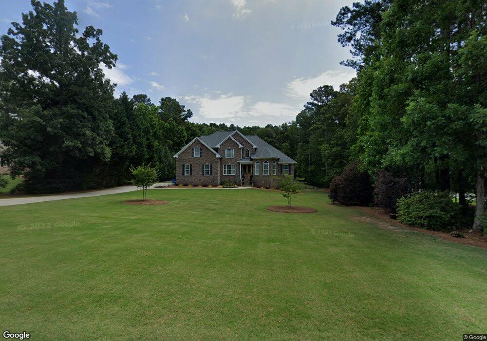
197 Saint Andrews Ct Social Circle, GA 30025
Estimated Value: $614,000 - $733,000
4
Beds
4
Baths
3,027
Sq Ft
$222/Sq Ft
Est. Value
About This Home
This home is located at 197 Saint Andrews Ct, Social Circle, GA 30025 and is currently estimated at $672,172, approximately $222 per square foot. 197 Saint Andrews Ct is a home located in Walton County with nearby schools including Social Circle Primary School, Social Circle Elementary School, and Social Circle Middle School.
Ownership History
Date
Name
Owned For
Owner Type
Purchase Details
Closed on
Feb 24, 2017
Sold by
Wilhelm Jeff
Bought by
Knight Kenneth Lance and Knight Kari Lynn
Current Estimated Value
Home Financials for this Owner
Home Financials are based on the most recent Mortgage that was taken out on this home.
Original Mortgage
$292,800
Outstanding Balance
$242,940
Interest Rate
4.19%
Mortgage Type
New Conventional
Estimated Equity
$429,232
Purchase Details
Closed on
Jul 11, 2005
Sold by
Therrien Hms Inc
Bought by
Wilhelm Jeff and Wilhelm Susan
Purchase Details
Closed on
Nov 30, 2004
Sold by
Barrs Earl D
Bought by
Therien Hms Inc
Home Financials for this Owner
Home Financials are based on the most recent Mortgage that was taken out on this home.
Original Mortgage
$250,000
Interest Rate
5.6%
Mortgage Type
Purchase Money Mortgage
Create a Home Valuation Report for This Property
The Home Valuation Report is an in-depth analysis detailing your home's value as well as a comparison with similar homes in the area
Home Values in the Area
Average Home Value in this Area
Purchase History
| Date | Buyer | Sale Price | Title Company |
|---|---|---|---|
| Knight Kenneth Lance | $366,000 | -- | |
| Wilhelm Jeff | $350,000 | -- | |
| Therien Hms Inc | $42,900 | -- |
Source: Public Records
Mortgage History
| Date | Status | Borrower | Loan Amount |
|---|---|---|---|
| Open | Knight Kenneth Lance | $292,800 | |
| Closed | Knight Kenneth Lance | $73,200 | |
| Previous Owner | Therien Hms Inc | $250,000 |
Source: Public Records
Tax History Compared to Growth
Tax History
| Year | Tax Paid | Tax Assessment Tax Assessment Total Assessment is a certain percentage of the fair market value that is determined by local assessors to be the total taxable value of land and additions on the property. | Land | Improvement |
|---|---|---|---|---|
| 2024 | $7,826 | $246,240 | $39,200 | $207,040 |
| 2023 | $7,773 | $238,560 | $35,200 | $203,360 |
| 2022 | $1,631 | $204,600 | $28,000 | $176,600 |
| 2021 | $1,631 | $174,120 | $20,000 | $154,120 |
| 2020 | $1,619 | $163,680 | $20,000 | $143,680 |
| 2019 | $1,697 | $147,120 | $20,000 | $127,120 |
| 2018 | $1,596 | $147,120 | $20,000 | $127,120 |
| 2017 | $5,715 | $136,760 | $20,000 | $116,760 |
| 2016 | $1,417 | $129,120 | $20,000 | $109,120 |
| 2015 | $1,218 | $112,280 | $16,000 | $96,280 |
| 2014 | $1,208 | $105,760 | $16,000 | $89,760 |
Source: Public Records
Map
Nearby Homes
- 100 Saint Andrews Ct
- 318 Richmond Dr
- 226 Rogue Rd
- 603 Lakewood Dr SW
- 184 Wildflower Dr
- 498 Clover Dr
- 246 Azalea Farms Rd
- 159 S Forest Ave
- 357 W Hightower Trail
- 433 Clover Dr
- 355 Conner Ct
- 443 Windsong Ln
- 2049 Emily Dr
- 215 Park Place Trail
- 413 Crossroads Dr
- 582 S Cherokee Rd
- 210 Park Place Trail
- 381 Crossroads Dr
- 185 Saint Andrews Ct
- 215 Saint Andrews Ct
- 215 Saint Andrews Ct
- 173 Saint Andrews Ct
- 208 Saint Andrews Ct
- 196 St Andrews Ct
- 0 Saint Andrews Ct Unit 7034167
- 0 Saint Andrews Ct Unit LOT 2 10039391
- 0 Saint Andrews Ct Unit 8681470
- 0 Saint Andrews Ct
- 184 Saint Andrews Ct
- 161 Saint Andrews Ct
- 0 St Andrews Ct Unit LOT 27 3175128
- 0 St Andrews Ct Unit LOT 10 7398474
- 0 St Andrews Ct Unit 10 8059165
- 0 St Andrews Ct Unit 10078369
- 0 St Andrews Ct Unit 10140043
- 0 St Andrews Ct Unit 7189656
- 0 St Andrews Ct Unit 7034167
- 0 St Andrews Ct Unit 8730670