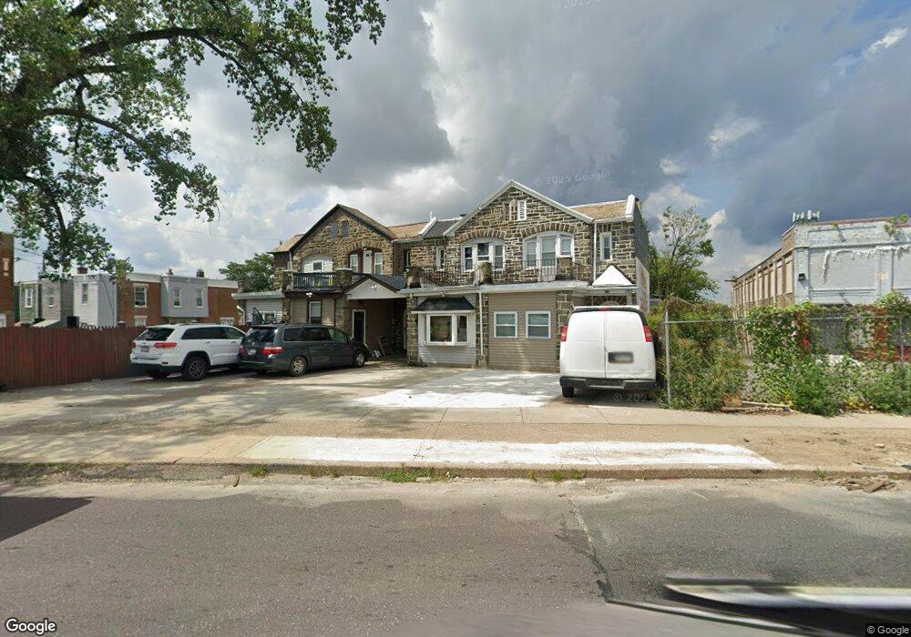
197 W Roosevelt Blvd Philadelphia, PA 19120
Olney NeighborhoodEstimated Value: $140,000 - $230,492
4
Beds
4
Baths
1,782
Sq Ft
$109/Sq Ft
Est. Value
About This Home
This home is located at 197 W Roosevelt Blvd, Philadelphia, PA 19120 and is currently estimated at $194,373, approximately $109 per square foot. 197 W Roosevelt Blvd is a home located in Philadelphia County with nearby schools including Andrew J. Morrison School, Olney Charter High School, and Olney Christian School.
Ownership History
Date
Name
Owned For
Owner Type
Purchase Details
Closed on
Jul 25, 2022
Sold by
Chadan Luis O
Bought by
Llumitasig Martha Cecilia Chuq and Chuquiana Wilmer Giovanni
Current Estimated Value
Purchase Details
Closed on
Sep 29, 2020
Sold by
Garcia Martinez Francisco Israel
Bought by
Chalan Luis O
Purchase Details
Closed on
Nov 20, 2013
Sold by
Pressman Joseph I and The Estate Of Marsha Pressman
Bought by
Martinez Francisco Israel Garcia
Purchase Details
Closed on
Aug 25, 1997
Sold by
Pressman Marsha and Pressman Dorothy
Bought by
Pressman Marsha
Create a Home Valuation Report for This Property
The Home Valuation Report is an in-depth analysis detailing your home's value as well as a comparison with similar homes in the area
Home Values in the Area
Average Home Value in this Area
Purchase History
| Date | Buyer | Sale Price | Title Company |
|---|---|---|---|
| Llumitasig Martha Cecilia Chuq | $180,000 | First Partners Abstract | |
| Chalan Luis O | $115,000 | Key Abstract Llc | |
| Martinez Francisco Israel Garcia | $10,000 | None Available | |
| Pressman Marsha | -- | -- |
Source: Public Records
Tax History Compared to Growth
Tax History
| Year | Tax Paid | Tax Assessment Tax Assessment Total Assessment is a certain percentage of the fair market value that is determined by local assessors to be the total taxable value of land and additions on the property. | Land | Improvement |
|---|---|---|---|---|
| 2025 | $941 | $110,200 | $22,040 | $88,160 |
| 2024 | $941 | $110,200 | $22,040 | $88,160 |
| 2023 | $941 | $67,200 | $13,440 | $53,760 |
| 2022 | $641 | $67,200 | $13,440 | $53,760 |
| 2021 | $641 | $0 | $0 | $0 |
| 2020 | $641 | $0 | $0 | $0 |
| 2019 | $596 | $0 | $0 | $0 |
| 2018 | $675 | $0 | $0 | $0 |
| 2017 | $675 | $0 | $0 | $0 |
| 2016 | $675 | $0 | $0 | $0 |
| 2015 | $642 | $0 | $0 | $0 |
| 2014 | -- | $48,200 | $8,964 | $39,236 |
| 2012 | -- | $8,288 | $1,630 | $6,658 |
Source: Public Records
Map
Nearby Homes
- 207 W Albanus St
- 253 W Albanus St
- 263 W Sulis St
- 4987 N 2nd St
- 4993 N 2nd St
- 163 W Roosevelt Blvd
- 161 W Roosevelt Blvd
- 222 W Roosevelt Blvd
- 159 W Roosevelt Blvd
- 182 1/2 W Roosevelt Blvd
- 157 W Roosevelt Blvd
- 234 W Roosevelt Blvd Unit 38
- 155 W Roosevelt Blvd
- 153 W Roosevelt Blvd
- 151 W Roosevelt Blvd
- 149 W Roosevelt Blvd
- 205 W Loudon St
- 156 W Albanus St
- 2511 N Leithgow St
- 258 W Sheldon St
- 199 W Roosevelt Blvd
- 195 W Roosevelt Blvd
- 4921 N 2nd St
- 4923 N 2nd St
- 200 W Sulis St
- 4925 N 2nd St
- 202 W Sulis St
- 4927 N 2nd St
- 204 W Sulis St
- 4929 N 2nd St
- 206 W Sulis St
- 201 W Sulis St
- 203 W Rockland St
- 203 W Rockland St Unit 5
- 203 W Sulis St
- 208 W Sulis St
- 4931 N 2nd St
- 207 W Rockland St
- 205 W Sulis St
- 210 W Sulis St