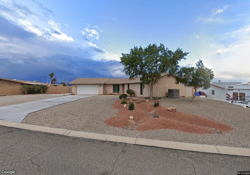
1970 Cliffrose Dr Lake Havasu City, AZ 86403
Estimated Value: $278,000 - $421,000
--
Bed
1
Bath
1,343
Sq Ft
$259/Sq Ft
Est. Value
About This Home
This home is located at 1970 Cliffrose Dr, Lake Havasu City, AZ 86403 and is currently estimated at $348,479, approximately $259 per square foot. 1970 Cliffrose Dr is a home located in Mohave County with nearby schools including Smoketree Elementary School, Thunderbolt Middle School, and Lake Havasu High School.
Ownership History
Date
Name
Owned For
Owner Type
Purchase Details
Closed on
Dec 15, 2023
Sold by
Walker Andrea Lucille
Bought by
Andrea Lucille Walker Living Trust and Walker
Current Estimated Value
Purchase Details
Closed on
Dec 7, 2023
Sold by
Walker Andrea Lucille
Bought by
Andrea Lucille Walker Living Trust and Walker
Purchase Details
Closed on
May 3, 2002
Sold by
Walker Andrea L
Bought by
Walker Edward and Walker Andrea L
Purchase Details
Closed on
Apr 19, 2002
Sold by
Whitted Kenneth F and Whitted Barbara Jean
Bought by
Walker Andrea
Purchase Details
Closed on
Feb 17, 2000
Sold by
Sacheli James and Sacheli Shirley
Bought by
Whitted Kenneth F and Whitted Barbara Jean
Home Financials for this Owner
Home Financials are based on the most recent Mortgage that was taken out on this home.
Original Mortgage
$33,000
Interest Rate
8.21%
Mortgage Type
Seller Take Back
Create a Home Valuation Report for This Property
The Home Valuation Report is an in-depth analysis detailing your home's value as well as a comparison with similar homes in the area
Home Values in the Area
Average Home Value in this Area
Purchase History
| Date | Buyer | Sale Price | Title Company |
|---|---|---|---|
| Andrea Lucille Walker Living Trust | -- | None Listed On Document | |
| Andrea Lucille Walker Living Trust | -- | None Listed On Document | |
| Walker Edward | -- | Transnation Title Insurance | |
| Walker Andrea | $86,000 | Transnation Title Insurance | |
| Whitted Kenneth F | $72,000 | Capital Title Agency Inc |
Source: Public Records
Mortgage History
| Date | Status | Borrower | Loan Amount |
|---|---|---|---|
| Previous Owner | Whitted Kenneth F | $33,000 |
Source: Public Records
Tax History Compared to Growth
Tax History
| Year | Tax Paid | Tax Assessment Tax Assessment Total Assessment is a certain percentage of the fair market value that is determined by local assessors to be the total taxable value of land and additions on the property. | Land | Improvement |
|---|---|---|---|---|
| 2026 | -- | -- | -- | -- |
| 2025 | $807 | $25,273 | $0 | $0 |
| 2024 | $807 | $41,033 | $0 | $0 |
| 2023 | $807 | $26,598 | $0 | $0 |
| 2022 | $777 | $22,703 | $0 | $0 |
| 2021 | $946 | $18,996 | $0 | $0 |
| 2019 | $902 | $15,471 | $0 | $0 |
| 2018 | $874 | $14,698 | $0 | $0 |
| 2017 | $860 | $13,738 | $0 | $0 |
| 2016 | $770 | $11,796 | $0 | $0 |
| 2015 | $751 | $10,367 | $0 | $0 |
Source: Public Records
Map
Nearby Homes
- 1962 Cliffrose Dr
- 1939 Pine Ln
- 72 Mariposa Dr Unit D
- 2042 Swanson Ave Unit A
- 2042 Swanson Ave Unit H
- 160 Aspen Dr
- 190 Aspen Dr
- 1926 Swanson Ave
- 1958 Montana Vista Unit D
- 2080 Swanson Ave Unit F
- 2080 Swanson Ave Unit C
- 2080 Swanson Ave Unit D
- 2080 Swanson Ave Unit I
- 1910 Swanson Ave Unit A22
- 1910 Swanson Ave Unit B11
- 1910 Swanson Ave Unit B19
- 211 Columbine Dr
- 1884 Montana Vista Unit 63B
- 100 Mulberry Ave Unit 210
- 100 Mulberry Ave Unit 113
- 1966 Cliffrose Dr
- 1974 Cliffrose Dr
- 131 Mariposa Dr
- 1971 Poplar Dr
- 141 Mariposa Dr
- 1967 Cliffrose Dr
- 1971 Cliffrose Dr
- 1963 Cliffrose Dr
- 1961 Poplar Dr
- 1975 Cliffrose Dr
- 1958 Cliffrose Dr
- 124 Mariposa Dr
- 132 Mariposa Dr
- 1959 Cliffrose Dr
- 1970 Magnolia Dr
- 116 Mariposa Dr
- 140 Mariposa Dr
- 1955 Cliffrose Dr
- 1960 Magnolia Dr
- 1951 Poplar Dr