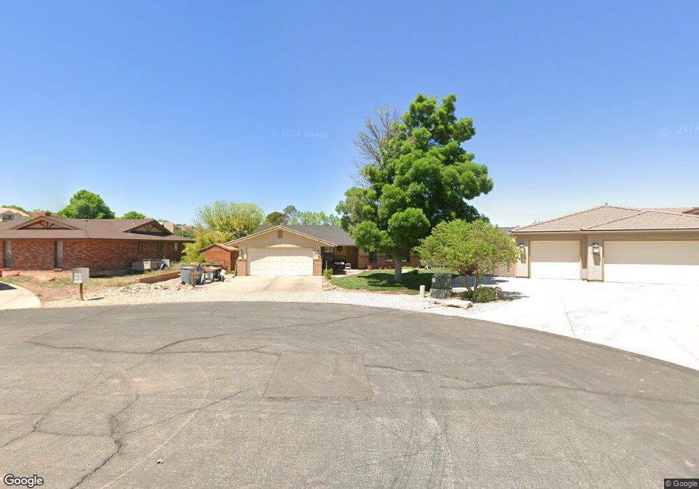
1970 Erin Dawn Cir Saint George, UT 84790
Bloomington Hills NeighborhoodEstimated Value: $471,092 - $519,000
4
Beds
2
Baths
1,818
Sq Ft
$272/Sq Ft
Est. Value
About This Home
This home is located at 1970 Erin Dawn Cir, Saint George, UT 84790 and is currently estimated at $495,273, approximately $272 per square foot. 1970 Erin Dawn Cir is a home located in Washington County with nearby schools including Bloomington Hills Elementary School, Desert Hills Middle School, and Sunrise Ridge Intermediate School.
Ownership History
Date
Name
Owned For
Owner Type
Purchase Details
Closed on
May 23, 2014
Sold by
Skousen Craig L and Skousen Marianne R
Bought by
Borgeson Joshua H and Borgeson Janessa L
Current Estimated Value
Home Financials for this Owner
Home Financials are based on the most recent Mortgage that was taken out on this home.
Original Mortgage
$194,411
Outstanding Balance
$144,883
Interest Rate
3.75%
Mortgage Type
FHA
Estimated Equity
$350,390
Create a Home Valuation Report for This Property
The Home Valuation Report is an in-depth analysis detailing your home's value as well as a comparison with similar homes in the area
Home Values in the Area
Average Home Value in this Area
Purchase History
| Date | Buyer | Sale Price | Title Company |
|---|---|---|---|
| Borgeson Joshua H | -- | Southern Utah Title |
Source: Public Records
Mortgage History
| Date | Status | Borrower | Loan Amount |
|---|---|---|---|
| Open | Borgeson Joshua H | $194,411 |
Source: Public Records
Tax History Compared to Growth
Tax History
| Year | Tax Paid | Tax Assessment Tax Assessment Total Assessment is a certain percentage of the fair market value that is determined by local assessors to be the total taxable value of land and additions on the property. | Land | Improvement |
|---|---|---|---|---|
| 2025 | $1,659 | $242,990 | $78,100 | $164,890 |
| 2023 | $1,701 | $254,155 | $82,500 | $171,655 |
| 2022 | $1,771 | $248,875 | $68,750 | $180,125 |
| 2021 | $1,528 | $320,100 | $80,000 | $240,100 |
| 2020 | $1,398 | $275,900 | $65,000 | $210,900 |
| 2019 | $1,391 | $268,100 | $65,000 | $203,100 |
| 2018 | $1,371 | $132,495 | $0 | $0 |
| 2017 | $1,225 | $118,360 | $0 | $0 |
| 2016 | $1,282 | $114,620 | $0 | $0 |
| 2015 | $1,228 | $105,325 | $0 | $0 |
| 2014 | $1,125 | $97,075 | $0 | $0 |
Source: Public Records
Map
Nearby Homes
- 1180 Hubbard Place
- 1125 E Sherman Cir
- 1365 E Fort Pierce Dr Unit 9
- 1790 S River Rd
- 2050 S 1400 E Unit K101
- 2050 S 1400 E Unit 3
- 2050 S 1400 E Unit 23
- 2050 S 1400 E Unit 18
- 2045 S 1400 E Unit 14
- 2045 S 1400 E Unit 10
- 2045 S 1400 E Unit 13
- 2285 Shilo Cir
- 2280 Bloomington Hills Dr Unit 5
- 1118 Lizzie Ln
- 830 Larkspur Rd
- 1523 E Talus Way
- 1942 Acacia Place
- Cambria Plan at Cottam Cove
- Scarlett Plan at Cottam Cove
- Bryce Plan at Cottam Cove
- 1960 Erin Dawn Cir Unit 61
- 1960 Erin Dawn Cir
- 1980 Erin Dawn Cir
- 1977 Hedera Place
- 1987 Hedera Place
- 1967 Hedera Place
- 1137 E Fort Pierce Dr
- 1137 Fort Pierce Dr N
- 1997 Hedera Place
- Lot 61 Erin Dawn Cir
- 0 Erin Dawn Cir
- 1985 Erin Dawn Cir
- 1957 Hedera Place
- 1994 Hedera Place
- 1974 Hedera Place
- 1995 Erin Dawn Cir
- 1964 Hedera Place
- 1134 E Fort Pierce Dr N
- 1130 E Fort Pierce Dr N
- 2002 Sherman Rd