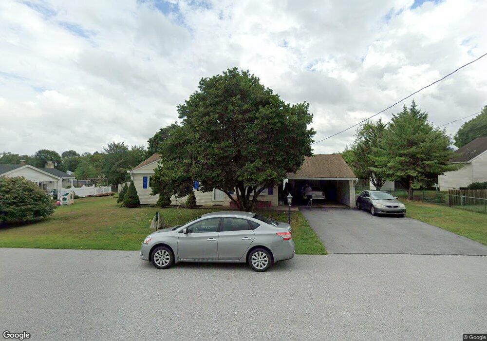
1970 Fry Loop Ave Carlisle, PA 17013
Estimated Value: $201,000 - $255,000
3
Beds
2
Baths
1,363
Sq Ft
$172/Sq Ft
Est. Value
About This Home
This home is located at 1970 Fry Loop Ave, Carlisle, PA 17013 and is currently estimated at $234,835, approximately $172 per square foot. 1970 Fry Loop Ave is a home located in Cumberland County with nearby schools including Crestview Elementary School, Wilson Middle School, and Carlisle Area High School.
Ownership History
Date
Name
Owned For
Owner Type
Purchase Details
Closed on
Sep 23, 2011
Sold by
Martin Trena A
Bought by
Sheaffer Wayne L
Current Estimated Value
Home Financials for this Owner
Home Financials are based on the most recent Mortgage that was taken out on this home.
Original Mortgage
$136,353
Outstanding Balance
$93,329
Interest Rate
4.25%
Mortgage Type
FHA
Estimated Equity
$141,506
Purchase Details
Closed on
Aug 31, 2000
Sold by
Wells Douglas W
Bought by
Martin Trena A
Home Financials for this Owner
Home Financials are based on the most recent Mortgage that was taken out on this home.
Original Mortgage
$80,000
Interest Rate
8.16%
Create a Home Valuation Report for This Property
The Home Valuation Report is an in-depth analysis detailing your home's value as well as a comparison with similar homes in the area
Home Values in the Area
Average Home Value in this Area
Purchase History
| Date | Buyer | Sale Price | Title Company |
|---|---|---|---|
| Sheaffer Wayne L | $139,900 | -- | |
| Martin Trena A | $112,500 | -- |
Source: Public Records
Mortgage History
| Date | Status | Borrower | Loan Amount |
|---|---|---|---|
| Open | Sheaffer Wayne L | $136,353 | |
| Previous Owner | Martin Trena A | $80,000 |
Source: Public Records
Tax History Compared to Growth
Tax History
| Year | Tax Paid | Tax Assessment Tax Assessment Total Assessment is a certain percentage of the fair market value that is determined by local assessors to be the total taxable value of land and additions on the property. | Land | Improvement |
|---|---|---|---|---|
| 2025 | $2,617 | $124,900 | $22,000 | $102,900 |
| 2024 | $2,517 | $124,900 | $22,000 | $102,900 |
| 2023 | $2,426 | $124,900 | $22,000 | $102,900 |
| 2022 | $2,387 | $124,900 | $22,000 | $102,900 |
| 2021 | $2,349 | $124,900 | $22,000 | $102,900 |
| 2020 | $2,293 | $124,900 | $22,000 | $102,900 |
| 2019 | $2,239 | $124,900 | $22,000 | $102,900 |
| 2018 | $2,180 | $124,900 | $22,000 | $102,900 |
| 2017 | $2,131 | $124,900 | $22,000 | $102,900 |
| 2016 | -- | $124,900 | $22,000 | $102,900 |
| 2015 | -- | $124,900 | $22,000 | $102,900 |
| 2014 | -- | $124,900 | $22,000 | $102,900 |
Source: Public Records
Map
Nearby Homes
- 111 Lakeview Dr
- 1877 Spring Rd
- 1698 Douglas Dr
- 1312 Pheasant Dr S
- 2069 Spring Rd
- 1422 Bradley Dr
- 117 Pearl Dr
- 1830 Heishman Gardens
- 203 Cumberland Dr
- 14 Morgan Cir
- 14 Morgan Cir Unit 8-02
- 10 Morgan Cir
- 10 Morgan Cir Unit 10-02
- 12 Morgan Cir
- 12 Morgan Cir Unit 9-02
- 4 Morgan Cir
- 18 Morgan Cir
- 18 Morgan Cir Unit 6-01
- 16 Morgan Cir Unit 7-02
- 28 Morgan Cir
- 1974 Fry Loop Ave
- 1968 Fry Loop Ave
- 1912 Fry Loop Ave
- 1910 Fry Loop Ave
- 1914 Fry Loop Ave
- 1975 Fry Loop Ave
- 1977 Fry Loop Ave
- 1966 Fry Loop Ave
- 1973 Fry Loop Ave
- 1978 Fry Loop Ave
- 1908 Fry Loop Ave
- 131 Wagner St
- 1909 Fry Loop Ave
- 1911 Fry Loop Ave
- 1916 Ferry Loop Ave
- 1967 Fry Loop Ave
- 1907 Fry Loop Ave
- 1915 Fry Loop Ave
- 1905 Sterretts Gap Ave
- 1907 Sterretts Gap Ave