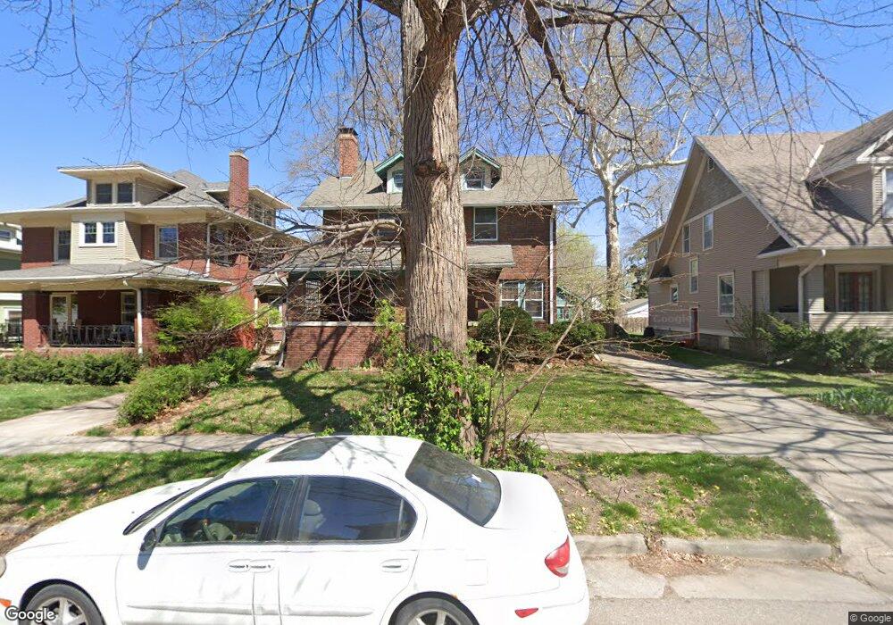
1970 Harwood St Lincoln, NE 68502
Near South NeighborhoodEstimated Value: $249,000 - $286,000
3
Beds
2
Baths
2,187
Sq Ft
$122/Sq Ft
Est. Value
About This Home
This home is located at 1970 Harwood St, Lincoln, NE 68502 and is currently estimated at $267,398, approximately $122 per square foot. 1970 Harwood St is a home located in Lancaster County with nearby schools including Prescott Elementary School, Irving Middle School, and Lincoln High School.
Ownership History
Date
Name
Owned For
Owner Type
Purchase Details
Closed on
Nov 1, 2006
Sold by
Collins Rayna Dee
Bought by
Hansen Mark and Hansen Sherilynne A
Current Estimated Value
Home Financials for this Owner
Home Financials are based on the most recent Mortgage that was taken out on this home.
Original Mortgage
$142,500
Outstanding Balance
$84,609
Interest Rate
6.37%
Mortgage Type
New Conventional
Estimated Equity
$182,789
Purchase Details
Closed on
Sep 9, 1999
Sold by
Winkle Michael Don
Bought by
Collins Rayna Dee
Create a Home Valuation Report for This Property
The Home Valuation Report is an in-depth analysis detailing your home's value as well as a comparison with similar homes in the area
Home Values in the Area
Average Home Value in this Area
Purchase History
| Date | Buyer | Sale Price | Title Company |
|---|---|---|---|
| Hansen Mark | $150,000 | Rels | |
| Collins Rayna Dee | -- | -- |
Source: Public Records
Mortgage History
| Date | Status | Borrower | Loan Amount |
|---|---|---|---|
| Open | Hansen Mark | $142,500 |
Source: Public Records
Tax History Compared to Growth
Tax History
| Year | Tax Paid | Tax Assessment Tax Assessment Total Assessment is a certain percentage of the fair market value that is determined by local assessors to be the total taxable value of land and additions on the property. | Land | Improvement |
|---|---|---|---|---|
| 2025 | $3,399 | $206,000 | $43,000 | $163,000 |
| 2024 | $3,399 | $245,900 | $35,000 | $210,900 |
| 2023 | $4,121 | $245,900 | $35,000 | $210,900 |
| 2022 | $3,737 | $187,500 | $30,000 | $157,500 |
| 2021 | $3,535 | $187,500 | $30,000 | $157,500 |
| 2020 | $3,128 | $163,700 | $30,000 | $133,700 |
| 2019 | $3,128 | $163,700 | $30,000 | $133,700 |
| 2018 | $2,912 | $151,700 | $30,000 | $121,700 |
| 2017 | $2,939 | $151,700 | $30,000 | $121,700 |
| 2016 | $2,775 | $142,500 | $30,000 | $112,500 |
| 2015 | $2,756 | $142,500 | $30,000 | $112,500 |
| 2014 | $2,647 | $136,100 | $25,000 | $111,100 |
| 2013 | -- | $136,100 | $30,000 | $106,100 |
Source: Public Records
Map
Nearby Homes
- 2045 S 20th St
- 1806 Harwood St
- 1959 South St
- 1801 Euclid Ave
- 2045 South St
- 1736 Euclid Ave
- 2024 S 17th St Unit 5
- 1730 Prospect St
- 1610 S 20th St
- 1826 Sumner St
- 1915 S 17th St
- 1560 S 19th St
- 1541 S 21st St
- 1934 Park Ave
- 1610 Euclid Ave
- 2248 Sewell St
- 1811 S 16th St
- 1611 Sumner St
- 1954 Lake St
- 2500 Worthington Ave
- 1950 Harwood St
- 1980 Harwood St
- 1948 Harwood St
- 1984 Harwood St
- 1951 Euclid Ave
- 1944 Harwood St
- 1943 Euclid Ave
- 1959 Euclid Ave
- 1935 Euclid Ave
- 1967 Harwood St
- 1957 Harwood St
- 1973 Harwood St
- 1920 Harwood St
- 1913 Euclid Ave
- 1927 Euclid Ave
- 1951 Harwood St
- 1985 Harwood St
- 1911 S 20th St
- 1989 Harwood St
- 1941 Harwood St