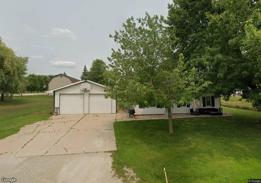
1970 River St de Pere, WI 54115
Estimated Value: $267,313 - $375,000
3
Beds
2
Baths
1,500
Sq Ft
$210/Sq Ft
Est. Value
About This Home
This home is located at 1970 River St, de Pere, WI 54115 and is currently estimated at $315,328, approximately $210 per square foot. 1970 River St is a home located in Brown County with nearby schools including Westwood Elementary School, West De Pere Middle School, and West De Pere High School.
Ownership History
Date
Name
Owned For
Owner Type
Purchase Details
Closed on
Sep 29, 2009
Sold by
Treichel Lee A and Treichel Carmen N
Bought by
Mcdermid Nathan P and Mcdermid Nichole L
Current Estimated Value
Home Financials for this Owner
Home Financials are based on the most recent Mortgage that was taken out on this home.
Original Mortgage
$124,999
Outstanding Balance
$82,079
Interest Rate
5.19%
Mortgage Type
New Conventional
Estimated Equity
$233,249
Purchase Details
Closed on
Mar 30, 2006
Sold by
Chopin Jay C and Chopin Lisa A
Bought by
Treichel Lee A and Treichel Carmen N
Home Financials for this Owner
Home Financials are based on the most recent Mortgage that was taken out on this home.
Original Mortgage
$98,000
Interest Rate
6.33%
Mortgage Type
Fannie Mae Freddie Mac
Create a Home Valuation Report for This Property
The Home Valuation Report is an in-depth analysis detailing your home's value as well as a comparison with similar homes in the area
Home Values in the Area
Average Home Value in this Area
Purchase History
| Date | Buyer | Sale Price | Title Company |
|---|---|---|---|
| Mcdermid Nathan P | $122,500 | None Available | |
| Treichel Lee A | $122,500 | Bay Title & Abstract Inc |
Source: Public Records
Mortgage History
| Date | Status | Borrower | Loan Amount |
|---|---|---|---|
| Open | Mcdermid Nathan P | $124,999 | |
| Previous Owner | Treichel Lee A | $98,000 |
Source: Public Records
Tax History Compared to Growth
Tax History
| Year | Tax Paid | Tax Assessment Tax Assessment Total Assessment is a certain percentage of the fair market value that is determined by local assessors to be the total taxable value of land and additions on the property. | Land | Improvement |
|---|---|---|---|---|
| 2024 | $1,967 | $135,900 | $10,300 | $125,600 |
| 2023 | $1,794 | $135,900 | $10,300 | $125,600 |
| 2022 | $1,777 | $135,900 | $10,300 | $125,600 |
| 2021 | $1,763 | $135,900 | $10,300 | $125,600 |
| 2020 | $1,895 | $101,900 | $8,800 | $93,100 |
| 2019 | $2,044 | $101,900 | $8,800 | $93,100 |
| 2018 | $1,943 | $101,900 | $8,800 | $93,100 |
| 2017 | $1,970 | $101,900 | $8,800 | $93,100 |
| 2016 | $1,994 | $101,900 | $8,800 | $93,100 |
| 2015 | $1,960 | $101,900 | $8,800 | $93,100 |
| 2014 | $1,972 | $101,900 | $8,800 | $93,100 |
| 2013 | $1,972 | $101,900 | $8,800 | $93,100 |
Source: Public Records
Map
Nearby Homes
- 3237 Lost Dauphin Rd
- 0 Cth Zz
- 3379 Lost Dauphin Rd
- 3141 Toad Island Trail
- 3137 Toad Island Trail
- 3128 Toad Island Trail
- 3133 Toad Island Trail
- 726 Tambour Ct
- 726 Tambour Ct Unit 7
- 733 Tambour Ct
- 733 Tambour Ct Unit 10
- 706 Tambour Ct
- 2835 Tambour Trail
- 0 Tambour Trail Unit 50212878
- 0 Tambour Trail Unit 50212876
- 0 Tambour Trail Unit 50212793
- 0 Tambour Trail Unit 50212791
- 0 Tambour Trail Unit 50212783
- 0 Sabal Oak Dr Unit 50212865
- 0 Sabal Oak Dr Unit 50212858
- 1966 River St
- 3141 Lost Dauphin Rd
- 1973 River St
- 3142 Lost Dauphin Rd
- 3138 Lost Dauphin Rd
- 3137 Lost Dauphin Rd
- 1953 Center St
- 3156 Wisconsin St
- 3171 Wisconsin St
- 0 Wisconsin St
- 3182 Wisconsin St
- 3165 Wisconsin St
- 3175 Wisconsin St
- 3121 Lost Dauphin Rd
- 3181 Wisconsin St
- 3181 Wisconsin St Unit BLOCK
- 1921 Center St
- 1971 Little Rapids Rd
- 1928 Center St
- 3226 Lost Dauphin Rd