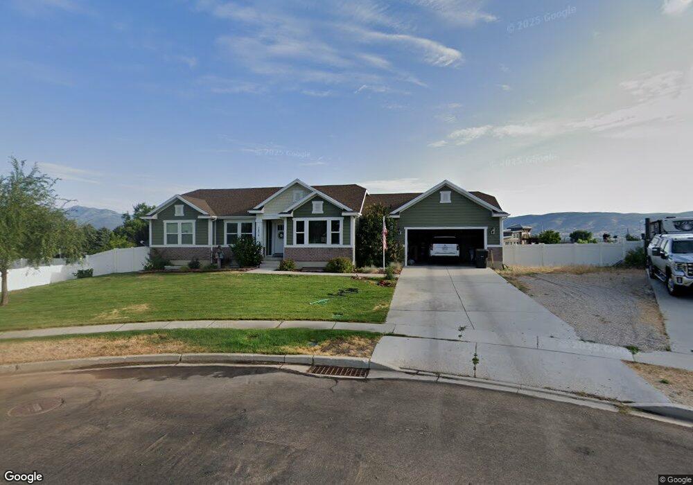
1970 S 440 E Heber City, UT 84032
Estimated Value: $694,000 - $874,000
Studio
--
Bath
1,460
Sq Ft
$517/Sq Ft
Est. Value
About This Home
This home is located at 1970 S 440 E, Heber City, UT 84032 and is currently estimated at $754,421, approximately $516 per square foot. 1970 S 440 E is a home located in Wasatch County with nearby schools including Daniels Canyon Elementary School and Wasatch High School.
Ownership History
Date
Name
Owned For
Owner Type
Purchase Details
Closed on
May 9, 2013
Sold by
Edge Land 14 Llc
Bought by
Mair Michael L and Mair Marilyn B
Current Estimated Value
Home Financials for this Owner
Home Financials are based on the most recent Mortgage that was taken out on this home.
Original Mortgage
$243,168
Outstanding Balance
$172,774
Interest Rate
3.54%
Mortgage Type
New Conventional
Estimated Equity
$581,647
Purchase Details
Closed on
Jan 16, 2013
Sold by
Edge Elite Llc
Bought by
Edge Land 14 Llc
Home Financials for this Owner
Home Financials are based on the most recent Mortgage that was taken out on this home.
Original Mortgage
$172,000
Interest Rate
3.27%
Mortgage Type
Construction
Purchase Details
Closed on
Jan 11, 2013
Sold by
Edge Land 13 Llc
Bought by
Edge Elite Llc
Home Financials for this Owner
Home Financials are based on the most recent Mortgage that was taken out on this home.
Original Mortgage
$172,000
Interest Rate
3.27%
Mortgage Type
Construction
Purchase Details
Closed on
Oct 19, 2012
Sold by
Pdq Development Inc
Bought by
Edge Land 13 Llc
Home Financials for this Owner
Home Financials are based on the most recent Mortgage that was taken out on this home.
Original Mortgage
$1,064,115
Interest Rate
3.52%
Mortgage Type
Purchase Money Mortgage
Create a Home Valuation Report for This Property
The Home Valuation Report is an in-depth analysis detailing your home's value as well as a comparison with similar homes in the area
Home Values in the Area
Average Home Value in this Area
Purchase History
| Date | Buyer | Sale Price | Title Company |
|---|---|---|---|
| Mair Michael L | -- | Affiliated First Title | |
| Edge Land 14 Llc | -- | Affilited First Title Co | |
| Edge Elite Llc | -- | None Available | |
| Edge Land 13 Llc | -- | Affiliated First Title |
Source: Public Records
Mortgage History
| Date | Status | Borrower | Loan Amount |
|---|---|---|---|
| Open | Mair Michael L | $243,168 | |
| Previous Owner | Edge Elite Llc | $172,000 | |
| Previous Owner | Edge Land 13 Llc | $1,064,115 |
Source: Public Records
Tax History
| Year | Tax Paid | Tax Assessment Tax Assessment Total Assessment is a certain percentage of the fair market value that is determined by local assessors to be the total taxable value of land and additions on the property. | Land | Improvement |
|---|---|---|---|---|
| 2025 | $3,477 | $678,500 | $240,000 | $438,500 |
| 2024 | $3,678 | $722,750 | $240,000 | $482,750 |
| 2023 | $3,678 | $649,000 | $150,000 | $499,000 |
| 2022 | $3,611 | $649,000 | $150,000 | $499,000 |
| 2021 | $3,100 | $442,500 | $125,080 | $317,420 |
| 2020 | $3,183 | $442,500 | $125,080 | $317,420 |
| 2019 | $1,885 | $152,152 | $0 | $0 |
| 2018 | $1,885 | $152,152 | $0 | $0 |
| 2017 | $1,855 | $148,852 | $0 | $0 |
| 2016 | $1,693 | $132,352 | $0 | $0 |
| 2015 | $1,615 | $132,352 | $0 | $0 |
| 2014 | $536 | $117,777 | $0 | $0 |
Source: Public Records
Map
Nearby Homes
- 351 E 2110 S
- 327 E 2260 S
- 2377 S 400 E
- 2586 E Water Wheel Ct
- 2063 S 920 E
- 1922 S Highway 40 Unit 35
- 1922 S Highway 40 Unit 2
- 1922 S Highway 40 Unit 38
- 1922 S Highway 40 Unit 36
- 1922 S Highway 40 Unit 43
- 1922 S Highway 40 Unit 4
- 1922 S Highway 40 Unit 39
- 1922 S Highway 40 Unit 40
- 1922 S Highway 40 Unit 37
- 1922 S Highway 40 Unit 3
- 2029 S Sawmill Blvd
- 1901 S Sawmill Blvd E Unit 415
- 1901 S Sawmill Blvd E
- 1891 Sawmill Blvd E Unit 414
- 1891 Sawmill Blvd E
- 1970 S 440 E Unit 2
- 1975 S 440 E
- 1980 S 440 E Unit 1
- 1980 S 440 E
- 1981 S 440 E Unit 4
- 1981 S 440 E
- 400 Airport Rd
- 400 Airport Rd
- 1974 S 500 E Unit 6
- 1970 S 500 E
- 1970 S 500 E Unit 7
- 1990 S 500 E Unit 5
- 414 E 2010 S Unit 37
- 414 E 2010 S
- 430 E 2010 S Unit 38
- 446 E 2010 S
- 1980 S 400 E Unit 1
- 1980 S 400 E
- 2000 S 400 E
- 2000 S 400 E Unit 2
Your Personal Tour Guide
Ask me questions while you tour the home.