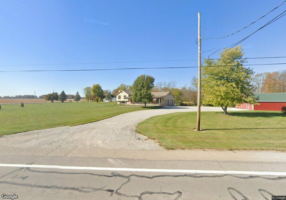
1970 S State Route 48 Ludlow Falls, OH 45339
Estimated Value: $284,000 - $560,000
4
Beds
4
Baths
2,368
Sq Ft
$187/Sq Ft
Est. Value
About This Home
This home is located at 1970 S State Route 48, Ludlow Falls, OH 45339 and is currently estimated at $442,398, approximately $186 per square foot. 1970 S State Route 48 is a home located in Miami County with nearby schools including Milton-Union Elementary School, Milton-Union Middle School, and Milton-Union High School.
Ownership History
Date
Name
Owned For
Owner Type
Purchase Details
Closed on
Jan 7, 2009
Sold by
Scherman Meloyde
Bought by
Knostman Lee J
Current Estimated Value
Home Financials for this Owner
Home Financials are based on the most recent Mortgage that was taken out on this home.
Original Mortgage
$199,938
Outstanding Balance
$128,721
Interest Rate
5.53%
Mortgage Type
FHA
Estimated Equity
$313,677
Create a Home Valuation Report for This Property
The Home Valuation Report is an in-depth analysis detailing your home's value as well as a comparison with similar homes in the area
Home Values in the Area
Average Home Value in this Area
Purchase History
| Date | Buyer | Sale Price | Title Company |
|---|---|---|---|
| Knostman Lee J | -- | -- |
Source: Public Records
Mortgage History
| Date | Status | Borrower | Loan Amount |
|---|---|---|---|
| Open | Knostman Lee J | $199,938 |
Source: Public Records
Tax History Compared to Growth
Tax History
| Year | Tax Paid | Tax Assessment Tax Assessment Total Assessment is a certain percentage of the fair market value that is determined by local assessors to be the total taxable value of land and additions on the property. | Land | Improvement |
|---|---|---|---|---|
| 2024 | $3,711 | $103,040 | $22,470 | $80,570 |
| 2023 | $3,711 | $103,040 | $22,470 | $80,570 |
| 2022 | $3,753 | $103,040 | $22,470 | $80,570 |
| 2021 | $3,614 | $85,860 | $18,730 | $67,130 |
| 2020 | $3,622 | $85,860 | $18,730 | $67,130 |
| 2019 | $3,402 | $85,860 | $18,730 | $67,130 |
| 2018 | $3,150 | $74,100 | $16,420 | $57,680 |
| 2017 | $3,151 | $74,100 | $16,420 | $57,680 |
| 2016 | $3,001 | $74,100 | $16,420 | $57,680 |
| 2015 | $3,004 | $71,270 | $15,790 | $55,480 |
| 2014 | $3,004 | $71,270 | $15,790 | $55,480 |
| 2013 | $3,003 | $71,270 | $15,790 | $55,480 |
Source: Public Records
Map
Nearby Homes
- 2211 S State Route 48
- 115 Vine St
- 3155 S State Route 48
- 5940 Horseshoe Bend Rd
- 5920 Horseshoe Bend Rd
- 5845 Fenner Rd
- G12-072300 S Kessler Frederick Rd
- 6200 State Route 718
- 490 N Jay St
- 488 N Jay St
- 309 W Franklin St
- 1 N Main St
- 275 N Jay St
- 216 N Miami St
- 207 Palm Ct
- 111 Hayes St
- 6477 W State Route 571
- 4063 W State Route 55
- 128 S Miami St
- 125 S Miami St
- 1953 S State Route 48
- 7425 Horseshoe Bend Rd
- 1850 S State Route 48
- 7487 Horseshoe Bend Rd
- 2055 S State Route 48
- 7254 Horseshoe Bend Rd
- 1825 S State Route 48
- 1905 S State Route 48
- 7505 Horseshoe Bend Rd
- 1780 S State Route 48
- 7214 Horseshoe Bend Rd
- 7205 Horseshoe Bend Rd
- 2125 S State Route 48
- 7545 Horseshoe Bend Rd
- 7165 Horseshoe Bend Rd
- 2165 S State Route 48
- 7585 Horseshoe Bend Rd
- 7200 Horseshoe Bend Rd
- 7627 Horseshoe Bend Rd
- 7007 Horseshoe Bend Rd