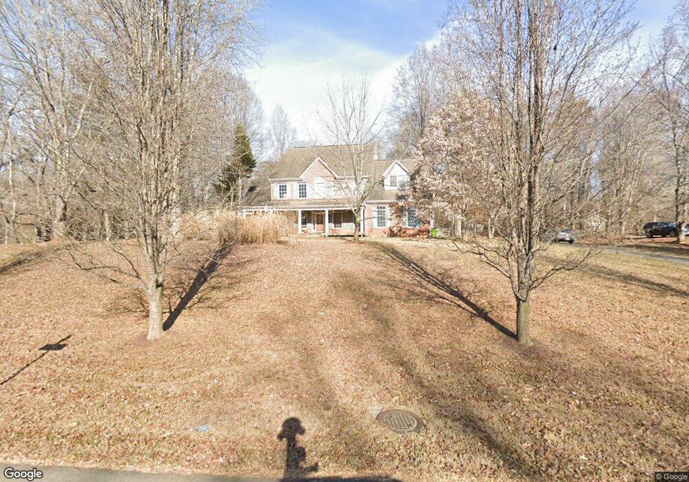
1970 Somerset Dr Jeffersonton, VA 22724
Estimated Value: $699,000 - $808,000
4
Beds
3
Baths
3,389
Sq Ft
$222/Sq Ft
Est. Value
About This Home
This home is located at 1970 Somerset Dr, Jeffersonton, VA 22724 and is currently estimated at $752,701, approximately $222 per square foot. 1970 Somerset Dr is a home located in Culpeper County with nearby schools including Emerald Hill Elementary School, Culpeper Middle School, and Culpeper County High School.
Ownership History
Date
Name
Owned For
Owner Type
Purchase Details
Closed on
Jul 15, 2003
Sold by
Kay William C
Bought by
Lunsford Allan T
Current Estimated Value
Home Financials for this Owner
Home Financials are based on the most recent Mortgage that was taken out on this home.
Original Mortgage
$303,920
Outstanding Balance
$131,060
Interest Rate
5.45%
Mortgage Type
New Conventional
Estimated Equity
$621,641
Purchase Details
Closed on
Sep 15, 2000
Sold by
Park Horse Capital
Bought by
Kay William C
Home Financials for this Owner
Home Financials are based on the most recent Mortgage that was taken out on this home.
Original Mortgage
$242,100
Interest Rate
8%
Create a Home Valuation Report for This Property
The Home Valuation Report is an in-depth analysis detailing your home's value as well as a comparison with similar homes in the area
Home Values in the Area
Average Home Value in this Area
Purchase History
| Date | Buyer | Sale Price | Title Company |
|---|---|---|---|
| Lunsford Allan T | $39,900 | -- | |
| Kay William C | $302,000 | -- |
Source: Public Records
Mortgage History
| Date | Status | Borrower | Loan Amount |
|---|---|---|---|
| Open | Lunsford Allan T | $303,920 | |
| Previous Owner | Kay William C | $242,100 |
Source: Public Records
Tax History Compared to Growth
Tax History
| Year | Tax Paid | Tax Assessment Tax Assessment Total Assessment is a certain percentage of the fair market value that is determined by local assessors to be the total taxable value of land and additions on the property. | Land | Improvement |
|---|---|---|---|---|
| 2024 | -- | $686,400 | $140,000 | $546,400 |
| 2023 | $0 | $686,400 | $140,000 | $546,400 |
| 2022 | $2,691 | $489,300 | $110,000 | $379,300 |
| 2021 | $0 | $489,300 | $110,000 | $379,300 |
| 2020 | $2,592 | $418,000 | $97,500 | $320,500 |
| 2019 | $2,592 | $418,000 | $97,500 | $320,500 |
| 2018 | $2,635 | $393,300 | $90,300 | $303,000 |
| 2017 | $2,635 | $393,300 | $90,300 | $303,000 |
| 2016 | $2,867 | $392,800 | $89,800 | $303,000 |
| 2015 | -- | $392,800 | $89,800 | $303,000 |
Source: Public Records
Map
Nearby Homes
- 2357 Brighton Place
- 17277 Kettlebrook Landing
- 2089 Whithorn Hill
- Harlow II Plan at Stonehaven - Executive Collection
- Columbia Plan at Stonehaven - Executive Collection
- Innisbrook Plan at Stonehaven - Executive Collection
- 17246 Pepperstock Ln
- 18142 Telford Dr
- 2110 Whithorn Hill
- 2114 Whithorn Hill
- 2449 Newton Dr
- 17046 Lee Hwy
- 18446 Gleneagle Dr Unit MACARTHUR LOT 2320
- 18438 Gleneagle Dr Unit MACARTHUR LOT 2318
- Lot 2325 Gleneagle Dr Unit HARLOW II
- 1468 Parker Place
- 2554 Northumberland Dr Unit MACARTHUR LOT 2294
- 18511 NewMacHar Ct Unit MACARTHUR LOT 2307
- 2526 Northumberland Dr Unit AZALEA LOT 2287
- 2518 Northumberland Dr Unit MACARTHUR LOT 2285
- 1954 Somerset Dr
- 1994 Somerset Dr
- 1963 Somerset Dr
- 2254 Welton Pond Ct
- 1938 Somerset Dr
- 2012 Somerset Dr
- 2245 Welton Pond Ct
- 2009 Somerset Dr
- 1927 Somerset Dr
- 1918 Somerset Dr
- 2267 Welton Pond Ct
- 2034 Somerset Dr
- 2270 Welton Pond Ct
- 2031 Somerset Dr
- 2282 Welton Pond Ct
- 2285 Welton Pond Ct
- 2043 Somerset Dr
- 2042 Somerset Dr
- 2292 Welton Pond Ct
- 2293 Welton Pond Ct