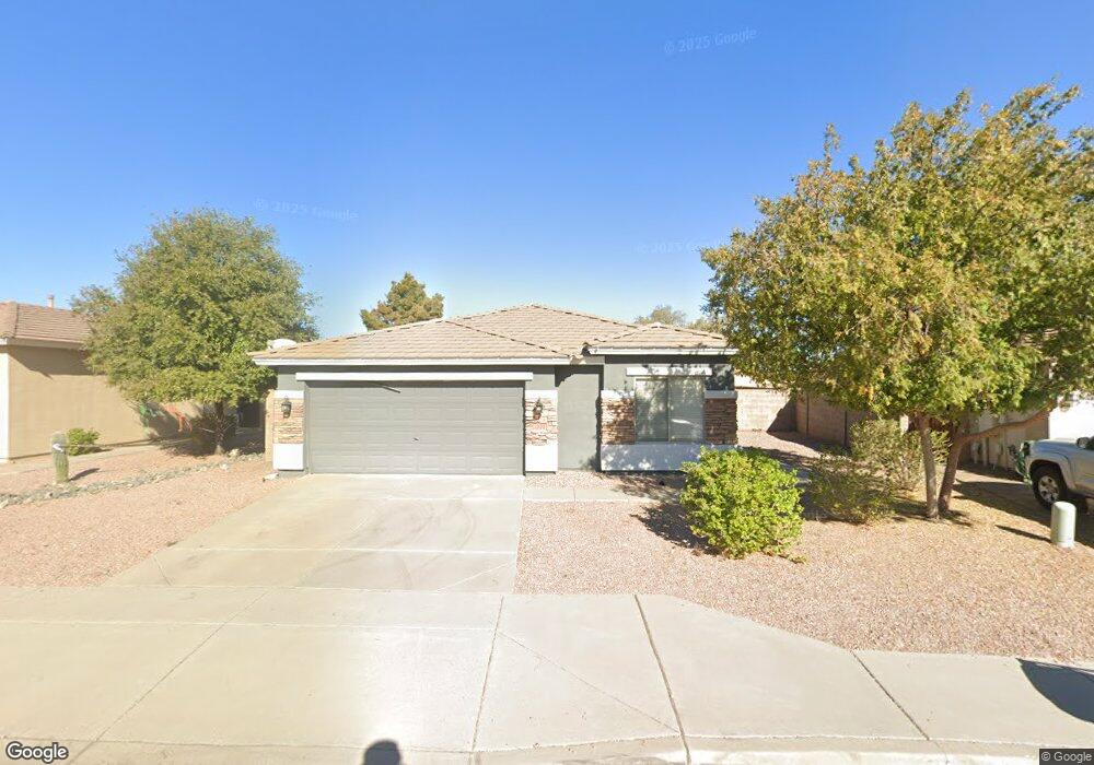
1970 W Tanner Ranch Rd Queen Creek, AZ 85142
San Tan Heights NeighborhoodEstimated Value: $337,184 - $410,000
--
Bed
--
Bath
1,913
Sq Ft
$201/Sq Ft
Est. Value
About This Home
This home is located at 1970 W Tanner Ranch Rd, Queen Creek, AZ 85142 and is currently estimated at $383,796, approximately $200 per square foot. 1970 W Tanner Ranch Rd is a home located in Pinal County with nearby schools including American Leadership Academy, San Tan Valley, Legacy Traditional-San Tan, and Eduprize School.
Ownership History
Date
Name
Owned For
Owner Type
Purchase Details
Closed on
Sep 17, 2007
Sold by
Smith Mark Robert and Smith Jennifer Marie
Bought by
Baker Fred and Baker Cheryl
Current Estimated Value
Home Financials for this Owner
Home Financials are based on the most recent Mortgage that was taken out on this home.
Original Mortgage
$157,600
Outstanding Balance
$99,217
Interest Rate
6.46%
Mortgage Type
New Conventional
Estimated Equity
$284,579
Purchase Details
Closed on
Apr 20, 2004
Sold by
First American Title Insurance Co
Bought by
Smith Mark Robert and Smith Jennifer
Home Financials for this Owner
Home Financials are based on the most recent Mortgage that was taken out on this home.
Original Mortgage
$120,850
Interest Rate
5.77%
Mortgage Type
New Conventional
Create a Home Valuation Report for This Property
The Home Valuation Report is an in-depth analysis detailing your home's value as well as a comparison with similar homes in the area
Home Values in the Area
Average Home Value in this Area
Purchase History
| Date | Buyer | Sale Price | Title Company |
|---|---|---|---|
| Baker Fred | $197,000 | Grand Canyon Title Agency In | |
| Smith Mark Robert | $151,063 | First American Title Ins Co |
Source: Public Records
Mortgage History
| Date | Status | Borrower | Loan Amount |
|---|---|---|---|
| Open | Baker Fred | $157,600 | |
| Previous Owner | Smith Mark Robert | $120,850 |
Source: Public Records
Tax History Compared to Growth
Tax History
| Year | Tax Paid | Tax Assessment Tax Assessment Total Assessment is a certain percentage of the fair market value that is determined by local assessors to be the total taxable value of land and additions on the property. | Land | Improvement |
|---|---|---|---|---|
| 2025 | $1,375 | $31,378 | -- | -- |
| 2024 | $1,354 | $35,239 | -- | -- |
| 2023 | $1,376 | $28,701 | $5,677 | $23,024 |
| 2022 | $1,354 | $19,553 | $3,785 | $15,768 |
| 2021 | $1,467 | $17,991 | $0 | $0 |
| 2020 | $1,337 | $17,755 | $0 | $0 |
| 2019 | $1,148 | $14,127 | $0 | $0 |
| 2018 | $1,099 | $12,999 | $0 | $0 |
| 2017 | $1,033 | $13,144 | $0 | $0 |
| 2016 | $1,048 | $12,478 | $1,800 | $10,678 |
| 2014 | $928 | $8,396 | $1,000 | $7,396 |
Source: Public Records
Map
Nearby Homes
- 1983 W Allens Peak Dr
- 2056 W Allens Peak Dr
- 2037 W Hayden Peak Dr
- 33153 N Cat Hills Ave
- 33223 N Legend Hills Trail
- 2269 W Silver Creek Ln
- 2260 W Mineral Butte Dr
- 32764 N Cat Hills Ave
- 1845 W Desert Mountain Dr
- 2055 W Fruit Tree Ln
- 33335 N Hidden Canyon Dr
- 2507 W Tanner Ranch Rd
- 2191 W Goldmine Mountain Dr
- 33504 N Dill Ave
- 33575 N Butte Dr
- 2347 W Jasper Butte Dr
- 2237 W Agrarian Hills Dr
- 2140 W Agrarian Hills Dr
- 2033 W Green Tree Dr
- 32347 N Vernal Ln
- 1986 W Tanner Ranch Rd
- 1954 W Tanner Ranch Rd
- 2002 W Tanner Ranch Rd
- 1969 W Allens Peak Dr
- 1999 W Allens Peak Dr
- 1953 W Allens Peak Dr
- 1937 W Tanner Ranch Rd
- 2013 W Allens Peak Dr
- 2018 W Tanner Ranch Rd
- 1955 W Tanner Ranch Rd
- 2029 W Allens Peak Dr
- 1973 W Tanner Ranch Rd
- 1973 W Tanner Ranch Rd
- 33003 N Hidden Canyon Dr
- 32987 N Hidden Canyon Dr
- 2034 W Tanner Ranch Rd
- 32971 N Hidden Canyon Dr
- 1991 W Tanner Ranch Rd
- 2045 W Allens Peak Dr
- 33035 N Hidden Canyon Dr