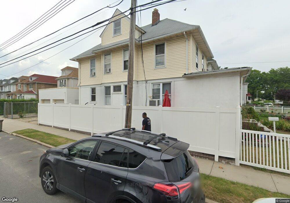
19701 89th Ave Hollis, NY 11423
Hollis NeighborhoodEstimated Value: $805,202 - $960,000
--
Bed
--
Bath
1,776
Sq Ft
$496/Sq Ft
Est. Value
About This Home
This home is located at 19701 89th Ave, Hollis, NY 11423 and is currently estimated at $881,301, approximately $496 per square foot. 19701 89th Ave is a home located in Queens County with nearby schools including P.S. 35 Nathaniel Woodhull, I.S. 238 Susan B Anthony Academy, and The Wellspring Schools.
Ownership History
Date
Name
Owned For
Owner Type
Purchase Details
Closed on
Dec 22, 2004
Sold by
Duval and Richard G
Bought by
Duval Richard G and Harris Debbie
Current Estimated Value
Purchase Details
Closed on
Mar 2, 1998
Sold by
Ramirez Ramiro and Ramirez Anna
Bought by
Duval Richard and Duval Shere E
Home Financials for this Owner
Home Financials are based on the most recent Mortgage that was taken out on this home.
Original Mortgage
$163,400
Interest Rate
7.11%
Mortgage Type
FHA
Create a Home Valuation Report for This Property
The Home Valuation Report is an in-depth analysis detailing your home's value as well as a comparison with similar homes in the area
Home Values in the Area
Average Home Value in this Area
Purchase History
| Date | Buyer | Sale Price | Title Company |
|---|---|---|---|
| Duval Richard G | -- | -- | |
| Duval Richard G | -- | -- | |
| Duval Richard | $165,000 | Commonwealth Land Title Ins | |
| Duval Richard | $165,000 | Commonwealth Land Title Ins |
Source: Public Records
Mortgage History
| Date | Status | Borrower | Loan Amount |
|---|---|---|---|
| Previous Owner | Duval Richard | $163,400 | |
| Closed | Duval Richard G | $0 |
Source: Public Records
Tax History Compared to Growth
Tax History
| Year | Tax Paid | Tax Assessment Tax Assessment Total Assessment is a certain percentage of the fair market value that is determined by local assessors to be the total taxable value of land and additions on the property. | Land | Improvement |
|---|---|---|---|---|
| 2025 | $6,484 | $34,219 | $10,367 | $23,852 |
| 2024 | $6,484 | $32,282 | $9,780 | $22,502 |
| 2023 | $6,117 | $30,456 | $8,577 | $21,879 |
| 2022 | $6,080 | $41,880 | $14,160 | $27,720 |
| 2021 | $6,361 | $38,280 | $14,160 | $24,120 |
| 2020 | $6,036 | $34,320 | $14,160 | $20,160 |
| 2019 | $5,628 | $33,540 | $14,160 | $19,380 |
| 2018 | $5,174 | $25,380 | $14,160 | $11,220 |
| 2017 | $5,207 | $25,545 | $12,719 | $12,826 |
| 2016 | $5,068 | $25,545 | $12,719 | $12,826 |
| 2015 | $2,907 | $23,917 | $12,867 | $11,050 |
| 2014 | $2,907 | $22,564 | $14,561 | $8,003 |
Source: Public Records
Map
Nearby Homes
- 88-27 196th St
- 89-48 196th St
- 88-38 201st St
- 8925 201st St
- 90-35 198th St
- 88-44 202nd St
- 88-49 202nd St
- 196-33 Foothill Ave
- 19633 Foothill Ave
- 9051 201st St
- 196-35 Dunton Ave Unit 1
- 87-44 Marengo St Unit 2A
- 9048 204th St
- 93-17 201st St
- 9302 202nd St
- 92-22 195th Place
- 87-24 Marengo St Unit 2B
- 90-62 204th St
- 8919 205th St
- 87-16 Marengo St Unit 2B
- 19703 89th Ave
- 197-07 89th Ave
- 197-01 89th Ave
- 19705 89th Ave
- 19637 89th Ave
- 8835 197th St
- 19707 89th Ave
- 19633 89th Ave
- 19715 89th Ave
- 8831 197th St
- 19629 89th Ave
- 89-02 197th St Unit 2
- 19717 89th Ave
- 19717 89th Ave
- 19702 89th Ave
- 19704 89th Ave
- 8829 197th St
- 8902 197th St
- 19706 89th Ave
- 8838 197th St