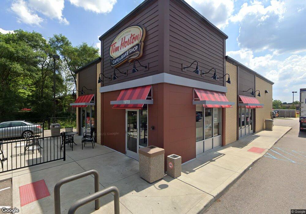
19701 W 12 Mile Rd Southfield, MI 48076
Estimated Value: $1,123,314
--
Bed
--
Bath
11,036
Sq Ft
$102/Sq Ft
Est. Value
About This Home
This home is located at 19701 W 12 Mile Rd, Southfield, MI 48076 and is currently estimated at $1,123,314, approximately $101 per square foot. 19701 W 12 Mile Rd is a home located in Oakland County with nearby schools including Alice M. Birney K-8 School and Mcintyre Elementary School.
Ownership History
Date
Name
Owned For
Owner Type
Purchase Details
Closed on
Jun 21, 2022
Sold by
Tim Donut Us Limited Inc
Bought by
12-Th Llc
Current Estimated Value
Purchase Details
Closed on
Feb 21, 2019
Sold by
Sbrd Llc
Bought by
12 Th Llc
Purchase Details
Closed on
Oct 25, 2013
Sold by
19701 Twelve Mile Investmenet Llc
Bought by
Sbrd Llc
Purchase Details
Closed on
Feb 2, 2011
Sold by
Bayview Loan Servicing Llc
Bought by
Ib Property Holdings Llc
Purchase Details
Closed on
Dec 21, 2010
Sold by
Uptown Investments Inc
Bought by
Bayview Loan Servicing Llc
Purchase Details
Closed on
Jul 18, 2003
Sold by
Zhang Tong Bin
Bought by
T & Z Properties Llc
Purchase Details
Closed on
May 28, 2003
Sold by
Taylor Carol A
Bought by
Zhang Tong Bin
Purchase Details
Closed on
Dec 26, 2001
Sold by
Joan R Nelson Tr
Bought by
Carol A Taylor Tr
Create a Home Valuation Report for This Property
The Home Valuation Report is an in-depth analysis detailing your home's value as well as a comparison with similar homes in the area
Home Values in the Area
Average Home Value in this Area
Purchase History
| Date | Buyer | Sale Price | Title Company |
|---|---|---|---|
| 12-Th Llc | -- | Barris Sott Denn & Driker Pllc | |
| 12 Th Llc | -- | Ata National Title Group Llc | |
| Sbrd Llc | $530,000 | Lawyers Title-Commonwealth N | |
| Ib Property Holdings Llc | -- | None Available | |
| Bayview Loan Servicing Llc | $499,000 | None Available | |
| T & Z Properties Llc | -- | -- | |
| Zhang Tong Bin | $480,000 | -- | |
| Carol A Taylor Tr | -- | -- |
Source: Public Records
Tax History Compared to Growth
Tax History
| Year | Tax Paid | Tax Assessment Tax Assessment Total Assessment is a certain percentage of the fair market value that is determined by local assessors to be the total taxable value of land and additions on the property. | Land | Improvement |
|---|---|---|---|---|
| 2022 | $22,759 | $515,080 | $228,690 | $286,390 |
| 2021 | $34,513 | $499,070 | $228,690 | $270,380 |
| 2020 | $26,984 | $500,950 | $44,760 | $456,190 |
| 2018 | $26,539 | $404,840 | $154,500 | $250,340 |
| 2015 | -- | $387,690 | $0 | $0 |
| 2014 | -- | $196,070 | $0 | $0 |
| 2011 | -- | $319,870 | $0 | $0 |
Source: Public Records
Map
Nearby Homes
- 19601 W 12 Mile Rd Unit 102
- 20141 Lacrosse Ave
- 20351 Lacrosse Ave
- 28450 Tapert Dr
- 21650 W 11 Mile Rd
- 20120 Covington Pkwy
- 29662 Westbrook Pkwy
- 29140 Candlewood Ln
- 18797 Wiltshire Blvd
- 29214 Candlewood Ln
- 29743 Chelmsford Rd
- 29484 Spring Hill Dr
- 30130 Woodgate Dr
- 29807 Spring Hill Dr
- 29239 Somerset Dr
- 27925 Arlington Dr
- 20345 Harbor Ln
- 29848 Rambling Rd
- 18830 San Quentin Dr
- 20780 Wayland St
- 29215 Kensington Ct
- 19603 W 12 Mile Rd Unit 204
- 19601 W 12 Mile Rd Unit 102
- 19601 W 12 Mile Rd Unit 1
- 19639 W 12 Mile Rd Unit 282 201
- 19603 W 12 Mile Rd
- 19603 W 12 Mile Rd
- 19603 W 12 Mile Rd
- 19603 W 12 Mile Rd
- 19603 W 12 Mile Rd
- 19603 W 12 Mile Rd
- 19603 W 12 Mile Rd
- 19603 W 12 Mile Rd
- 19601 W 12 Mile Rd
- 19601 W 12 Mile Rd
- 19601 W 12 Mile Rd
- 19601 W 12 Mile Rd
- 19601 W 12 Mile Rd
- 19601 W 12 Mile Rd
- 19601 W 12 Mile Rd