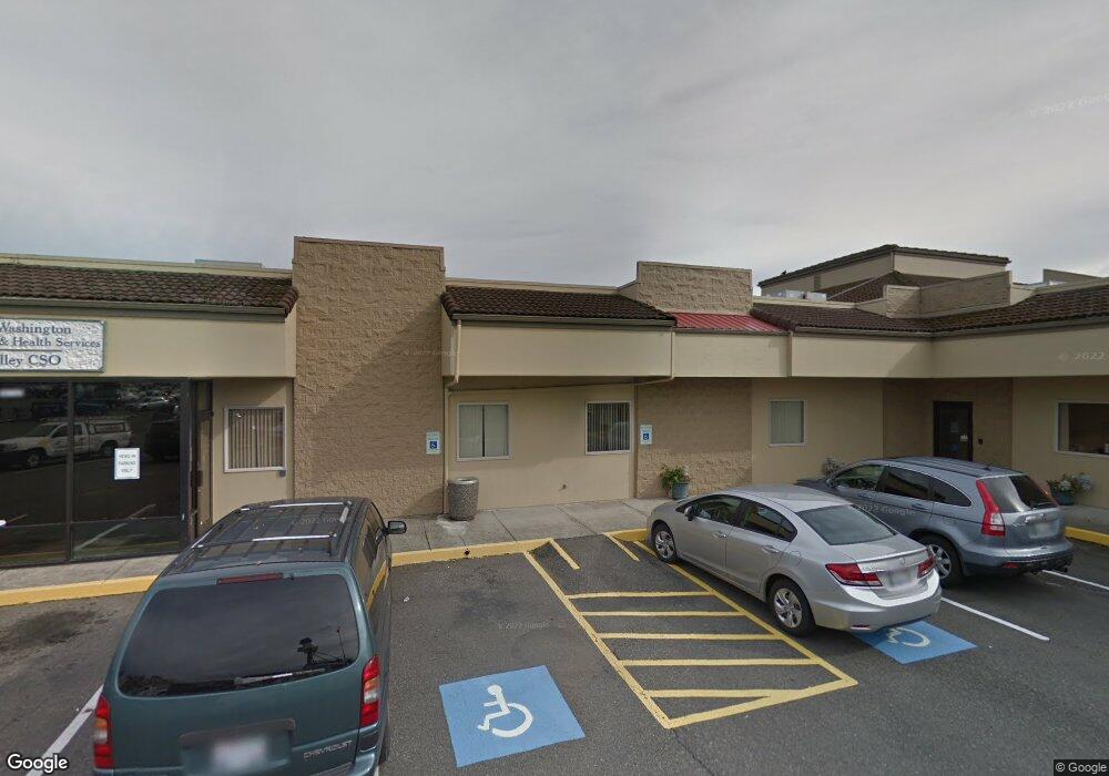
19705 State Route 2 Monroe, WA 98272
Estimated Value: $2,489,238
--
Bed
1
Bath
12,637
Sq Ft
$197/Sq Ft
Est. Value
About This Home
This home is located at 19705 State Route 2, Monroe, WA 98272 and is currently estimated at $2,489,238, approximately $196 per square foot. 19705 State Route 2 is a home located in Snohomish County with nearby schools including Chain Lake Elementary School, Monroe High School, and Monroe Montessori School.
Ownership History
Date
Name
Owned For
Owner Type
Purchase Details
Closed on
Jan 5, 2020
Sold by
Monroe T2000 Llc
Bought by
Ladd James R and Ladd Harold W
Current Estimated Value
Purchase Details
Closed on
Dec 30, 2009
Sold by
Dshs Building Llc
Bought by
Kem Llc and Kehle Monroe Llc
Home Financials for this Owner
Home Financials are based on the most recent Mortgage that was taken out on this home.
Original Mortgage
$2,062,500
Interest Rate
4.78%
Mortgage Type
Commercial
Purchase Details
Closed on
Jan 2, 2008
Sold by
Marhanlo Llc
Bought by
Dshs Building Llc
Purchase Details
Closed on
Oct 2, 2001
Sold by
Hanson Harold and Hanson Geraldine
Bought by
Marhanlo Llc
Purchase Details
Closed on
Dec 12, 2000
Sold by
Hanson Harold and Hanson Geraldine
Bought by
Marhanlo Llc
Create a Home Valuation Report for This Property
The Home Valuation Report is an in-depth analysis detailing your home's value as well as a comparison with similar homes in the area
Home Values in the Area
Average Home Value in this Area
Purchase History
| Date | Buyer | Sale Price | Title Company |
|---|---|---|---|
| Ladd James R | -- | None Available | |
| Kem Llc | $2,750,280 | First American Title Insuran | |
| Dshs Building Llc | -- | None Available | |
| Marhanlo Llc | -- | -- | |
| Marhanlo Llc | -- | -- |
Source: Public Records
Mortgage History
| Date | Status | Borrower | Loan Amount |
|---|---|---|---|
| Previous Owner | Kem Llc | $2,062,500 |
Source: Public Records
Tax History Compared to Growth
Tax History
| Year | Tax Paid | Tax Assessment Tax Assessment Total Assessment is a certain percentage of the fair market value that is determined by local assessors to be the total taxable value of land and additions on the property. | Land | Improvement |
|---|---|---|---|---|
| 2025 | $27,519 | $3,234,000 | $882,600 | $2,351,400 |
| 2024 | $27,519 | $3,406,400 | $815,400 | $2,591,000 |
| 2023 | $24,487 | $3,288,400 | $794,500 | $2,493,900 |
| 2022 | $31,902 | $3,417,000 | $690,000 | $2,727,000 |
| 2020 | $31,375 | $3,239,000 | $669,100 | $2,569,900 |
| 2019 | $29,991 | $3,056,000 | $585,400 | $2,470,600 |
| 2018 | $34,536 | $2,883,000 | $575,000 | $2,308,000 |
| 2017 | $31,741 | $2,772,000 | $575,000 | $2,197,000 |
| 2016 | $32,238 | $2,591,000 | $564,500 | $2,026,500 |
| 2015 | $32,638 | $2,468,000 | $564,500 | $1,903,500 |
| 2013 | $32,992 | $2,282,000 | $564,500 | $1,717,500 |
Source: Public Records
Map
Nearby Homes
- 162 Charles St
- 230 N Madison St
- 216 S Blakeley St
- 304 S Lewis St
- 19722 146th St SE
- 319 Short Columbia St
- 14483 Ramblewood Rd SE
- 14369 Autumns Ave SE
- 517 Roberts St
- 700 W Maple St
- 628 Roberts St
- 18510 Blueberry Ln
- 643 Monroe St
- 19910 Old Owen Rd
- 20418 Springbrook Rd SE
- 20708 Woods Creek Rd
- 18621 Blueberry Ln Unit A204
- 535 Terrace St
- 520 S Kelsey St
- 523 Park St
- 19721 U S 2
- 19721 State Route 2
- 19677 State Route 2
- 15178 Woods Creek Rd
- 15214 Woods Creek Rd
- 19677 U S 2 Unit 224
- 19677 U S 2
- 19693 U S 2
- tbd Route 2
- 19853 U S 2
- 19697 U S 2
- 19979 State Route 2
- 19959 Hwy 2
- 57 Woods Creek Rd
- 15014 121st Ave SE
- 14922 121st Ave SE
- 21825 U S 2
- 500 E Main St
- 19565 U S 2 Unit 162
- 19565 U S 2