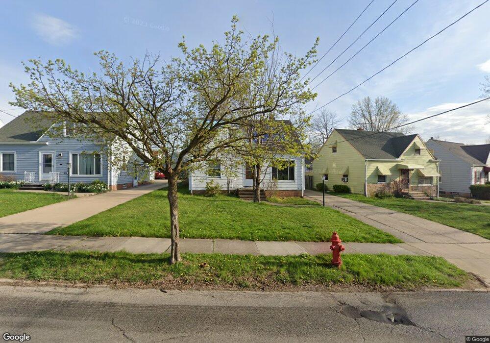
19707 Raymond St Maple Heights, OH 44137
Estimated Value: $108,058 - $125,000
3
Beds
1
Bath
1,131
Sq Ft
$105/Sq Ft
Est. Value
About This Home
This home is located at 19707 Raymond St, Maple Heights, OH 44137 and is currently estimated at $118,515, approximately $104 per square foot. 19707 Raymond St is a home located in Cuyahoga County with nearby schools including Abraham Lincoln Elementary School, Rockside/ J.F. Kennedy School, and Barack Obama School.
Ownership History
Date
Name
Owned For
Owner Type
Purchase Details
Closed on
Apr 14, 2023
Sold by
Spencer Jasman
Bought by
Taylor Acquisitions Llc
Current Estimated Value
Purchase Details
Closed on
Jan 8, 2022
Sold by
Patricia Spencer
Bought by
Spencer Jasman
Purchase Details
Closed on
Jul 1, 2007
Sold by
Ennis Rose M Rogozynski and Ennis Henry
Bought by
Spencer James T and Spencer Patricia Ann
Purchase Details
Closed on
Mar 24, 1989
Sold by
Carollo Anna L
Bought by
Rogozynski Rose M
Purchase Details
Closed on
Feb 9, 1976
Sold by
Carollo Frank and Carollo Anna L
Bought by
Carollo Anna L
Purchase Details
Closed on
Jan 1, 1975
Bought by
Carollo Frank and Carollo Anna L
Create a Home Valuation Report for This Property
The Home Valuation Report is an in-depth analysis detailing your home's value as well as a comparison with similar homes in the area
Home Values in the Area
Average Home Value in this Area
Purchase History
| Date | Buyer | Sale Price | Title Company |
|---|---|---|---|
| Taylor Acquisitions Llc | $32,000 | Innovative Title | |
| Taylor Acquisitions Llc | $32,000 | Innovative Title | |
| Spencer Jasman | -- | None Listed On Document | |
| Spencer James T | $25,000 | None Available | |
| Rogozynski Rose M | $49,900 | -- | |
| Carollo Anna L | -- | -- | |
| Carollo Frank | -- | -- |
Source: Public Records
Tax History
| Year | Tax Paid | Tax Assessment Tax Assessment Total Assessment is a certain percentage of the fair market value that is determined by local assessors to be the total taxable value of land and additions on the property. | Land | Improvement |
|---|---|---|---|---|
| 2024 | $3,243 | $34,650 | $7,105 | $27,545 |
| 2023 | $2,068 | $18,480 | $4,060 | $14,420 |
| 2022 | $2,103 | $18,480 | $4,060 | $14,420 |
| 2021 | $2,238 | $18,480 | $4,060 | $14,420 |
| 2020 | $1,924 | $14,000 | $3,080 | $10,920 |
| 2019 | $2,962 | $40,000 | $8,800 | $31,200 |
| 2018 | $2,516 | $14,000 | $3,080 | $10,920 |
| 2017 | $1,799 | $12,780 | $2,870 | $9,910 |
| 2016 | $1,739 | $12,780 | $2,870 | $9,910 |
| 2015 | $4,863 | $12,780 | $2,870 | $9,910 |
| 2014 | $4,863 | $14,040 | $3,150 | $10,890 |
Source: Public Records
Map
Nearby Homes
- 19931 Raymond St
- 5165 Camden Rd
- 5147 Warrensville Center Rd
- 19520 Maple Heights Blvd
- 20600 Watson Rd
- 20517 Raymond St
- 18990 Raymond St
- 18851 Raymond St
- 5194 Homewood Ave
- 20705 Hansen Rd
- 20715 Watson Rd
- 18704 Longview Ave
- 20806 Clare Ave
- 20905 Clare Ave
- 19289 Stafford Ave
- 18715 Libby Rd
- 21202 Hillgrove Ave
- 5100 Erwin St
- 21207 Franklin Rd
- 18909 Maple Heights Blvd
- 19711 Raymond St
- 19703 Raymond St
- 19617 Raymond St
- 19815 Maple Heights Blvd
- 19613 Raymond St
- 19616 Longview Ave
- 19620 Longview Ave
- 19608 Longview Ave
- 19819 Maple Heights Blvd
- 19740 Raymond St
- 19604 Longview Ave
- 19651 Raymond St
- 19700 Raymond St
- 19698 Raymond St
- 19823 Maple Heights Blvd
- 19600 Longview Ave
- 19652 Raymond St
- 19605 Raymond St
- 19516 Longview Ave
- 19610 Raymond St
Your Personal Tour Guide
Ask me questions while you tour the home.