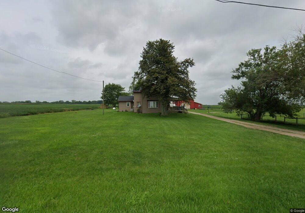
1971 Barnetts Mill Rd Camden, OH 45311
Estimated Value: $294,000 - $448,000
5
Beds
4
Baths
2,429
Sq Ft
$144/Sq Ft
Est. Value
About This Home
This home is located at 1971 Barnetts Mill Rd, Camden, OH 45311 and is currently estimated at $349,881, approximately $144 per square foot. 1971 Barnetts Mill Rd is a home located in Preble County with nearby schools including Preble Shawnee Elementary School, West Elkton Intermediate School, and Preble Shawnee Junior/Senior High School.
Ownership History
Date
Name
Owned For
Owner Type
Purchase Details
Closed on
Sep 13, 2012
Sold by
Riddick Dennis R
Bought by
Riddick Ida M and Dinuizio
Current Estimated Value
Purchase Details
Closed on
Aug 6, 2003
Sold by
Dill Ronald A and Dill Traci R
Bought by
Riddick Dennis R and Riddick Ida M
Home Financials for this Owner
Home Financials are based on the most recent Mortgage that was taken out on this home.
Original Mortgage
$159,375
Outstanding Balance
$68,596
Interest Rate
5.31%
Mortgage Type
Purchase Money Mortgage
Estimated Equity
$281,285
Purchase Details
Closed on
Sep 15, 1998
Sold by
Williams Irene
Bought by
Dill Ronald A and Dill Noretta S
Home Financials for this Owner
Home Financials are based on the most recent Mortgage that was taken out on this home.
Original Mortgage
$107,000
Interest Rate
7.06%
Mortgage Type
New Conventional
Create a Home Valuation Report for This Property
The Home Valuation Report is an in-depth analysis detailing your home's value as well as a comparison with similar homes in the area
Home Values in the Area
Average Home Value in this Area
Purchase History
| Date | Buyer | Sale Price | Title Company |
|---|---|---|---|
| Riddick Ida M | -- | None Available | |
| Riddick Dennis R | $187,500 | Performance Title | |
| Dill Ronald A | $98,000 | -- |
Source: Public Records
Mortgage History
| Date | Status | Borrower | Loan Amount |
|---|---|---|---|
| Open | Riddick Dennis R | $159,375 | |
| Previous Owner | Dill Ronald A | $107,000 |
Source: Public Records
Tax History Compared to Growth
Tax History
| Year | Tax Paid | Tax Assessment Tax Assessment Total Assessment is a certain percentage of the fair market value that is determined by local assessors to be the total taxable value of land and additions on the property. | Land | Improvement |
|---|---|---|---|---|
| 2024 | $2,650 | $83,690 | $18,870 | $64,820 |
| 2023 | $2,751 | $83,690 | $18,870 | $64,820 |
| 2022 | $2,066 | $59,570 | $16,380 | $43,190 |
| 2021 | $2,182 | $59,570 | $16,380 | $43,190 |
| 2020 | $2,061 | $59,570 | $16,380 | $43,190 |
| 2019 | $2,034 | $57,690 | $15,930 | $41,760 |
| 2018 | $2,072 | $57,690 | $15,930 | $41,760 |
| 2017 | $1,956 | $57,690 | $15,930 | $41,760 |
| 2016 | $1,336 | $40,050 | $15,440 | $24,610 |
| 2014 | $1,402 | $40,050 | $15,440 | $24,610 |
| 2013 | -- | $39,760 | $15,435 | $24,325 |
Source: Public Records
Map
Nearby Homes
- 759 Barnetts Mill Rd
- 725 Sr
- 103 Katherine Ct
- 471 Camden West Elkton Rd
- 131 S Lafayette St
- 388 W Hendricks St
- 407 W Central Ave
- 6171 Somers Gratis Rd
- 817 Old Norse Dr
- 805 Brande Dr
- 787 Baltic Dr
- 820 Lars Cove
- 0 Lars Cove Unit 1745954
- 751 Lakengren Dr
- 314 Lakengren Dr
- 724 Lakengren Dr
- 250 Lakengren Dr
- 127 Voyage Dr
- 632-636 Skodborg Dr
- 1958 Barnetts Mill Rd
- 1619 Barnetts Mill Rd
- 2154 Barnetts Mill Rd
- 2359 Barnetts Mill Rd
- 5913 Wayne Trace Rd
- 6184 Wayne Trace Rd
- 6260 Wayne Trace Rd
- 0 Wayne Trace Rd
- 1474 Barnetts Mill Rd
- 4590 Eidson Rd
- 5674 Wayne Trace Rd
- 5236 Eidson Rd
- 4592 Eidson Rd
- 5164 Eidson Rd
- 2224 Aukerman Creek Rd
- 5098 Eidson Rd
- 5461 Wayne Trace Rd
- 7812 Upper Somers Rd
- 5012 Eidson Rd
- 2320 Aukerman Creek Rd