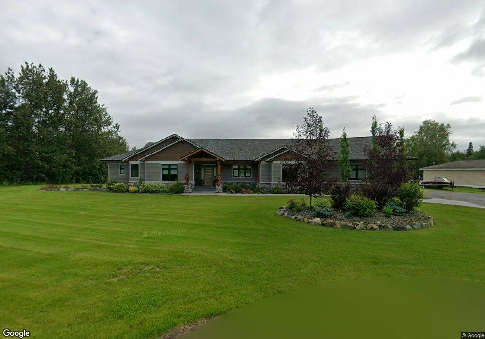
1971 Driftwood Cir Palmer, AK 99645
South Lakes NeighborhoodEstimated Value: $284,000 - $892,629
--
Bed
--
Bath
3,199
Sq Ft
$184/Sq Ft
Est. Value
About This Home
This home is located at 1971 Driftwood Cir, Palmer, AK 99645 and is currently estimated at $588,315, approximately $183 per square foot. 1971 Driftwood Cir is a home with nearby schools including Colony Middle School, Finger Lake Elementary School, and Colony High School.
Ownership History
Date
Name
Owned For
Owner Type
Purchase Details
Closed on
Dec 15, 2020
Sold by
Cedros Patrick M and Cedros Bonnie L
Bought by
Cedros Patrick M and Cedros Bonnie L
Current Estimated Value
Home Financials for this Owner
Home Financials are based on the most recent Mortgage that was taken out on this home.
Original Mortgage
$664,753
Outstanding Balance
$592,884
Interest Rate
2.8%
Mortgage Type
New Conventional
Estimated Equity
-$4,569
Purchase Details
Closed on
May 20, 2005
Sold by
Dyer Robert D and Dyer Dianne L
Bought by
Kizer Raymond L and Kizer Anati S
Create a Home Valuation Report for This Property
The Home Valuation Report is an in-depth analysis detailing your home's value as well as a comparison with similar homes in the area
Home Values in the Area
Average Home Value in this Area
Purchase History
| Date | Buyer | Sale Price | Title Company |
|---|---|---|---|
| Cedros Patrick M | -- | Accommodation | |
| Kizer Raymond L | -- | Mat Su Title Ins Agency Inc |
Source: Public Records
Mortgage History
| Date | Status | Borrower | Loan Amount |
|---|---|---|---|
| Open | Cedros Patrick M | $664,753 |
Source: Public Records
Tax History Compared to Growth
Tax History
| Year | Tax Paid | Tax Assessment Tax Assessment Total Assessment is a certain percentage of the fair market value that is determined by local assessors to be the total taxable value of land and additions on the property. | Land | Improvement |
|---|---|---|---|---|
| 2025 | $12,797 | $1,060,300 | $114,600 | $945,700 |
| 2024 | $12,797 | $1,034,200 | $114,600 | $919,600 |
| 2023 | $12,069 | $998,800 | $114,600 | $884,200 |
| 2022 | $11,697 | $908,500 | $114,600 | $793,900 |
| 2021 | $11,298 | $792,600 | $114,600 | $678,000 |
| 2020 | $1,686 | $114,600 | $114,600 | $0 |
| 2019 | $1,701 | $114,600 | $114,600 | $0 |
| 2018 | $1,692 | $114,600 | $114,600 | $0 |
| 2017 | $1,692 | $114,600 | $114,600 | $0 |
| 2016 | $1,649 | $114,600 | $114,600 | $0 |
| 2015 | $1,463 | $111,800 | $111,800 | $0 |
| 2014 | $1,463 | $111,800 | $111,800 | $0 |
Source: Public Records
Map
Nearby Homes
- 6600 E Finger Lake View Dr
- 6020 E Westview Cir
- 6860 E Marge
- 7302 &7303 E Double B Cir
- 6880 E Rabbit Cir
- 7460 E Rawhide Ln
- 6061 E Menke Cir
- 7786 E Reisner Loop
- 1125 N Colonial Dr
- 2525 N Larkspur Hill Cir
- 7140 E Riparian Loop
- 834 N Upstream Place
- 6816 E Andrew Cir
- 5965 E Wolverine Ave
- 555 S Lower Rd
- 4931 E Aspen St
- 4970 E Alder Dr
- 7535 E Woodview Way
- 7340 E Timber Ridge Cir Unit 3
- 7340 E Timber Ridge Cir Unit 28
- 1941 Driftwood Cir
- 1941 Driftwood Cir
- 1960 Driftwood Cir
- 1940 N Driftwood Cir
- 1940 Driftwood Cir
- 1980 Driftwood Cir
- 1901 Driftwood Cir
- 1991 Driftwood Cir
- 1910 Driftwood Cir
- 1901 Driftwood Cir
- 1991 Driftwood Cir
- 1871 Driftwood Cir
- 1871 Driftwood Cir
- 1880 Driftwood Cir
- 1831 Driftwood Cir
- 1850 Driftwood Cir
- 1820 Driftwood Cir
- 1761 Driftwood Cir
- 1690 Driftwood Cir
- 1740 Driftwood Cir