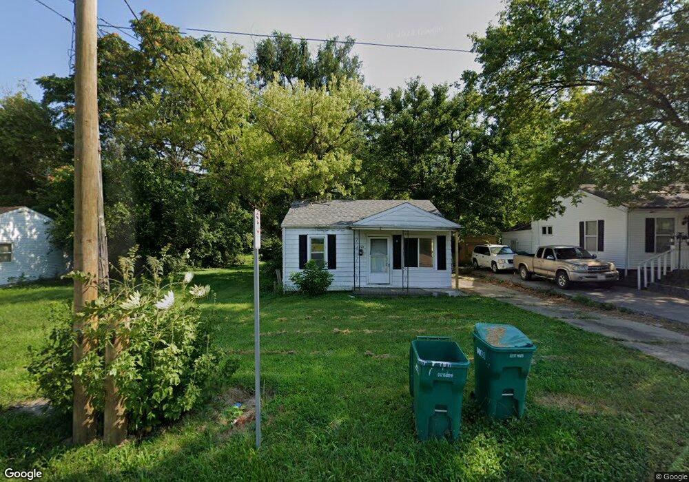
1971 E Cantrell St Decatur, IL 62521
Saint Mary's NeighborhoodEstimated Value: $40,000 - $62,000
2
Beds
--
Bath
900
Sq Ft
$58/Sq Ft
Est. Value
About This Home
This home is located at 1971 E Cantrell St, Decatur, IL 62521 and is currently estimated at $52,020, approximately $57 per square foot. 1971 E Cantrell St is a home located in Macon County with nearby schools including Muffley Elementary School, Stephen Decatur Middle School, and Robertson Charter School.
Ownership History
Date
Name
Owned For
Owner Type
Purchase Details
Closed on
Jun 16, 2025
Sold by
Real Estate Usa Llc and Durden Lacey
Bought by
Dream Prime Homes Llc
Current Estimated Value
Purchase Details
Closed on
May 17, 2024
Sold by
Henson Tony R
Bought by
Dream Prime Homes Llc
Purchase Details
Closed on
Sep 21, 2017
Sold by
Hinshaw Randy
Bought by
Henson Tony
Purchase Details
Closed on
Jan 29, 2007
Sold by
Beasley Edward E
Bought by
Henson Tony R
Home Financials for this Owner
Home Financials are based on the most recent Mortgage that was taken out on this home.
Original Mortgage
$21,960
Interest Rate
9.75%
Mortgage Type
Adjustable Rate Mortgage/ARM
Purchase Details
Closed on
Mar 1, 1991
Create a Home Valuation Report for This Property
The Home Valuation Report is an in-depth analysis detailing your home's value as well as a comparison with similar homes in the area
Home Values in the Area
Average Home Value in this Area
Purchase History
| Date | Buyer | Sale Price | Title Company |
|---|---|---|---|
| Dream Prime Homes Llc | -- | None Listed On Document | |
| Dream Prime Homes Llc | $11,000 | None Listed On Document | |
| Henson Tony | -- | None Available | |
| Henson Tony R | $24,500 | None Available | |
| -- | $13,000 | -- |
Source: Public Records
Mortgage History
| Date | Status | Borrower | Loan Amount |
|---|---|---|---|
| Previous Owner | Henson Tony R | $21,960 |
Source: Public Records
Tax History
| Year | Tax Paid | Tax Assessment Tax Assessment Total Assessment is a certain percentage of the fair market value that is determined by local assessors to be the total taxable value of land and additions on the property. | Land | Improvement |
|---|---|---|---|---|
| 2024 | $867 | $8,956 | $3,006 | $5,950 |
| 2023 | $860 | $8,639 | $2,900 | $5,739 |
| 2022 | $807 | $7,891 | $2,684 | $5,207 |
| 2021 | $758 | $7,368 | $2,506 | $4,862 |
| 2020 | $747 | $7,027 | $2,390 | $4,637 |
| 2019 | $747 | $7,027 | $2,390 | $4,637 |
| 2018 | $546 | $5,193 | $541 | $4,652 |
| 2017 | $558 | $5,331 | $555 | $4,776 |
| 2016 | $569 | $5,386 | $561 | $4,825 |
| 2015 | $541 | $5,291 | $551 | $4,740 |
| 2014 | $502 | $5,239 | $546 | $4,693 |
| 2013 | $519 | $5,435 | $566 | $4,869 |
Source: Public Records
Map
Nearby Homes
- 1872 Shady Crest St
- 2039 E Whitmer St
- 1901 Indiana Ct
- 2104 E Whitmer St
- 1135 S 21st St
- 632 S 17th St
- 1136 S 21st St
- 1202 Florida Ave
- 1722 E Johns Ave
- 2152 E Decatur St
- 855 S Stone St
- 1422 Sedgwick St
- 2150 E Clay St
- 2353 E Hendrix St
- 1484 E Clay St
- 246 Southmoreland Place
- 228 Southmoreland Place
- 66 Eastmoreland Dr
- 2360 E Wood St
- 1283 S Illinois St
- 1967 E Cantrell St
- 1965 E Cantrell St
- 1989 E Cantrell St
- 1985 E Roosevelt Ave
- 1945 E Cantrell St
- 1984 E Cantrell St
- 2004 E Roosevelt Ave
- 2000 E Roosevelt Ave
- 1970 E Cantrell St
- 1966 E Cantrell St
- 1993 E Cantrell St
- 1980 E Cantrell St
- 1925 E Cantrell St
- 2010 E Roosevelt Ave
- 1979 E Roosevelt Ave
- 1996 E Cantrell St
- 1997 E Cantrell St
- 2016 E Roosevelt Ave
- 1905 E Cantrell St
- 1971 E Roosevelt Ave
Your Personal Tour Guide
Ask me questions while you tour the home.