Estimated Value: $179,000 - $408,000
--
Bed
--
Bath
1,440
Sq Ft
$192/Sq Ft
Est. Value
About This Home
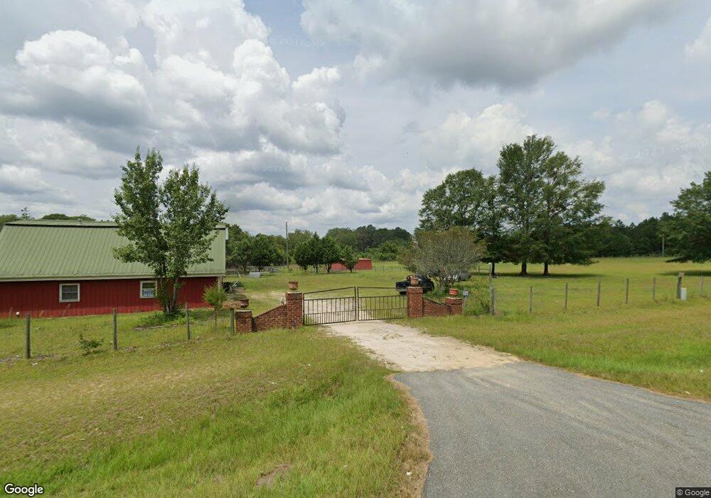
This home is located at 1971 Ga Highway 90 W, Mauk, GA 31058 and is currently estimated at $276,003, approximately $191 per square foot. 1971 Ga Highway 90 W is a home with nearby schools including Taylor County Primary School, Taylor County Upper Elementary School, and Taylor County Middle School.
Ownership History
Date
Name
Owned For
Owner Type
Purchase Details
Closed on
Jun 1, 2012
Sold by
Mcmillan Jennifer Nash
Bought by
Long Talmadge
Current Estimated Value
Purchase Details
Closed on
May 20, 2008
Sold by
Mcmillan Alton Glenn
Bought by
Mcmillan Jennifer Lynn
Purchase Details
Closed on
Aug 30, 2000
Sold by
Walls Homer
Bought by
Mcmillan Alton G
Purchase Details
Closed on
Jan 10, 1997
Bought by
Felsted Beverly
Create a Home Valuation Report for This Property
The Home Valuation Report is an in-depth analysis detailing your home's value as well as a comparison with similar homes in the area
Home Values in the Area
Average Home Value in this Area
Purchase History
| Date | Buyer | Sale Price | Title Company |
|---|---|---|---|
| Long Talmadge | $72,500 | -- | |
| Mcmillan Jennifer Lynn | -- | -- | |
| Mcmillan Alton G | $8,000 | -- | |
| Felsted Beverly | $20,000 | -- |
Source: Public Records
Tax History Compared to Growth
Tax History
| Year | Tax Paid | Tax Assessment Tax Assessment Total Assessment is a certain percentage of the fair market value that is determined by local assessors to be the total taxable value of land and additions on the property. | Land | Improvement |
|---|---|---|---|---|
| 2024 | $1,393 | $71,160 | $11,480 | $59,680 |
| 2023 | $997 | $49,920 | $11,480 | $38,440 |
| 2022 | $1,100 | $47,880 | $11,520 | $36,360 |
| 2021 | $900 | $44,040 | $9,600 | $34,440 |
| 2020 | $905 | $43,320 | $8,880 | $34,440 |
| 2019 | $917 | $43,320 | $8,880 | $34,440 |
| 2018 | $999 | $41,472 | $8,880 | $32,592 |
| 2017 | $812 | $39,333 | $8,611 | $30,722 |
| 2016 | $815 | $39,334 | $8,611 | $30,722 |
| 2015 | -- | $37,206 | $8,611 | $28,595 |
| 2014 | -- | $46,026 | $13,680 | $32,346 |
| 2013 | -- | $46,025 | $13,680 | $32,345 |
Source: Public Records
Map
Nearby Homes
- 15 Georgia 127
- 375 Village Ln
- 0 Brannon Montgomery Rd Unit 10453495
- 0 Brannon Montgomery Rd Unit 25510431
- 0 Poll Mill Rd
- 62 Brannon Montgomery Rd
- 221 Flamingo Dr
- 65 Saddle Trail
- 2450 Fort Perry Rd
- 0 Liberty Rd
- 12 AC Liberty Rd
- 3599 Ga Highway 127
- 0 Miller Rd Unit 10319190
- 0 Miller Rd Unit 25510377
- 0 Miller Rd Unit 25510378
- Moores Chapel Rd
- 0 Moores Chapel Rd Unit 10650485
- 0 Moores Chapel Rd Unit 25800784
- 0 Moores Chapel Rd Unit 25510371
- 0 Moores Chapel Rd Unit 2 10582259
- 782 Evergreen Church Rd
- 1930 Ga Highway 90 W
- 865 Evergreen Church Rd
- 0 Sidney Rustin Rd Unit 20067746
- 25 Edward Green Rd
- 12 Ga Highway 127 E
- Tract 5 Highway 127
- 35 Edward Green Rd
- 8 Walls Rd
- 45 Edward Green Rd
- 817 Evergreen Church Rd
- 2048 Ga Highway 90 W
- 2048 Georgia 90
- 11 Mauk Church Rd
- 49 Mauk Church Rd
- 21 Walls Rd
- 54 Mount Zion Church Rd
- 54 Mount Zion Church Rd
- 2062 Ga Highway 90 W
- 2058 Ga Highway 90 W