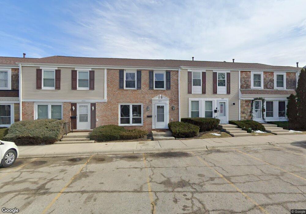
1971 Haddam Place Unit 2 Hoffman Estates, IL 60169
South Hoffman Estates NeighborhoodEstimated Value: $280,000 - $316,000
3
Beds
2
Baths
1,380
Sq Ft
$214/Sq Ft
Est. Value
About This Home
This home is located at 1971 Haddam Place Unit 2, Hoffman Estates, IL 60169 and is currently estimated at $295,426, approximately $214 per square foot. 1971 Haddam Place Unit 2 is a home located in Cook County with nearby schools including John Muir Literacy Academy, Dwight D Eisenhower Junior High School, and Hoffman Estates High School.
Ownership History
Date
Name
Owned For
Owner Type
Purchase Details
Closed on
Nov 22, 2006
Sold by
Buttner Patrick S and Buttner Linda S
Bought by
Ali Agha H
Current Estimated Value
Home Financials for this Owner
Home Financials are based on the most recent Mortgage that was taken out on this home.
Original Mortgage
$128,000
Outstanding Balance
$76,815
Interest Rate
6.47%
Mortgage Type
New Conventional
Estimated Equity
$218,611
Purchase Details
Closed on
Aug 18, 1997
Sold by
Amiry Abas A and Flood Amiry Maureen P
Bought by
Buttner Patrick S and Buttner Linda S
Home Financials for this Owner
Home Financials are based on the most recent Mortgage that was taken out on this home.
Original Mortgage
$90,491
Interest Rate
7.55%
Mortgage Type
FHA
Create a Home Valuation Report for This Property
The Home Valuation Report is an in-depth analysis detailing your home's value as well as a comparison with similar homes in the area
Home Values in the Area
Average Home Value in this Area
Purchase History
| Date | Buyer | Sale Price | Title Company |
|---|---|---|---|
| Ali Agha H | $160,000 | Attorneys Title Guaranty Fun | |
| Buttner Patrick S | $61,333 | -- |
Source: Public Records
Mortgage History
| Date | Status | Borrower | Loan Amount |
|---|---|---|---|
| Open | Ali Agha H | $128,000 | |
| Previous Owner | Buttner Patrick S | $90,491 |
Source: Public Records
Tax History Compared to Growth
Tax History
| Year | Tax Paid | Tax Assessment Tax Assessment Total Assessment is a certain percentage of the fair market value that is determined by local assessors to be the total taxable value of land and additions on the property. | Land | Improvement |
|---|---|---|---|---|
| 2024 | $5,830 | $19,000 | $3,000 | $16,000 |
| 2023 | $4,627 | $19,000 | $3,000 | $16,000 |
| 2022 | $4,627 | $19,000 | $3,000 | $16,000 |
| 2021 | $3,716 | $14,420 | $1,858 | $12,562 |
| 2020 | $3,703 | $14,420 | $1,858 | $12,562 |
| 2019 | $3,687 | $16,023 | $1,858 | $14,165 |
| 2018 | $4,084 | $15,959 | $1,622 | $14,337 |
| 2017 | $4,030 | $15,959 | $1,622 | $14,337 |
| 2016 | $4,011 | $15,959 | $1,622 | $14,337 |
| 2015 | $2,809 | $13,422 | $1,416 | $12,006 |
| 2014 | $2,774 | $13,422 | $1,416 | $12,006 |
| 2013 | $2,057 | $13,422 | $1,416 | $12,006 |
Source: Public Records
Map
Nearby Homes
- 1956 Georgetown Ln Unit 4
- 1925 Georgetown Ln Unit 4
- 1886 Stockton Dr Unit 3253
- 1996 Blackberry Ln Unit 14
- 1862 Stockton Dr Unit 3283
- 2230 Stratham Place
- 1854 Huntington Blvd Unit C
- 1840 Huntington Blvd Unit 415
- 1840 Huntington Blvd Unit 412
- 1738 Ardwick Dr
- 1685 Cornell Dr
- 1977 Kenilworth Cir Unit D
- 1672 Cornell Dr
- 1808 Fayette Walk Unit H
- 1800 Huntington Blvd Unit AE615
- 1940 Kenilworth Cir Unit D
- 2004 E Parkview Cir
- 1704 Fayette Walk Unit B
- 1763 Bristol Walk Unit 1763
- 2079 E Parkview Cir
- 1973 Haddam Place
- 1969 Haddam Place
- 1975 Haddam Place Unit 2
- 1975 Haddam Place
- 1967 Haddam Place Unit 2
- 1977 Haddam Place Unit 2
- 1965 Haddam Place
- 1963 Haddam Place Unit 2
- 1970 Swindon Place Unit 2
- 1972 Swindon Place Unit 2
- 1968 Swindon Place Unit 2
- 1961 Haddam Place Unit 2
- 1966 Swindon Place Unit 2
- 1974 Swindon Place Unit 2
- 1974 Swindon Place Unit 1964
- 1976 Swindon Place
- 1964 Swindon Place Unit 2
- 1959 Haddam Place Unit 2
- 1962 Swindon Place Unit 2
- 1970 Haddam Place Unit 2