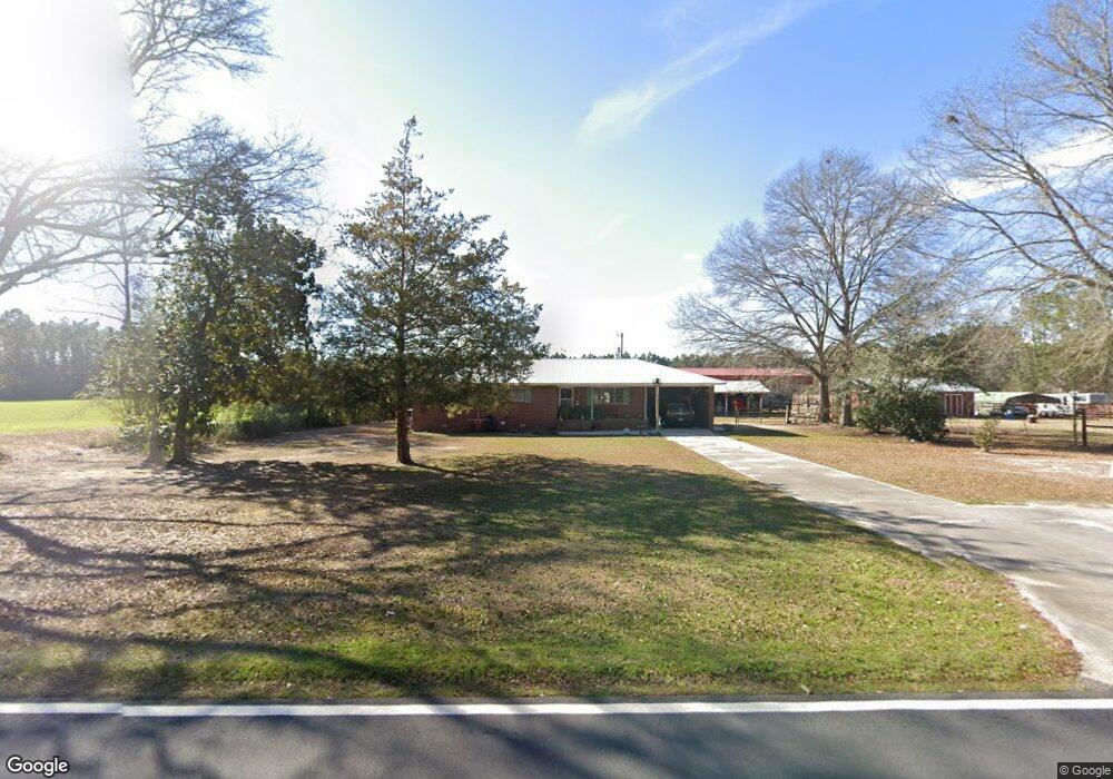
1971 Jennie Station Rd Claxton, GA 30417
Estimated Value: $180,000 - $293,000
3
Beds
2
Baths
1,424
Sq Ft
$170/Sq Ft
Est. Value
About This Home
This home is located at 1971 Jennie Station Rd, Claxton, GA 30417 and is currently estimated at $241,709, approximately $169 per square foot. 1971 Jennie Station Rd is a home located in Evans County with nearby schools including Claxton Elementary School, Second Chance, and Claxton Middle School.
Ownership History
Date
Name
Owned For
Owner Type
Purchase Details
Closed on
May 14, 2021
Sold by
Todd James Carlton
Bought by
Todd Agalia M
Current Estimated Value
Purchase Details
Closed on
Jan 14, 2014
Sold by
Shuman Henry Gilbert
Bought by
Todd James C
Purchase Details
Closed on
Jan 11, 1993
Sold by
Lewis Betty Jean
Bought by
Todd Carlton
Purchase Details
Closed on
Mar 31, 1978
Sold by
Shuman Rebecca Jean
Bought by
Shuman H G
Purchase Details
Closed on
Dec 20, 1973
Sold by
Lewis Raymond
Bought by
Shuman Henry Gilbert
Create a Home Valuation Report for This Property
The Home Valuation Report is an in-depth analysis detailing your home's value as well as a comparison with similar homes in the area
Home Values in the Area
Average Home Value in this Area
Purchase History
| Date | Buyer | Sale Price | Title Company |
|---|---|---|---|
| Todd Agalia M | -- | -- | |
| Todd James C | $1,000 | -- | |
| Todd Carlton | -- | -- | |
| Shuman H G | -- | -- | |
| Shuman Henry Gilbert | -- | -- | |
| Shuman Harry | -- | -- |
Source: Public Records
Tax History Compared to Growth
Tax History
| Year | Tax Paid | Tax Assessment Tax Assessment Total Assessment is a certain percentage of the fair market value that is determined by local assessors to be the total taxable value of land and additions on the property. | Land | Improvement |
|---|---|---|---|---|
| 2024 | $1,750 | $69,188 | $14,760 | $54,428 |
| 2023 | $1,367 | $50,188 | $18,080 | $32,108 |
| 2022 | $1,267 | $49,348 | $18,080 | $31,268 |
| 2021 | $1,361 | $49,348 | $18,080 | $31,268 |
| 2020 | $1,366 | $49,348 | $18,080 | $31,268 |
| 2019 | $1,338 | $49,348 | $18,080 | $31,268 |
| 2018 | $1,510 | $49,348 | $18,080 | $31,268 |
| 2017 | $1,456 | $49,348 | $18,080 | $31,268 |
| 2016 | $1,547 | $51,856 | $20,720 | $31,136 |
| 2015 | -- | $51,220 | $19,640 | $31,580 |
| 2014 | -- | $51,220 | $19,640 | $31,580 |
| 2013 | -- | $53,868 | $21,840 | $32,028 |
Source: Public Records
Map
Nearby Homes
- 0 Bay Branch Church Rd Unit 25551331
- 87.21 AC Bay Branch Church Rd
- 3772 US Highway 301
- 00 Sharpe Ln
- 7307 Blocker Rd
- 4164 Perry Rd
- LOT 7 Camp Ground Rd
- 12444 U S 301
- 4909 Perry Rd
- 8893 Sunbury Rd
- 13320 Sunbury Rd
- 12 Wisteria Ln
- 12 Wysteria Ln
- 3 Honeysuckle Dr
- 10 Honeysuckle Dr
- 7 Honeysuckle Dr
- 7 Honeysuckle Way
- 9 Honeysuckle Dr
- 19 Wysteria Ln
- 29 Grove Ln
- 1478 Us Highway 301
- 1382 Us Highway 301
- 2267 Jennie Station Rd
- 2317 Jennie Station Rd
- 306 Tom McCall Rd
- 2339 Jennie Station Rd
- 1730 Jennie Station Rd
- 1720 Us Highway 301
- 0 Tom McCall Rd Unit 7465611
- 304 Tom McCall Rd
- 1800 U S Hwy 301
- 1800 Us Highway 301
- 2487 Jennie Station Rd
- 2519 Jennie Station Rd
- 2555 Jennie Station Rd
- 286 Little Dirt Ln
- 2631 Jennie Station Rd
- 2628 Jennie Station Rd
- 459 Tom McCall Rd
- 378 Tom McCall Rd