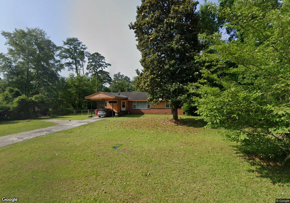
1971 Karen Dr Macon, GA 31217
Estimated Value: $81,000 - $127,000
3
Beds
1
Bath
1,477
Sq Ft
$70/Sq Ft
Est. Value
About This Home
This home is located at 1971 Karen Dr, Macon, GA 31217 and is currently estimated at $102,684, approximately $69 per square foot. 1971 Karen Dr is a home located in Bibb County with nearby schools including Martin Luther King Jr. Elementary School, Appling Middle School, and Northeast High School.
Ownership History
Date
Name
Owned For
Owner Type
Purchase Details
Closed on
Jun 25, 2025
Sold by
Thomas Tanesha D and Thomas Tanesha Danielle
Bought by
Mcintyre Dwight David and Middleton Ava Kristina
Current Estimated Value
Purchase Details
Closed on
Jun 12, 2009
Sold by
Nicholas Group Properties Llc
Bought by
Thomas Tanesha D
Home Financials for this Owner
Home Financials are based on the most recent Mortgage that was taken out on this home.
Original Mortgage
$47,130
Outstanding Balance
$29,777
Interest Rate
4.77%
Mortgage Type
FHA
Estimated Equity
$72,907
Purchase Details
Closed on
Oct 2, 2003
Bought by
Scott T Nicholls Llc
Purchase Details
Closed on
Sep 3, 2003
Create a Home Valuation Report for This Property
The Home Valuation Report is an in-depth analysis detailing your home's value as well as a comparison with similar homes in the area
Purchase History
| Date | Buyer | Sale Price | Title Company |
|---|---|---|---|
| Mcintyre Dwight David | -- | None Listed On Document | |
| Mcintyre Dwight David | -- | None Listed On Document | |
| Thomas Tanesha D | $48,000 | None Available | |
| Scott T Nicholls Llc | -- | -- | |
| -- | $56,500 | -- |
Source: Public Records
Mortgage History
| Date | Status | Borrower | Loan Amount |
|---|---|---|---|
| Open | Thomas Tanesha D | $47,130 |
Source: Public Records
Tax History
| Year | Tax Paid | Tax Assessment Tax Assessment Total Assessment is a certain percentage of the fair market value that is determined by local assessors to be the total taxable value of land and additions on the property. | Land | Improvement |
|---|---|---|---|---|
| 2025 | $983 | $40,009 | $3,949 | $36,060 |
| 2024 | $924 | $36,365 | $3,434 | $32,931 |
| 2023 | $1,077 | $36,365 | $3,434 | $32,931 |
| 2022 | $827 | $23,876 | $2,564 | $21,312 |
| 2021 | $675 | $17,769 | $1,710 | $16,059 |
| 2020 | $597 | $15,371 | $1,425 | $13,946 |
| 2019 | $602 | $15,371 | $1,425 | $13,946 |
| 2018 | $1,101 | $15,371 | $1,425 | $13,946 |
| 2017 | $576 | $15,371 | $1,425 | $13,946 |
| 2016 | $532 | $15,370 | $1,425 | $13,946 |
| 2015 | $776 | $15,845 | $1,900 | $13,946 |
| 2014 | $946 | $16,796 | $2,308 | $14,488 |
Source: Public Records
Map
Nearby Homes
- 1977 Thomas Dr
- 2361 Ollie Dr
- 2161 Melton Ave
- 2229 New Clinton Rd
- 2066 Melton Ave
- 837 Artic Cir
- 1980 Bayswater Rd
- 2418 Tredway Dr
- 896 Roseview Dr
- 4436 Jeffersonville Rd
- 2458 Tredway Dr
- 909 Johnson St
- 1008 Sunnydale Dr
- 2630 Pauladale Dr
- 2675 Pauladale Dr
- 2639 Tredway Dr
- 1235 Boone St
- 2721 Kensington Place
- 2504 Bedford Place
- 806 Magnolia Dr
- 1961 Karen Dr
- 2013 Karen Dr
- 1953 Karen Dr
- 1956 Thomas Dr
- 1962 Thomas Dr
- 1950 Thomas Dr
- 1970 Karen Dr
- 1962 Karen Dr
- 1970 Thomas Dr
- 1980 Karen Dr Unit 1
- 1980 Karen Dr
- 1980 Karen Dr Unit 9
- 1945 Karen Dr
- 1944 Thomas Dr
- 2012 Karen Dr
- 1952 Karen Dr
- 2031 Karen Dr
- 1938 Thomas Dr
- 2022 Karen Dr
- 2378 Ollie Dr Unit A14
Your Personal Tour Guide
Ask me questions while you tour the home.