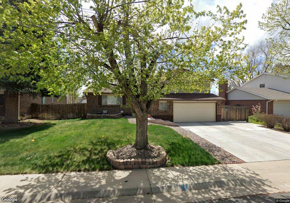
1971 S Mobile St Aurora, CO 80013
Horseshoe Park NeighborhoodEstimated Value: $437,218 - $509,000
3
Beds
3
Baths
2,233
Sq Ft
$208/Sq Ft
Est. Value
About This Home
This home is located at 1971 S Mobile St, Aurora, CO 80013 and is currently estimated at $465,555, approximately $208 per square foot. 1971 S Mobile St is a home located in Arapahoe County with nearby schools including Yale Elementary School, Mrachek Middle School, and Rangeview High School.
Ownership History
Date
Name
Owned For
Owner Type
Purchase Details
Closed on
Aug 24, 2012
Sold by
Abdale Agnes M
Bought by
Bryan Randall Anderson
Current Estimated Value
Home Financials for this Owner
Home Financials are based on the most recent Mortgage that was taken out on this home.
Original Mortgage
$182,337
Outstanding Balance
$126,170
Interest Rate
3.57%
Mortgage Type
VA
Estimated Equity
$339,385
Purchase Details
Closed on
Mar 4, 1994
Sold by
Abdale Eugene J
Bought by
Abdale Agnes M
Purchase Details
Closed on
Feb 29, 1988
Sold by
Conversion Arapco
Bought by
Abdale Agnes M
Purchase Details
Closed on
Sep 1, 1978
Sold by
Conversion Arapco
Bought by
Conversion Arapco
Purchase Details
Closed on
Jul 4, 1776
Bought by
Conversion Arapco
Create a Home Valuation Report for This Property
The Home Valuation Report is an in-depth analysis detailing your home's value as well as a comparison with similar homes in the area
Home Values in the Area
Average Home Value in this Area
Purchase History
| Date | Buyer | Sale Price | Title Company |
|---|---|---|---|
| Bryan Randall Anderson | $178,500 | North Amer Title Co Of Co | |
| Abdale Agnes M | -- | -- | |
| Abdale Agnes M | -- | -- | |
| Conversion Arapco | -- | -- | |
| Conversion Arapco | -- | -- |
Source: Public Records
Mortgage History
| Date | Status | Borrower | Loan Amount |
|---|---|---|---|
| Open | Bryan Randall Anderson | $182,337 |
Source: Public Records
Tax History Compared to Growth
Tax History
| Year | Tax Paid | Tax Assessment Tax Assessment Total Assessment is a certain percentage of the fair market value that is determined by local assessors to be the total taxable value of land and additions on the property. | Land | Improvement |
|---|---|---|---|---|
| 2024 | $2,694 | $28,984 | -- | -- |
| 2023 | $2,694 | $28,984 | $0 | $0 |
| 2022 | $2,548 | $25,180 | $0 | $0 |
| 2021 | $2,610 | $25,180 | $0 | $0 |
| 2020 | $2,459 | $23,617 | $0 | $0 |
| 2019 | $2,446 | $23,617 | $0 | $0 |
| 2018 | $2,068 | $19,555 | $0 | $0 |
| 2017 | $1,799 | $19,555 | $0 | $0 |
| 2016 | $1,695 | $18,037 | $0 | $0 |
| 2015 | $1,636 | $18,037 | $0 | $0 |
| 2014 | $1,054 | $11,192 | $0 | $0 |
| 2013 | -- | $12,950 | $0 | $0 |
Source: Public Records
Map
Nearby Homes
- 1996 S Olathe St
- 16845 E Asbury Ave
- 16836 E Asbury Ave
- 16800 E Bails Place
- 2139 S Ouray St
- 1750 S Norfolk St
- 17033 E Pacific Place
- 15671 E Atlantic Cir
- 1656 S Mobile St
- 1740 S Ouray Ct
- 15880 E Utah Place
- 16026 E Warren Place
- 1825 S Pitkin Cir Unit 10
- 1840 S Pitkin Cir Unit A
- 1790 S Pitkin Cir Unit B
- 2002 S Richfield St
- 15532 E Pacific Place
- 2007 S Rifle St
- 1876 S Pitkin Cir Unit B
- 16133 E Iowa Ave
- 1961 S Mobile St
- 1981 S Mobile St
- 16551 E Asbury Place
- 16561 E Asbury Place
- 16541 E Asbury Place
- 1951 S Mobile St
- 1991 S Mobile St
- 16610 E Atlantic Place
- 16571 E Asbury Place
- 16531 E Asbury Place
- 16591 E Asbury Place
- 16609 E Atlantic Place
- 16620 E Atlantic Place
- 16601 E Asbury Ave
- 1949 S Mobile St
- 1941 S Mobile St
- 16552 E Asbury Place
- 16619 E Atlantic Place
- 16522 E Asbury Place
- 1942 S Mobile St